
Pingeling, Thomas Albrecht (sold)

Thomas Albrecht Pingeling (August 19, 1727 - July 16, 1803) was a German engraver based in Hamburg. He trained under his father Gottfried Christian Pingeling (1688 - 1769), who had learned the craft from Martin Bernigeroth (1670 - 1733)/ Pingeling the elder moved from his native Saxony to Hamburg with a fellow engraver Christian Fritzsch (1695 - 1769) around 1720 and remained there afterwards. The father-son Pingeling excelled at engraving and their workshop was among the most celebrated in Hamburg in the mid-late 18th century (even working for clients as far away as London and St. Petersburg). They engraved maps, plates, illustrations, and other works for a wide variety of publications at the height of the Enlightenment. After his father's death and operating the firm alone for a time, Thomas Albrecht Pingeling took on Johann Thomas Hagemann (1771 - 1853) as an apprentice and then business partner.
Die Ära der Amerikanischen Revolution.
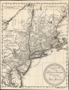
Special Karte von den Mitteleren Brittishen Colonien in Nord Amerika.
sold
- Digital Map Information
- Suitable for large format printing
- File Size: 9.26 MB
- File Type: ZIP / TIFF
- ICC color profile embedded
- Delivered instantly via download link
This is Thomas Albrecht Pingeling's finely engraved map of the British American colonies, published soon after their declaration of independence in Christian Leiste's 1778 book Beschreibung des Brittischen Amerika. (more details)
First English exploraiton fo the Upper Mississippi.
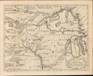
Karte von Hauptman Carvers Reise in den innern Shielen von Nord Amerika.
sold
- Digital Map Information
- Suitable for large format printing
- File Size: 20.22 MB
- File Type: ZIP / TIFF
- ICC color profile embedded
- Delivered instantly via download link
This is the 1780 German edition of Jonathan Carver's map illustrating his pioneering travels in the Upper Mississippi Valley, including parts of modern-day Wisconsin, Minnesota, and Michigan. Carver was the first Englishman to penetrate this region and map it in any detail, making this a significant piece, replete with novel information and fascinating annotations, offering some of the earliest insights into life and travel in this, at the time, near-impenetrable frontier. (more details)