
Rentschler, Fred (sold)

Fred Rentschler (fl. c. 1920 – c. 1943) was a Swiss-born American artist active in Cleveland, Ohio. Rentschler emigrated to the United States, settling in Cleveland, in the early 1920s. He later taught at the Cleveland School of Art. From 1935 to 1943 he was the head of the lithographic division at the Federal Art Project (WPA) in Cleveland. Rentschler's WPA artwork focused on adult education and challenged the viewer question his ignorances and rectify them.
Educational WPA Poster Map by the modernist Cleveland artist Fren Rentschler.
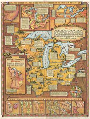
The Old Northwest Territory.
sold
- Digital Map Information
- Suitable for large format printing
- File Size: 13.85 MB
- File Type: ZIP / TIFF
- ICC color profile embedded
- Delivered instantly via download link
An uncommon 1937 pictorial map of the old Northwest Territory by Fred Rentschler. The map includes all five of the great lakes and focuses on the modern-day states of Minnesota, Wisconsin, Illinois, Indiana, Michigan, and Ohio. It includes numerous vignette ... (more details)
Educational WPA Poster Map by the modernist Cleveland artist Fren Rentschler.
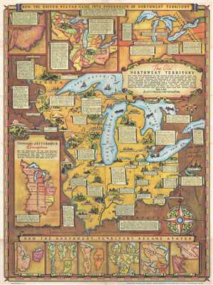
The Old Northwest Territory.
sold
- Digital Map Information
- Suitable for large format printing
- File Size: 14.35 MB
- File Type: ZIP / TIFF
- ICC color profile embedded
- Delivered instantly via download link
An uncommon 1937 pictorial map of the old Northwest Territory by Fred Rentschler. The map includes all five of the great lakes and focuses on the modern-day states of Minnesota, Wisconsin, Illinois, Indiana, Michigan, and Ohio. It includes numerous vignette ... (more details)
The 'Old Northwest' remembered.
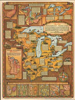
The Old Northwest Territory.
sold
- Digital Map Information
- Suitable for large format printing
- Full resolution TIFF file
- ICC color profile embedded
- Delivered instantly via download link
An uncommon 1937 pictorial map of the old Northwest Territory by Fred Rentschler. The map includes all five of the great lakes and focuses on the modern-day states of Minnesota, Wisconsin, Illinois, Indiana, Michigan, and Ohio. It includes numerous vignette illustrations referencing historic events, American Indian groups, and local folklore. The main map is surrounded by historical maps illustrating various ideas for the Northwest Territory ranging from the 'Thomas Jefferson Conception' to specific illustrations of the individual states in different configurations. The verso of the map features a transcript of the Ordinance of 1787 as well as additional historical text. (more details)
The 'Old Northwest' remembered.
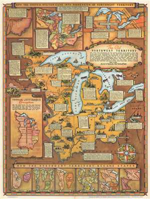
The Old Northwest Territory.
sold
- Digital Map Information
- Suitable for large format printing
- Full resolution TIFF file
- ICC color profile embedded
- Delivered instantly via download link
An uncommon 1937 pictorial map of the old Northwest Territory by Fred Rentschler. The map includes all five of the Great Lakes and the modern-day states of Minnesota, Wisconsin, Illinois, Indiana, Michigan, and Ohio. It includes numerous vignettes referencing historic events, American Indian peoples, and folklore. The main map is surrounded by historical maps illustrating various plans for the Northwest Territory ranging from the 'Thomas Jefferson Conception' to specific illustrations of the individual states in different configurations. The verso of the map features a transcript of the Ordinance of 1787 as well as additional historical text. (more details)
'Old Northwest' remembered.
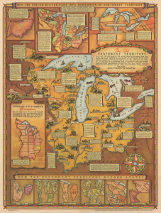
The Old Northwest Territory.
sold
- Digital Map Information
- Suitable for large format printing
- Full resolution TIFF file
- ICC color profile embedded
- Delivered instantly via download link
An uncommon 1937 pictorial map of the Old Northwest Territory by Fred Rentschler. The map graphically commemorates the Ordinance of 1787, which created the Northwest Territory and became one of the most influential acts of Congress. The map includes all five Great Lakes and the modern-day states of Minnesota, Wisconsin, Illinois, Indiana, Michigan, and Ohio. (more details)
The 'Old Northwest' remembered.
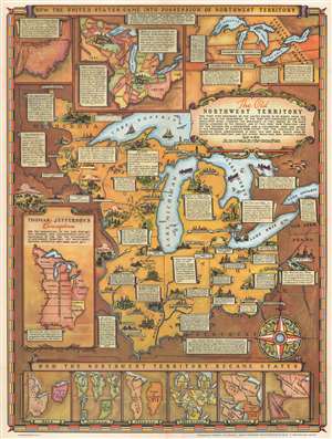
The Old Northwest Territory.
sold
- Digital Map Information
- Suitable for large format printing
- Full resolution TIFF file
- ICC color profile embedded
- Delivered instantly via download link
An uncommon 1937 pictorial map of the old Northwest Territory by Fred Rentschler. The map includes all five Great Lakes and the modern-day states of Minnesota, Wisconsin, Illinois, Indiana, Michigan, and Ohio. It includes numerous vignettes referencing historic events, American Indian peoples, and folklore. The main map is surrounded by historical maps illustrating various plans for the Northwest Territory ranging from the 'Thomas Jefferson Conception' to specific illustrations of the individual states in different configurations. The verso features a transcript of the Ordinance of 1787 as well as additional historical text. (more details)
The 'Old Northwest' remembered.
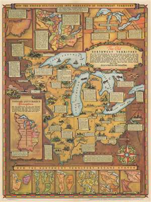
The Old Northwest Territory.
sold
- Digital Map Information
- Suitable for large format printing
- Full resolution TIFF file
- ICC color profile embedded
- Delivered instantly via download link
An uncommon 1937 pictorial map of the old Northwest Territory by Fred Rentschler, accompanied by its original booklet. The map includes all five Great Lakes and the modern-day states of Minnesota, Wisconsin, Illinois, Indiana, Michigan, and Ohio. It includes numerous vignettes referencing historic events, American Indian peoples, and folklore. The main map is surrounded by historical maps illustrating various plans for the Northwest Territory ranging from the 'Thomas Jefferson Conception' to specific illustrations of the individual states in different configurations. The verso features a transcript of the Ordinance of 1787 as well as additional historical text. (more details)