
Senex, John

John Senex (1678 - 1740) was an English engraver and map maker active in London during the first half of the 18th century. Senex was born to upper middle class parents in Shropshire, England. As a young man, he was apprenticed to Robert Clavell, a London bookseller and member of the Stationers' Company, under whom he mastered the arts of engraving and printmaking. Around 1702 Senex completed his apprenticeship and established himself as a printer and bookseller in the Strand. A year later Senex partnered with Jeremiah Seller and Charles Price, the successors to the important mapmaker John Seller, and relocated to Cornhill. This was likely Senex's first introduction to mapmaking though he seems to have taken to it with abandon. In the subsequent years Senex established himself as one of the most prominent cartographers in London, publishing a number of beautiful and important maps that today rank among the finest examples from the Golden Age of British Cartography. In addition to a large corpus of flat maps, Senex also produced a number of important and highly desirable globes. Eventually Senex dissolved his partnership with Seller and Price and relocated to Fleet Street, where he maintained offices until his death in 1740. Senex was succeeded by his widow, Mary Senex, who continued to publish and update his works until about 1755, when the remaining globe and map plates were sold to James Ferguson.
Scarce, attractive English Map of Spain.
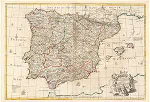
A Correct Map of Spain and Portugal According to the newest observations and discoveries comunicated to the Royal Society at London and the Royal Academy at Paris.
$850.00
Acquire
- Digital Map Information
- Suitable for large format printing
- Full resolution TIFF file
- ICC color profile embedded
- Delivered instantly via download link
This beautiful, large engraving is John Senex’s 1708 map of Spain and Portugal, covering the entire Iberian Peninsula, including the south of France, part of the north coast of Africa, the Strait of Gibraltar and the Balearic Islands of Ibiza, Majorca, and Minorca. It is attractively engraved, with decorative sailing ships and a baroque-inspired cartouche featuring a half-dozen putti wearing the classical iconography of the Greco-Roman gods (with a martial Mars front-and-center, and a commercial Mercury at top.) (more details)
First Modern Chart of the Solar System.
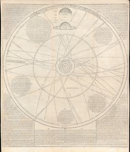
A scheme of the Solar System with the orbits of the planets and comets belonging thereto.
$6,500.00
Acquire
- Digital Map Information
- Suitable for large format printing
- File Size: 28.05 MB
- File Type: ZIP / TIFF
- ICC color profile embedded
- Delivered instantly via download link
This rare broadsheet engraving is a c.1763 Bowles edition of William Whiston's influential 1713 chart of the Solar System, including the orbits of known comets. It is the first modern chart of the Solar System, incorporating the observations of Newton, Halley, and Flamsteed. (more details)
Enigmatic lakes in the American West.
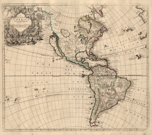
A New Map of America from the Latest Observations.
$2,500.00
Acquire
- Digital Map Information
- Suitable for large format printing
- File Size: 21.14 MB
- File Type: ZIP / TIFF
- ICC color profile embedded
- Delivered instantly via download link
This elegant English map of the Western Hemisphere, produced by John Senex in 1721, presents a fascinating glimpse of early Colonial America - increasingly detailed in the east, whilst retaining great misconceptions with regard to the western part of the continent. (more details)
From Vienna to Belgrade.
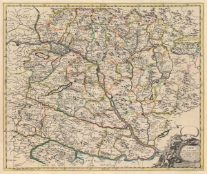
A Map of Hungary and Countries adjacent.
$400.00
Acquire
- Digital Map Information
- Suitable for large format printing
- DPI: 600
- File Size: 58.89 MB
- File Type: ZIP / TIFF
- ICC color profile embedded
- Delivered instantly via download link
This is a 1721 John Senex map of Hungary and the surrounding region, including parts of modern-day Austria, Slovakia, Croatia, and Serbia. (more details)
Wars of Religion in Switzerland.
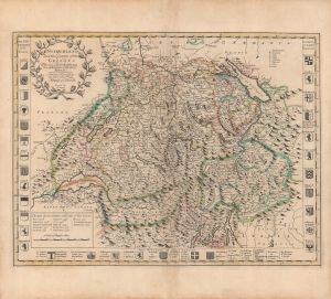
Switzerland and the country of the Grisons : wherein is described the XIII Switz cantons with their allies...
$1,000.00
Acquire
- Digital Map Information
- Suitable for large format printing
- Full resolution TIFF file
- ICC color profile embedded
- Delivered instantly via download link
A beautiful, original color example of John Senex's 1721 map of Switzerland, which appeared in his book A New General Atlas containing a Geographical and Historical account of All the Empires, Kingdoms, and other Dominions of the World. It captures the Swiss Confederation at a moment of internal strife due to confessional differences, which resulted in a change in the balance of power within the Confederation. (more details)
Frontier of France and Italy, with a Snarky Cartouche.
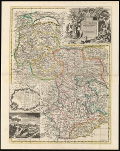
A New Map of Savoy and Piedmont From the latest Observations Revis'd by I. Senex.
$850.00
Acquire
- Digital Map Information
- Suitable for large format printing
- DPI: 600
- File Size: 66.23 MB
- File Type: ZIP / TIFF
- ICC color profile embedded
- Delivered instantly via download link
This is John Senex's 1721 map of the Duchy of Savoy and the Principality of Piedmont. The map is retrospective, illustrating the region in the wake of the War of the Spanish Succession (1701 - 1714). Coverage extends from Lake Geneva and Switzerland in the north to Nice and the Mediterranean Sea in the south, including parts of Dauphiné and Provence, and part of the Duchy of Milan to the east. (more details)
Features a gorgeous depiction of the Amazon River Basin.
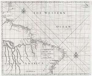
A Chart of the Coast of Brazil and Guiana in America : with Part of the Caribbe Islands
$525.00
Acquire
- Digital Map Information
- Suitable for large format printing
- DPI: 300
- File Size: 10.97 MB
- File Type: ZIP / TIFF
- ICC color profile embedded
- Delivered instantly via download link
This is a 1728 John Senex and Edmond Halley map of Brazil and Guiana. The map depicts the coast of South America from the mouth of the Orinoco (Oronoque) River to All Saint's Bay / Baia de Todos os Santos (labeled as Bay Todos Santos) and Salvador, Brazil and from ... (more details)
A richly detailed Africa.
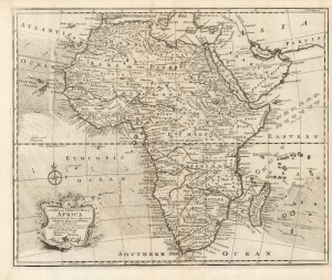
A New and Correct Map of Africa Drawn from the most Approved Modern Maps and Charts, and adjusted by Astronomical Observations, representing also the course of the Trade Winds Monsoons etc. By Eman. Bowen 1748.
$750.00
Acquire
- Digital Map Information
- Suitable for large format printing
- DPI: 600
- File Size: 36.9 MB
- File Type: ZIP / TIFF
- ICC color profile embedded
- Delivered instantly via download link
This is Emanuel Bowens' updated 1748 map of Africa. It depicts the continent in rich detail, particularly with respect to indigenous peoples, kingdoms, fortifications, and mines. It is not an amendment of the 1747 Bowen map of the continent, but an entirely new plate, and while it shares many characteristics of the earlier map, there is matter that is entirely new to it.
Most apparently, Bowen has included in the south Atlantic and the Indian Oceans the prevailing winds, and the directions of the seasonal monsoon winds. These were of particular relevance to ships sailing from Europe to India and were derived from the maps of the trade winds produced at the end of the seventeenth century by William Dampier. (more details)
Most apparently, Bowen has included in the south Atlantic and the Indian Oceans the prevailing winds, and the directions of the seasonal monsoon winds. These were of particular relevance to ships sailing from Europe to India and were derived from the maps of the trade winds produced at the end of the seventeenth century by William Dampier. (more details)