
Shapiro, Joseph (יוסף שפירא) (1900 - December 4, 1967) (sold)

Social Realism and Zionism.
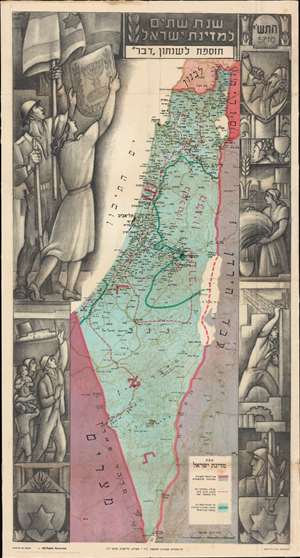
Second Year of the State of Israel. / שנת שתיים למדינת ישראל
sold
- Digital Map Information
- Suitable for large format printing
- File Size: 54.84 MB
- File Type: ZIP / TIFF
- ICC color profile embedded
- Delivered instantly via download link
A rare and striking 1950 Joseph Szapiro (Shapiro) Zionist map of Israel in Hebrew, with striking Social Realist imagery, celebrating the second anniversary of Israel's 1948 founding. The map depicts the region from the Mediterranean Sea to Jordan (Transjordan) and Syria and from Lebanon to Egypt and the Gulf of Eilat (Gulf of Aqaba). Highly detailed, cities, towns, and villages are labeled throughout, with Jerusalem and Tel Aviv given prominence. (more details)
An Israeli map of the 1956 Suez Crisis.
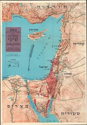
מפת האגן המזרחי של הים התיכון : המערכה על חצי האי סיני / [Map of the Eastern Basin of the Mediterranean: The Battle of the Sinai Peninsula].
sold
This is a 1956 Joseph Shapiro (Szapiro) Hebrew map of the Middle East centered on Israel during the 1956 Suez Crisis, also known as the Second Arab-Israeli War. It highlights the advances of Israeli forces across the Sinai Peninsula during the brief conflict. (more details)