
Smith, William V. (sold)

William V. Smith (1840 - ????) was a New York City surveyor active in the middle to late 19th century. Smith, although quite litigious, is otherwise elusive due to the commonness of his name. He was born in New York, and held the position of City Surveyor with John Bute Holmes in the 1860s and 1870s. He produced several maps in partnership with Homes. In 1886 he was appointed Deputy Commissioner of the Department of Public Works under the notoriously corrupt Rollin M. Squire.
Washington Square Park!
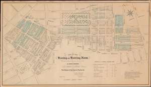
Map of the Haring or Herring Farm, showing its Original Perimeter as surveyed in 1784 by David Haring with the Streets and Avenues accurately laid down, also the Division of the Farm by Partition and c.
sold
- Digital Map Information
- Suitable for large format printing
- File Size: 29.8 MB
- File Type: ZIP / TIFF
- ICC color profile embedded
- Delivered instantly via download link
This is John Bute Holmes's rare January 1869 cadastral map of Greenwich Village, or more properly the West Village, New York City. Like Holmes' rarest and most desirable work, this is one of the earliest, if not the earliest, specific published maps of the West Village, including the area around and immediately to the south of Washington Square Park. Reference tables in the lower right and left corners reference deeds and other property documents on file with the city Clerk's office. (more details)