
Survey of Egypt (sold) (c. 1898 - 1952)

Survey of Egypt (c. 1898 - present; مصلحة المساحة المصرية) was the official surveying body of the Egyptian government from the turn of the 20th century until the founding of the Republic of Egypt. As Egypt was a British Protectorate for most of this period, the survey closely resembled government survey operations in other British colonies and protectorates. However, unlike many other surveys, the Survey of Egypt did not continue under its colonial name in the postcolonial period. Instead, in the independence era, the former Survey became known as the Egyptian General Survey Authority (الهيئة المصرية العامة للمساحة), from 1971 has been affiliated with the Ministry of Irrigation (وزارة الري).
AKA: c. 1898 - 1952
Planning Egypt's Agricultural Future.
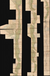
التفتيش العام ري الوجه القبلي / [General Inspection of Irrigation of Upper Egypt].
sold
- Digital Map Information
- Suitable for large format printing
- Full resolution TIFF file
- ICC color profile embedded
- Delivered instantly via download link
A unique and striking cartographic production clocking in at over 30 feet long, this 'strip map' was prepared c. 1940 to catalog irrigation works along the Nile River for most of its course through Egypt, from Cairo to Aswan. It was made by (or for) the Egyptian Ministry of Public Works, with extensive annotations suggesting 'field use.' (more details)
House of Saud's Modernization of Mecca.
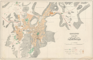
المملكة العربية السعودية (الأقطار الحجازية) مدينة مكة المكرمة / [The Kingdom of Saudi Arabia (Hejaz Territories) the Holy City of Mecca].
sold
- Digital Map Information
- Suitable for large format printing
- File Size: 38.6 MB
- File Type: ZIP / TIFF
- ICC color profile embedded
- Delivered instantly via download link
A remarkable find; this scarce, large-format Arabic-language map of the holy city of Mecca was prepared in 1948 by the Survey of Egypt. This map reflects an effort by the House of Saud to mark their rule over the Hejaz and the holy sites therein by making Mecca more accessible to Muslim pilgrims. (more details)
House of Saud's modernization of Mecca.
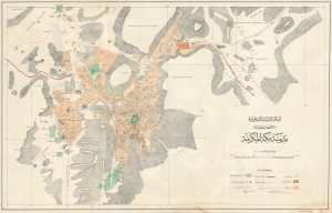
المملكة العربية السعودية (الأقطار الحجازية) مدينة مكة المكرمة / [The Kingdom of Saudi Arabia (Hejaz Territories) the Holy City of Mecca].
sold
- Digital Map Information
- Suitable for large format printing
- File Size: 35.37 MB
- File Type: ZIP / TIFF
- ICC color profile embedded
- Delivered instantly via download link
A remarkable find, this scarce, large-format Arabic-language map of the holy city of Mecca was prepared in 1948 by the Survey of Egypt. This map reflects an effort by the House of Saud to mark their rule over the Hejaz and the holy sites therein by making Mecca more accessible to Muslims. (more details)