
Thayer, Horace

Horace Thayer (June 29, 1811 - March 15, 1875) was an American map publisher and lithographer active in New York City, Buffalo, and Warsaw, New York, during the middle of the 19th century. Born in Hartwick, New York, he married Harriet Margaret Dodge (1814 - 1870) on February 20, 1833. He moved from Warsaw to New York City in 1845 and entered a short-lived association with the Kellogg lithographers, publishing as Kelloggs and Thayer in 1846 - 1847. His cartographic business specialized in travel guides, wall maps, and pocket maps, often drawing upon existing cartographic compilations. During the 1840s and early 1850s he worked with Timothy Ensign (1795 - 1849) and Edward Hooker Ensign (1818 - 1871), whose changing partnerships produced the imprints Ensigns and Thayer, Ensign and Thayer, and Ensign, Thayer, and Company. He subsequently published as Horace Thayer and Company. His business combined map publishing with the manufacture of map rollers, the wooden fittings used to mount wall maps. He returned to Warsaw in the 1850s to establish a map-roller manufactory while continuing his connections with New York publishing. In the late 1850s and early 1860s, he collaborated with George Woolworth Colton (1827 - 1901), son of Joseph Hutchins Colton (1800 - 1893); their publications included maps bearing the Thayer and Colton imprint. His various imprints included Kelloggs and Thayer (1846 - 1847), Ensigns and Thayer (1848), Ensign and Thayer (1849 - 1850), and Ensign, Thayer, and Company (1850 - 1851), Phelps and Watson (1859), and Thayer and Colton (1859-186?). Thayer's New York business addresses included 50 Ann Street and 18 Beekman Street, the latter appearing on his 1861 village map of Warsaw. He also invested in Warsaw real estate, purchasing farmland in 1853 and a house in 1864, and later operated a map-roller establishment in nearby Johnsonburg. Following his first wife's death, he married Mary O. Tuttle on June 19, 1872. Thayer drowned in Tonawanda Creek on March 15, 1875.
References: Lourie, Ira S., 'Alvin J. Johnson and His Role in 19th Century Map Making in America', The Portolan, no. 83 (Spring 2012), p. 40. Thayer, Richard A., 'Horace Thayer 1811-1875', The Thayer Quarterly, vol. 32, no. 4 (December 2024), p. 13.
Map of the United States just prior to the Mexican American War. Shows the Republic of Texas.
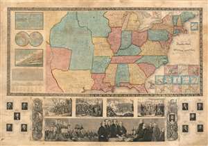
Ensign's Travellers' Guide, and Map of the United States, containing the Roads, Distances, Steam Boat and Canal Routes etc.
$4,000.00
Acquire
- Digital Map Information
- Suitable for large format printing
- Full resolution TIFF file
- ICC color profile embedded
- Delivered instantly via download link
An extremely scarce variant on Ensign and Thayer's series of highly decorative United States wall maps. This map, dated 1845, predates the annexation of Texas and the Mexican-American War by one year. It illustrates the Republic of Texas according to its early proclaimed borders, names Austin's colony, and identifies Austin as the capital. In addition, the map features a large Missouri Territory. Small mountains and rivers charts on the Bulla / Darton model appear in the upper left quadrant. The bottom of the map features a large panorama of the Signing of the Declaration of Independence as well as various scenes from American History. To either side are illustrations of Metacom, the Pokunoket Sachem called 'King Philip' and James Polk, who had just been elected 11th president of the United Sates. Portraits of other former presidents fan out on either side of the panorama. (more details)
Texas during the end of the Mexican-American War.
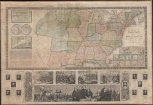
Ensign's Travellers' Guide, and Map of the United States, containing the roads, distances, Stam boat and canal routes etc.
$2,800.00
Acquire
- Digital Map Information
- Suitable for large format printing
- Full resolution TIFF file
- ICC color profile embedded
- Delivered instantly via download link
This is the 1847 Phelps, Ensigns and Thayer edition of Ensign's Travellers' Guide, and Map of the United States, a pictorial wall map that retains a restricted Texas at the height of the Mexican-American War (1846 - 1848). Its colored boundary follows the Nueces rather than the Rio Grande, preserving an earlier geographical conception of the very region whose disputed ownership helped precipitate the conflict. Issued during the presidency of James K. Polk, whose portrait appears below, the map combines practical transportation information with an extensive illustrated history of the republic. It is likely the rarest in this series, with no other known 1847 examples recorded. (more details)
John Hancock and the Boston Tea Party.
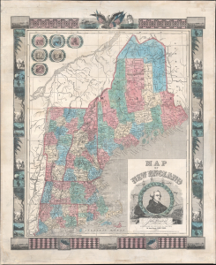
Map of New England.
$1,500.00
Acquire
- Digital Map Information
- Suitable for large format printing
- Full resolution TIFF file
- ICC color profile embedded
- Delivered instantly via download link
This is an 1847 Ensigns and Thayer map of New England: Connecticut, Rhode Island, Massachusetts, Vermont, New Hampshire, and Maine. (more details)
Pushing Manhattan's urbanization northward.
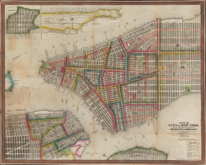
Map of the City of New York, with the Adjacent Cities of Brooklyn and Jersey City, and the Village of Williamsburg.
$1,200.00
Acquire
- Digital Map Information
- Suitable for large format printing
- Full resolution TIFF file
- ICC color profile embedded
- Delivered instantly via download link
This is a striking 1848 Ensigns and Thayer pocket map of New York City. It illustrates the city just as massive redistricting, leveling, and gridding were beginning to push urbanization into central and upper Manhattan. (more details)
Westward Expansion.
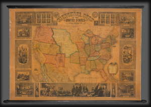
Pictorial Map of the United States.
$3,000.00
Acquire
- Digital Map Information
- Suitable for large format printing
- DPI: 600
- File Size: 1802.6 MB
- File Type: ZIP / TIFF
- ICC color profile embedded
- Delivered instantly via download link
A highly decorative 1853 wall map of the United States is published by Horace Thayer and engraved by J. M. Atwood. This map was published in editions from 1847 - 58, covering thus the critical moments of the American westward expansion, with each edition being significantly updated to reflect the rapid changes endemic to that heady period. The present 4th edition example reveals major developments following the 1849 Gold Rush. (more details)
Evolving Geography of a Metropolis.
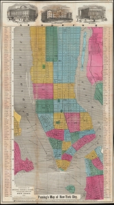
Fanning's Map of New-York City.
$1,500.00
Acquire
- Digital Map Information
- Suitable for large format printing
- File Size: 27.12 MB
- File Type: ZIP / TIFF
- ICC color profile embedded
- Delivered instantly via download link
An example of Thomas Fanning's 1855 map of New York City. Among several interesting features, it is most notable for including presumed future development, including in the central part of Uptown Manhattan, some of which in the process of being designated for Central Park. (more details)