1848 Ensigns and Thayer City Plan or Map of New York City
CityofNewYork-ensignsthayer-1848$1,200.00

Title
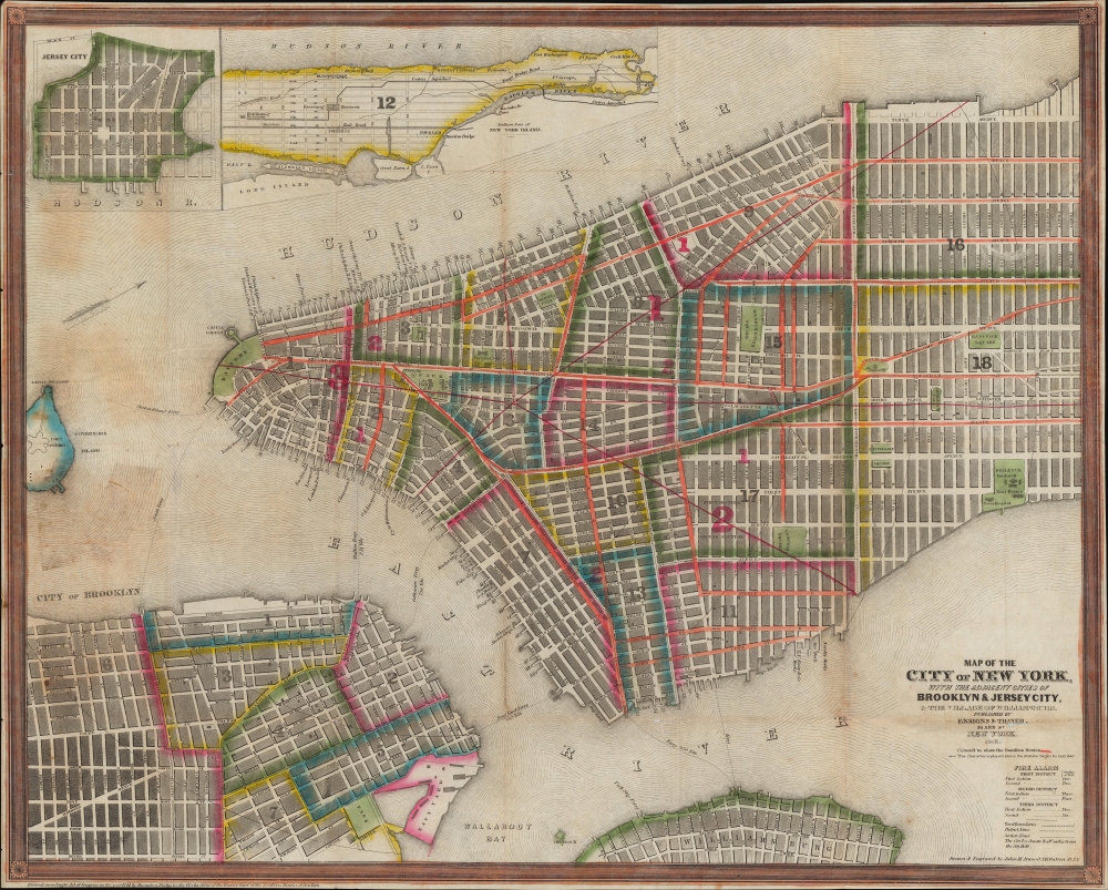
Map of the City of New York, with the Adjacent Cities of Brooklyn and Jersey City, and the Village of Williamsburg.
1848 (dated) 16.75 x 20.75 in (42.545 x 52.705 cm) 1 : 17000
1848 (dated) 16.75 x 20.75 in (42.545 x 52.705 cm) 1 : 17000
Description
This is a striking 1848 Ensigns and Thayer pocket map of New York City. It illustrates the city just as massive redistricting, leveling, and gridding were beginning to push urbanization into central and upper Manhattan.
Two insets occupy the upper left. The smaller focuses on Jersey City, projecting new streets to be built on future landfills. The second inset illustrates northern Manhattan from 41st Street to the Harlem River. The Croton Aqueduct is prominently depicted, with the Receiving and Distributing Reservoirs labeled. Yorkville, Bloomingdale, Manhattanville, and Haerlem appear, as do Fort Washington and Fort Tryon.
A Closer Look
Coverage embraces Manhattan from 32nd Street south to the Battery and Brooklyn from the Navy Yard to Sackett Street along with part of Williamsburg. Part of Governor's Island appears along the left border. City wards are numbered and outlined. Streets are labeled throughout with red highlighting omnibus routes. The Harlem Railroad is illustrated running up the Bowery and Fourth Avenue. Piers are identified along the rivers, as well as ferry routes across the East River to Brooklyn and Williamsburg. The original site of Columbia College near Park Place is labeled.Two insets occupy the upper left. The smaller focuses on Jersey City, projecting new streets to be built on future landfills. The second inset illustrates northern Manhattan from 41st Street to the Harlem River. The Croton Aqueduct is prominently depicted, with the Receiving and Distributing Reservoirs labeled. Yorkville, Bloomingdale, Manhattanville, and Haerlem appear, as do Fort Washington and Fort Tryon.
Publication History and Census
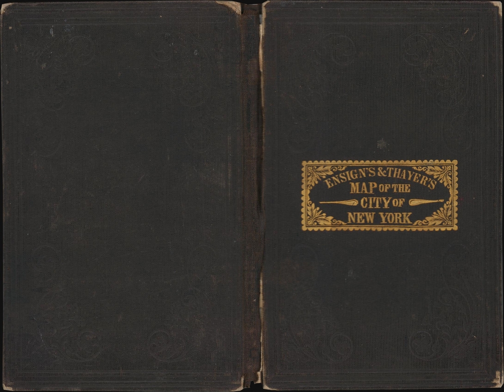
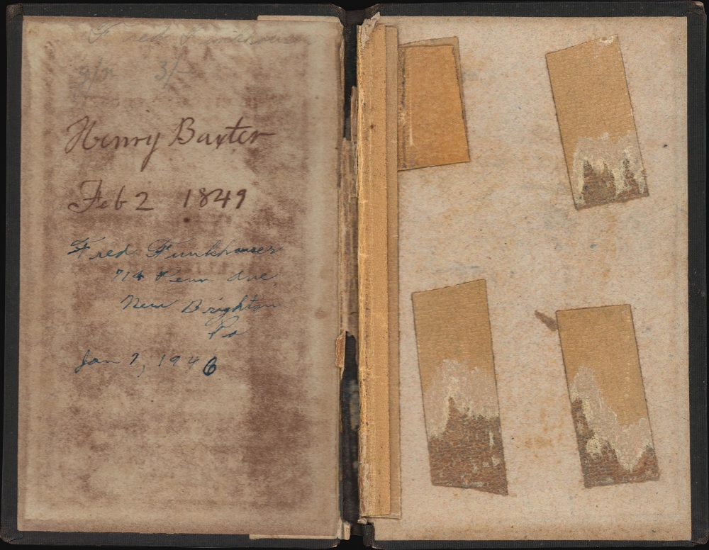
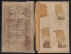
This map was drawn and engraved by John Atwood and published by Ensign and Thayer in 1848. While at least three examples of this edition of this map are cataloged in OCLC, only one, the New York Public Library example, represents the 1848 edition. Below the map in the lower left margin, the copyright notice states, 'Entered according to Act of Congress in the year 1844 by Humphrey Phelps in the Clerk's Office of the District Court of the Southern District of New York'. Three signatures appear inside the binder. The first is Henry Baxter and is dated February 2, 1849. The second is Fred Frankhauser of 714 Pennsylvania Avenue in New Brighton, Pennsylvania, dated January 7, 1946. Fred Frankhauser signed the binder a second time near the top above Baxter's signature. We have been unable to trace either of these individuals.CartographerS
Timothy Ensign (September 29, 1795 - September 16, 1849) was a map publisher based in Hartford, Connecticut, active in the early to mid-19th century. Early in his career, Timothy Ensign worked closely with the Hartford both D. W. Kellogg (1836 - 1841) and E. B. and E. C. Kellogg (1842 - 1848). From 1835, he also partnered with his son, Edward Hooker Ensign (1818 - 1871), and Horace Thayer (1811 - 1875) under the imprint of 'Ensigns and Thayer', until his untimely death in 1849 - after which the firm was renamed in the singular, 'Ensign and Thayer'. More by this mapmaker...
Edward Hooker Ensign (August 18, 1818 - July 10, 1871) was an American map and print publisher based in New York during the middle part of the 19th century. Edward was born in West Hartland, Connecticut. Little is known of Ensign's training but he may have inherited his business from his father, Timothy Ensign (1795 - 1859), who was a map publisher active in New York. Ensign seems to have had a flair for partnerships and variously published with Humphrey Phelps (1799 - 1875), Horace Thayer, Thomas C. Fanning (1805 - 1873) and Erastus C. Bridgman (1817 - 1870), among others. His various imprints include 'Phelps and Ensign' (1841-1844), 'T. and E. H. Ensign' (1844-1848), 'Ensign and Thayer' (1849), 'Ensign, Thayer, and Company' (1850-1851), 'Horace Thayer and Company' (1852), and 'Ensign, Bridgman and Fanning' (1854-1863). It appears that father and son worked together for some time as well, publishing as either 'T. and E. H. Ensign' or 'Ensigns'. At least some of these companies maintained offices in both Buffalo and New York City. Learn More...
Horace Thayer (June 29, 1811 - March 15, 1875) was a New York based publisher and lithographer active in New York City and Buffalo, New York, during the middle part of the 19th century. Thayer's publications focused on travel guides, wall, and pocket maps - many of which were based on the works of other American cartographers including J. H. Colton and S. A. Mitchell. In the 1840s, he partnered with the Hartford, Connecticut publisher Timothy Ensign (1795 - 1849) and later his son, Edward Hooker Ensign (1818 - 1871). According to map historian Walter Ristow, J. H. Colton's older son, George Washington Colton, partnered with Thayer in the late 1850s and early 1860s, possibly in order to learn Thayer's lithography techniques. Certainly a number of maps emerged bearing a 'Thayer and Colton' imprint. At various points Thayer also published with other prominent publishers and printmakers, publishing as Kelloggs and Thayer (1846 - 1847), Ensigns and Thayer (1848), Ensign and Thayer (1849 - 1850), and Ensign, Thayer, and Company (1850 - 1851), Phelps and Watson (1859), and Thayer and Colton (1859-186?). Thayer seems to have moved frequently and had offices at 50 Ann Street, 156 William Street, and at 18 Beekman Street, all in New York City. Learn More...
John M. Atwood (1817 - October 12, 1884) was an American engraver based in Philadelphia and New York City during the middle part of the 19th century. Atwood was born in Georgetown, near Washington D.C. Little is known of Atwood's life but most of his work was completed in conjunction with the publishing firms of Horace Thayer and J. H. Colton. A review of Atwood's work suggests that he was a highly accomplished, stylistically distinct, and detail oriented engraver. Colton seems to have turned to Atwood to engrave some of his most important as well as decorative maps. His most influential map is most likely the 1856 De Cordova pocket map of Texas, however, he also engraved the Colton's well known and highly decorative Thirty Three Miles Around New York and Colton's important 1849 Map of the United States. Learn More...
Condition
Very good. Light wear along original fold lines. Light soiling. Slight loss at a few fold intersections and an area of loss below 'Thayer' in the title. Accompanied by original binder.
References
OCLC 46396162. New York Public Library Map Div. 01-1823. Haskell, D., Manhattan Maps A Co-operative List, 873 (1849).