
Warren, James Dunlap (sold)

James Dunlap Warren (January 19, 1823 - December 17, 1886) was a printer, publisher, engraver, lithographer, businessman, and Republican politician based in Buffalo, New York, in the late 19th century. Warren was born in Bennington, Wyoming County, New York and from age 2 grew up in Clarence, Erie County, New York. He was elected in 1854 to represent Clarence the Erie County Board of Supervisors when he was 31. In 1861, Warren along with Joseph Cander and Rufus Wheeler, operating as 'Rufus Wheeler and Company', acquired the Commercial Advertiser and Journal newspaper from Elam Richardson Jewett (1810 - 1887). In 1862, James N. Matthews (later of Matthews-Northrup; 1828 - 1888), acquired Cander's shares, renaming the holding company 'Wheeler Matthews and Warren'. Wheeler retired in 1865, and the firm was again renamed 'Mathews and Warren.' Nonetheless, by 1877, Warren bought out his partners and became the sole owner. Warren also had a separate printing concern, the 'James D. Warren Printing House' which operated from about 1860 to his death, in 1886, from a bladder infection. At the time, he was one of the wealthiest men in Buffalo. The firm and the newspaper were passed to Warren's sons, William C. Warren (August 4, 1859 - 19??) and Orsamus George Warren (July 21, 1846 - May 6, 1892), who continued to operate as 'James D Warren's Sons Co.'
A glimpse at the Mount Desert 'Rusticator' life.
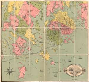
Mount Desert Direct Route vis Boston and Maine Railroad
sold
- Digital Map Information
- Suitable for large format printing
- File Size: 25.42 MB
- File Type: ZIP / TIFF
- ICC color profile embedded
- Delivered instantly via download link
A very scarce chromolithograph map, here dissected and laid on linen, covering Mount Desert Island, Blue Hill, Deer Isle, and vicinity, issued around 1880 for the Boston and Maine Railroad. Geared toward the 'Rusticator' crowd, this map illustrates ferry connections between Mount Desert Island and Rockland, Portland, Lewiston, Milbridge, and more. Although long predating the founding of Acadia National Park, this map offers a unique glimpse into the 'Rusticator' lifestyle - referring to seasonal Mount Desert enthusiasts, both men and women, who gathered on the island in summer months to enjoy the rigorous hiking, climbing, and scenic views. The Boston and Maine Railroad is promoted on the lower left, along with an engraved view of Great Head, a rocky promontory south of Bar Harbor. (more details)