
Weed, Parsons and Company

Weed, Parsons and Company (July 25, 1843 - July, 1892) was a New York based printing house based in Albany, active in the second half of the 19th century. The firm was founded by J. B. Weed (???? - June 18, 1851) and John D. Parsons. Weed, the son of Thurlow Weed, previously worked for the Evening Journal. Parsons was a compositor in the printing offices of Packard and Van Benthuysen. Shortly after their startup, the firm received financing from Visscher Ten Eyck, one of the owners of the Evening Journal to dramatically expand their printing operation. Leveraging Parsons' contacts with the state, the firm began receiving lucrative government printing contracts out of Albany. By 1868 they were one of the largest printing concerns in the United States. Their offices were gutted by a major fire on April 7, 1871. The owners rebuilt with new more modern equipment and continued to operate, with heirs taking over the shares of the original owners. They remained in operation until the firm went into receivership in July of 1892.
Ups and downs and New York canals.
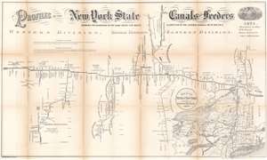
Profiles of the New York State Canals and Feeders Showing the Elevations of the Same Above Tide Water and Junction of the Lateral Canals with the Erie.
$400.00
Acquire
- Digital Map Information
- Suitable for large format printing
- File Size: 34.44 MB
- File Type: ZIP / TIFF
- ICC color profile embedded
- Delivered instantly via download link
This is an 1874 New York State Canal Commissioners profile map of New York canals. Illustrating height changes along New York's primary canals: the Erie Canal, Champlain Canal, Chenango Canal, Chemung Canal, Genesee Valley Canal, Black River Canal, Oneida Lake Canal, and Cayuga and Seneca Canal. The Erie Canal stretches across the sheet. Divided into the Eastern, Middle, and Western divisions, counties, superintendent's sections, and other divisions along the Erie Canal are delineated. Height changes and distances of each part of the canal are presented. Cities, aqueducts, falls, and other waypoints are labeled. The other canals, along with their feeders, are illustrated in much the same manner. Numerous lakes along the canal routes appear as well, including Seneca Lake, Cayuga Lake, and Crooked Lake. (more details)
Beginning of Adirondack Tourism.
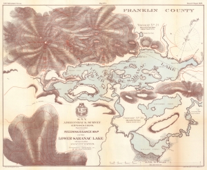
N.Y.S. Adirondack Survey. Map No. 4. Seventh Report. Reconnaissance Map of the Lower Saranac Lake with sketch of the Adjacent Waters.
$350.00
Acquire
- Digital Map Information
- Suitable for large format printing
- File Size: 29.6 MB
- File Type: ZIP / TIFF
- ICC color profile embedded
- Delivered instantly via download link
A large-scale detailed Lower Saranac Lake, the Adirondacks, New York, drawn by Verplanck Colvin for the 1879 annual report of the Adirondack Survey. The map corresponds with the Adirondacks development as a tourist destination for city folk seeking wilderness solace. (more details)
Saving the Adirondacks.
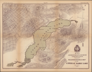
Reconnaissance Map of the Upper Au Sable Lake.
$400.00
Acquire
- Digital Map Information
- Suitable for large format printing
- File Size: 387.19 MB
- File Type: ZIP / TIFF
- ICC color profile embedded
- Delivered instantly via download link
A handsome 1879 map of Upper Ausable Lake and environs in the Adirondack region of New York, produced by Verplank Colvin. (more details)
A Vast and Wondrous Wilderness.
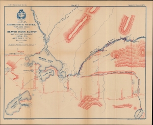
Beaver River Survey (Base-Lines and Topography), 1876-79. Section No. 1.
$400.00
Acquire
- Digital Map Information
- Suitable for large format printing
- File Size: 47.04 MB
- File Type: ZIP / TIFF
- ICC color profile embedded
- Delivered instantly via download link
A colorful 1879 map of Beaver Lake in Lewis County, the Adirondacks, New York, drawn by Frank Tweedy for Verplanck Colvin's Topographical Survey of the Adirondack Region. Europeans settled this portion of New York sporadically since the 17th century. Nonetheless, the thick forests and mountains made surveying so onerous that it was not mapped thoroughly until the late 19th century. (more details)