
Weed, Parsons and Company (sold)

Weed, Parsons and Company (July 25, 1843 - July, 1892) was a New York based printing house based in Albany, active in the second half of the 19th century. The firm was founded by J. B. Weed (???? - June 18, 1851) and John D. Parsons. Weed, the son of Thurlow Weed, previously worked for the Evening Journal. Parsons was a compositor in the printing offices of Packard and Van Benthuysen. Shortly after their startup, the firm received financing from Visscher Ten Eyck, one of the owners of the Evening Journal to dramatically expand their printing operation. Leveraging Parsons' contacts with the state, the firm began receiving lucrative government printing contracts out of Albany. By 1868 they were one of the largest printing concerns in the United States. Their offices were gutted by a major fire on April 7, 1871. The owners rebuilt with new more modern equipment and continued to operate, with heirs taking over the shares of the original owners. They remained in operation until the firm went into receivership in July of 1892.
Striking blue railroad map.
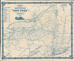
Map of the Rail-Roads of the State of New York.
sold
- Digital Map Information
- Suitable for large format printing
- File Size: 50.9 MB
- File Type: ZIP / TIFF
- ICC color profile embedded
- Delivered instantly via download link
A striking, cyan-toned railroad map of New York State issued in 1867 by Jonas Platt Goodsell. The map offers expansive coverage of New York, as well as some of the adjacent states, including all of Vermont, western Massachusetts and Connecticut, and northern Pennsylvania. This map was issued in Godsell's final year as State Engineer and Surveyor, and indeed the final year of his life. (more details)
Encouraging creation of the Adirondack Park.
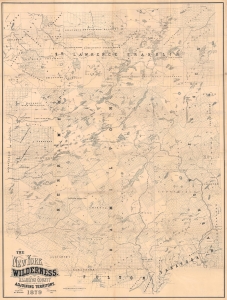
The New York Wilderness. Hamilton County and Adjoining Territory.
sold
- Digital Map Information
- Suitable for large format printing
- Full resolution TIFF file
- ICC color profile embedded
- Delivered instantly via download link
This is an 1879 Benjamin C. Butler and James A. Cooper map of the western portion of the Adirondacks. Published 13 years before the establishment of Adirondack Park, this map likely played a role in promoting the park's creation as well as encouraging tourists to visit the region. (more details)
Escape from New York (City).
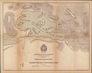
N.Y.S. Adirondack Survey. Map No. 3. Seventh Report. Reconnaissance Map of Tallow or Blue Mountain Lake.
sold
- Digital Map Information
- Suitable for large format printing
- File Size: 42.89 MB
- File Type: ZIP / TIFF
- ICC color profile embedded
- Delivered instantly via download link
A lovely map of Blue Mountain Lake, the Adirondacks, New York. Verplanck Colvin drew it for the 1879 annual report of the Adirondack Survey, which he was instrumental in creating. The map corresponds with the Adirondacks development as a tourist destination for city folk seeking wilderness solace. (more details)