

Johnson's Washington and Oregon.
sold
- Digital Map Information
- Suitable for large format printing
- File Size: 8.51 MB
- File Type: ZIP / TIFF
- ICC color profile embedded
- Delivered instantly via download link
A beautiful example of A. J. Johnson's 1862 map of Washington and Oregon. This rare map offers a fascinating snapshot of this region shortly following the outbreak of the American Civil War. Shows the state of Oregon with much of its eastern regions unsurveyed. ... (more details)
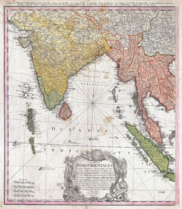
Carte des Indes orientales I. feuille, dans la quelle on represente les Indes deca la Riviere de Ganges, le Golfe de Bengale, Siam, Malacca, Sumatra dressee par Mr. de Tobie Mayer de la Societe Geograph.
sold
- Digital Map Information
- Suitable for large format printing
- DPI: 300
- File Size: 19.11 MB
- File Type: ZIP / TIFF
- ICC color profile embedded
- Delivered instantly via download link
An attractive example of the western sheet of the Homann Heirs 1748 map of India and Southeast Asia. Details the subcontinent as well as much of Southeast Asia, including modern day Burma, Thailand, Laos, Malaysia, Singapore and Sumatra. Extends north to include ... (more details)

Johnson's Palestine.
sold
- Digital Map Information
- Suitable for large format printing
- File Size: 8.77 MB
- File Type: ZIP / TIFF
- ICC color profile embedded
- Delivered instantly via download link
A beautiful example of A. J. Johnson's 1862 map of Palestine / Israel / Holy Land. Details the region from Beirut south to Busaireh and Kadesh Barnea. Extends eastward as far as Mount Alsadamus in modern day Syria. Offers both contemporary and ancient ... (more details)
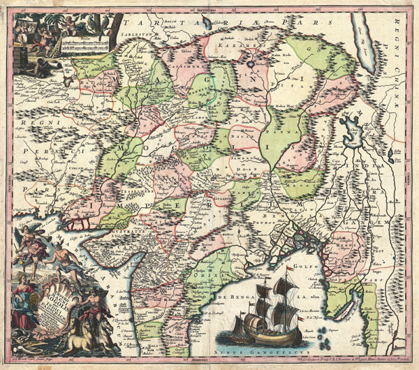
Imperii Magni Mogolis sive Indici Padschach, juxta recentiissimas Navigationes accurata delineato Geographica studio et sumtibus.
sold
- Digital Map Information
- Suitable for large format printing
- DPI: 300
- File Size: 23.09 MB
- File Type: ZIP / TIFF
- ICC color profile embedded
- Delivered instantly via download link
Representing 18th century Germany cartography at its finest; this is an absolutely spectacular c. 1740 map of northern India by Matthias Seutter. Showing the extent of the powerful Mughal Empire in the late 17th century, this map details the subcontinent ... (more details)

Plan de la Ville de Boston et ses Environs.
sold
- Digital Map Information
- Suitable for large format printing
- Full resolution TIFF file
- ICC color profile embedded
- Delivered instantly via download link
This hand colored map is a c. 1756 map of Boston, Massachusetts. Attributed to French cartographer Jacques-Nicholas Bellin, this map was issued for the French edition of Provost's Histoire des Voyages…. Beautifully rendered in stupendous detail. Shows ... (more details)

Johnson's Missouri and Kansas.
sold
- Digital Map Information
- Suitable for large format printing
- File Size: 23.23 MB
- File Type: ZIP / TIFF
- ICC color profile embedded
- Delivered instantly via download link
A beautiful example of A. J. Johnson's 1862 map of Missouri and Kansas. One of Johnson's more decorative maps, this rare map offers a fascinating snapshot of these hotly contested states shortly following the outbreak of the American Civil War. Map ... (more details)

Johnson's Arkansas Mississippi and Louisiana.
sold
- Digital Map Information
- Suitable for large format printing
- File Size: 22.11 MB
- File Type: ZIP / TIFF
- ICC color profile embedded
- Delivered instantly via download link
A beautiful example of A. J. Johnson's 1862 map of Arkansas, Louisiana, and Mississippi. This rare map offers a fascinating snapshot of these secessionist states shortly following the outbreak of the American Civil War. Map shows all three states in ... (more details)

Johnson's New York.
sold
- Digital Map Information
- Suitable for large format printing
- File Size: 9.71 MB
- File Type: ZIP / TIFF
- ICC color profile embedded
- Delivered instantly via download link
This is Johnson and Ward's 1862 map of New York State. This rare map offers a fascinating snapshot of New York shortly following the outbreak of the American Civil War. Map New York in full with bold and dramatic color coding according to county, ... (more details)

Johnson's Michigan and Wisconsin.
sold
- Digital Map Information
- Suitable for large format printing
- File Size: 21.26 MB
- File Type: ZIP / TIFF
- ICC color profile embedded
- Delivered instantly via download link
A beautiful example of A. J. Johnson's 1862 map of Michigan and Wisconsin. This rare map offers a fascinating snapshot of these two states shortly following the outbreak of the American Civil War. Map shows both states in full with color coding ... (more details)

Johnson's Kentucky and Tennessee.
sold
- Digital Map Information
- Suitable for large format printing
- File Size: 23.28 MB
- File Type: ZIP / TIFF
- ICC color profile embedded
- Delivered instantly via download link
A beautiful example of A. J. Johnson's 1862 map of Kentucky and Tennessee. Probably the most decorative of Johnson's Kentucky-Tennessee series, this rare map offers a fascinating snapshot of these secessionist states shortly following the ... (more details)

Johnson's Georgia and Alabama
sold
- Digital Map Information
- Suitable for large format printing
- File Size: 23.65 MB
- File Type: ZIP / TIFF
- ICC color profile embedded
- Delivered instantly via download link
A beautiful example of A. J. Johnson's 1862 map of Georgia and Alabama. Offers a fascinating snapshot of these southern states shortly following the outbreak of the American Civil War. Map shows both states in full with color coding ... (more details)

Johnson's Pennsylvania Virginia Delaware and Maryland.
sold
- Digital Map Information
- Suitable for large format printing
- File Size: 8.67 MB
- File Type: ZIP / TIFF
- ICC color profile embedded
- Delivered instantly via download link
A beautiful example of A. J. Johnson's 1862 map of Virginia, Maryland, Delaware and Pennsylvania. Offers a fascinating snapshot of these north-south borderlands shortly following the outbreak of the American Civil War. Map shows all ... (more details)

Johnson's North and South Carolina.
sold
- Digital Map Information
- Suitable for large format printing
- File Size: 22.11 MB
- File Type: ZIP / TIFF
- ICC color profile embedded
- Delivered instantly via download link
A beautiful example of A. J. Johnson's 1862 map of North Carolina and South Carolina. Offers a fascinating snapshot of these states shortly following the outbreak of the American Civil War. Map shows both states in full with color ... (more details)
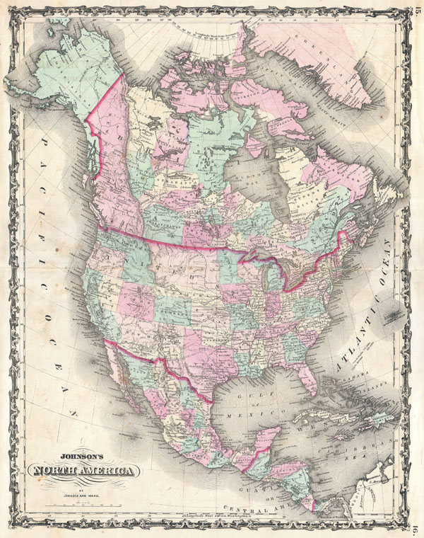
Johnson's North America.
sold
- Digital Map Information
- Suitable for large format printing
- File Size: 21.28 MB
- File Type: ZIP / TIFF
- ICC color profile embedded
- Delivered instantly via download link
A beautiful example of A. J. Johnson's 1862 map of North America. Offers a fascinating snapshot of North America, particularly the United States, Canada and Mexico, just after the outbreak of the American Civil War. States roughly ... (more details)

Johnson's Western Hemisphere. / Johnson's Eastern Hemisphere.
sold
- Digital Map Information
- Suitable for large format printing
- File Size: 19.63 MB
- File Type: ZIP / TIFF
- ICC color profile embedded
- Delivered instantly via download link
This is A. J. Johnson's fine 1862 map of the world on a hemispherical projection. Offers a fascinating snapshot of the world during a period of rapid globalization and discovery. Africa is largely 'unexplored' though Lake Uniamesi, ... (more details)

Johnson's Map of the World on Mercator's Projection.
sold
- Digital Map Information
- Suitable for large format printing
- File Size: 21.13 MB
- File Type: ZIP / TIFF
- ICC color profile embedded
- Delivered instantly via download link
This is A. J. Johnson's fine 1862 map of the world on Mercator's Projection. Depicts the entire world centered on North and South America. Offers a fascinating snapshot of the world during a period of rapid globalization and ... (more details)
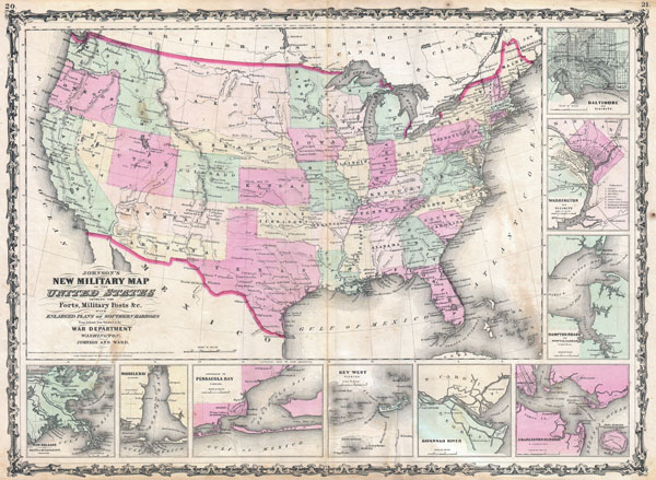
Johnson's New Military Map of the United States Showing the Forts, Military Posts & c. with Enlarged Plans of Southern Harbors From Authentic Data Obtained at the War Department, Washington.
sold
- Digital Map Information
- Suitable for large format printing
- File Size: 19.38 MB
- File Type: ZIP / TIFF
- ICC color profile embedded
- Delivered instantly via download link
An exceptional example of A. J. Johnson's highly desirable Military Map of the United States. Created at the height of the American Civil War, this map was issued by Johnson in order to capitalize on the general interest in ... (more details)

Johnson's New Map of the State of Texas.
sold
- Digital Map Information
- Suitable for large format printing
- File Size: 17.78 MB
- File Type: ZIP / TIFF
- ICC color profile embedded
- Delivered instantly via download link
An exceptional example of A. J. Johnson's highly desirable map of Texas. Created at the height of the American Civil War, this extraordinary folio map details the state of Texas in full. Shows the Elevated Table Lands, the ... (more details)
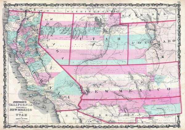
Johnson's California, Territories of New Mexico and Utah.
sold
- Digital Map Information
- Suitable for large format printing
- File Size: 10.92 MB
- File Type: ZIP / TIFF
- ICC color profile embedded
- Delivered instantly via download link
One of the scarcest and most historically significant of A. J. Johnson's southwest series. Published in 1862 at the height of the American Civil War, this stunning map depicts the state of California and the territories of ... (more details)
The most influential map of Florida ever printed.
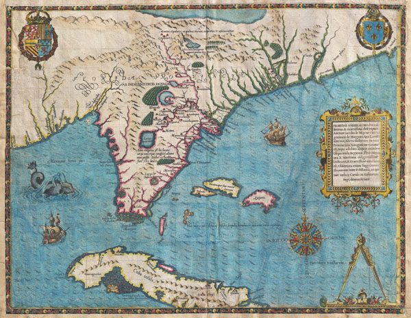
Floridae Americae Provinciae Recens & Exactissima Descriptio Auctore Iacobo Le Moyne cui Cognomen de Morgues, qui Laudonierum …
sold
- Digital Map Information
- Suitable for large format printing
- DPI: 300
- File Size: 13.89 MB
- File Type: ZIP / TIFF
- ICC color profile embedded
- Delivered instantly via download link
…the most remarkable and important map, which has been preserved from the sixteenth century maps, of that part of the East Coast which lies between Cape Hatteras and Cape Florida … the first French map to show Florida ... (more details)