
Map depicting Europe in the mid 19th century.

Europe.
sold
- Digital Map Information
- Suitable for large format printing
- File Size: 9.2 MB
- File Type: ZIP / TIFF
- ICC color profile embedded
- Delivered instantly via download link
This is a lovely 1856 example of Colton's map of Europe. Covers the entire continent from the Caspian Sea to Portugal, including the British Isles and Iceland. Throughout, Colton identifies various cities, towns, forts, rivers and assortment of additional ... (more details)
Beautiful map of the state of Ohio.

Ohio.
sold
- Digital Map Information
- Suitable for large format printing
- File Size: 8.59 MB
- File Type: ZIP / TIFF
- ICC color profile embedded
- Delivered instantly via download link
This is a beautiful 1856 example of Colton's map of Ohio. It covers the entire state as well as parts of the adjacent states. Like most of Colton's state maps, this map is largely derived from an earlier wall map of North America produced by Colton and ... (more details)
Mid 19th century map exclusively depicting New Hampshire.

New Hampshire.
sold
- Digital Map Information
- Suitable for large format printing
- File Size: 7.28 MB
- File Type: ZIP / TIFF
- ICC color profile embedded
- Delivered instantly via download link
A beautiful 1856 example of Colton's map of New Hampshire. Like most of Colton's state maps, this map was derived from an earlier wall map of North America produced by Colton and D. Griffing Johnson. One of the few maps specifically of New Hampshire ... (more details)
Colton's depiction of the city of Baltimore, Maryland.

City of Baltimore Maryland.
sold
- Digital Map Information
- Suitable for large format printing
- File Size: 8.32 MB
- File Type: ZIP / TIFF
- ICC color profile embedded
- Delivered instantly via download link
An excellent 1856 example of Colton's map of Baltimore, Maryland. The map is a lithographic plan covering the city of Baltimore from Gwinns Falls (and Bridge) to Seventh Street and from Green Mount Cemetery to the Patapsco River. Map is hand colored ... (more details)
The last edition of Johnson's map of Maine to include Browning's imprint.

Johnson's Maine.
sold
- Digital Map Information
- Suitable for large format printing
- File Size: 8.06 MB
- File Type: ZIP / TIFF
- ICC color profile embedded
- Delivered instantly via download link
This is a beautiful example of A. J. Johnson and R. Browning's 1861 map of Maine. It covers the entire state along with portions of adjacent Canada and New Hampshire. The map is color coded according to county and notes several towns, cities, ... (more details)
Identifies the Sea of Japan.

Johnson's China.
sold
- Digital Map Information
- Suitable for large format printing
- File Size: 8.6 MB
- File Type: ZIP / TIFF
- ICC color profile embedded
- Delivered instantly via download link
A very nice example of A. J. Johnson's 1862 map of China. Covers China from Tibet and Yunnan east to Korea and north as far as Mongolia. Extends south to include the island of Hainan. Formosa or Taiwan is also included. Insets detail the ... (more details)
Colton's representation of the Worlds land features and ocean currents.

Map of The World Illustrating the principal features of The Land and The Co-Tidal Lines. Map of The World Showing the principal Ocean Currents & Boundaries of River Systems.
sold
- Digital Map Information
- Suitable for large format printing
- File Size: 6.25 MB
- File Type: ZIP / TIFF
- ICC color profile embedded
- Delivered instantly via download link
A beautiful 1855 example of Colton's map of land features and ocean currents. The map is divided into two parts. The upper map depicts the principle features of land, and the co-tidal lines. Colors coded according to continent, ... (more details)
Interesting map depicting the distribution of the world's animals, industry and ocean currents.

Johnson's Map of The World Showing the Geographical Distribution & Range of The Principal Members of The Animal Kingdom. Johnson's Map of The World Illustrating the Productive Industry and exhibiting the principal features of Commerce And Navigation. Johnson's Map Showing the Principal Ocean Currents and Boundaries of the River Systems.
sold
- Digital Map Information
- Suitable for large format printing
- File Size: 6.84 MB
- File Type: ZIP / TIFF
- ICC color profile embedded
- Delivered instantly via download link
This is one of the thematic world map sets from the rare 1864 edition of Johnson and Ward's New Illustrated Atlas . It features three maps within a single border. The first map depicts the geographical distribution and range of ... (more details)
Interesting map of the world showing meteorological patterns, plant distribution and rainfall.

Johnson's Map Illustrating the Principal Features of Meteorology. Johnson's Map Illustrating the Principal Features of the Land and the Co-tidal Lines. Johnson's Map Showing the Distribution and Limits of Cultivation of the Principal Plants Useful to Mankind.
sold
- Digital Map Information
- Suitable for large format printing
- File Size: 7.45 MB
- File Type: ZIP / TIFF
- ICC color profile embedded
- Delivered instantly via download link
This is one of the thematic world map sets from the rare 1864 edition of Johnson and Ward's New Illustrated Atlas . It features three maps within a single border. The first map depicts the world's meteorological patterns and ... (more details)
Map of the Middle East with beautiful woodcut engravings.

Johnson's Turkey in Asia Persia Arabia etc.
sold
- Digital Map Information
- Suitable for large format printing
- File Size: 8.43 MB
- File Type: ZIP / TIFF
- ICC color profile embedded
- Delivered instantly via download link
A very nice example of A. J. Johnson's 1865 map of Arabia, Persia and Turkey in Asia. It covers from the Mediterranean and Egypt eastwards as far as the Mouths of the Indus River, as well as southward as far as the Horn of ... (more details)
Beautiful map of Japan.

Johnson’s Japan, Nippon, Kiusiu, Sikok, Yesso and the Japanese Kuriles.
sold
- Digital Map Information
- Suitable for large format printing
- File Size: 1.9 MB
- File Type: ZIP / TIFF
- ICC color profile embedded
- Delivered instantly via download link
This is Johnson's 1865 map of Japan. Compiled by A. J. Johnson from the map of Siebold with additions from the surveys and reconnaissance of the U.S. Japan expedition. This map covers the Japanese Islands from Kiusiu north ... (more details)
Johnson's map of Israel or Palestine with a view of Damascus.

Johnson's Palestine.
sold
- Digital Map Information
- Suitable for large format printing
- File Size: 9.74 MB
- File Type: ZIP / TIFF
- ICC color profile embedded
- Delivered instantly via download link
This is a beautiful example of Johnson and Ward's 1865 map of Israel, Palestine, or the Holy Land. The map includes the modern day nations of Israel, Palestine and Lebanon with parts of adjacent Syria and Jordan. Both ... (more details)
Johnson's map of the ocean currents and tides.

Map of The World Illustrating the principal features of the Land and the Co-Tidal Lines. / Map of the World Showing the principal Ocean Currents and Boundaries of River Systems.
sold
- Digital Map Information
- Suitable for large format printing
- File Size: 5.16 MB
- File Type: ZIP / TIFF
- ICC color profile embedded
- Delivered instantly via download link
This is one of the thematic world map sets from the rare 1861 edition of Johnson and Browning's Illustrated Atlas of the World . Features two maps drawn within a single border. The upper map depicts the world's ... (more details)
Identifies the Sea of Japan.
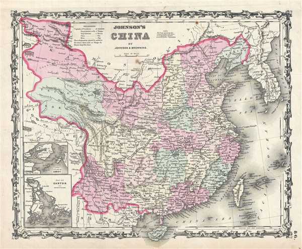
Johnson's China.
sold
- Digital Map Information
- Suitable for large format printing
- File Size: 8.79 MB
- File Type: ZIP / TIFF
- ICC color profile embedded
- Delivered instantly via download link
A fine example of A. J. Johnson and Ross C. Browning's 1861 map of China and Korea. Covers China from Tibet and Yunnan east to Korea (Corea) and north as far as Mongolia. It extends south to include the island of ... (more details)
The World on hemispherical projection as depicted by Johnson.

Johnson's Western Hemisphere. / Johnson's Eastern Hemisphere.
sold
- Digital Map Information
- Suitable for large format printing
- File Size: 15.39 MB
- File Type: ZIP / TIFF
- ICC color profile embedded
- Delivered instantly via download link
This is a beautiful example of A. J. Johnson and R. Browning's 1861 map of the world on a hemispherical projection. Offers a fascinating snapshot of the world during a period of rapid globalization and discovery. ... (more details)
Johnson's Map of Ireland and Scotland on a single sheet.

Johnson's Ireland. Johnson's Scotland.
sold
- Digital Map Information
- Suitable for large format printing
- File Size: 18.04 MB
- File Type: ZIP / TIFF
- ICC color profile embedded
- Delivered instantly via download link
This is a beautiful example of A. J. Johnson and R. Browning's 1861 map of Scotland and Ireland. It contains two separate maps within the same border. The left hand map features Ireland and covers the entire ... (more details)
Johnson's map depicting Austria, Greece and the Balkans.

Johnson's Austria Turkey In Europe And Greece.
sold
- Digital Map Information
- Suitable for large format printing
- File Size: 20.82 MB
- File Type: ZIP / TIFF
- ICC color profile embedded
- Delivered instantly via download link
This is a beautiful example of Johnson and Ward's 1863 map of Austria, Turkey in Europe and Greece. It covers from Italy eastward to include all of Austria, Hungary, the Balkans (Bosnia, Serbia, Albania, ... (more details)
Early map of Southeast Asia identifies the Singapore Strait.

Les Indes Orientales et leur archipel. Assujettie aux observations astronomiq(u)es combinees avec les itineraires anciens et modernes, et avec les routes des navigateurs.
sold
- Digital Map Information
- Suitable for large format printing
- DPI: 300
- File Size: 7.66 MB
- File Type: ZIP / TIFF
- ICC color profile embedded
- Delivered instantly via download link
This is an attractive 1783 map of India, Southeast Asia and the East Indies by Rigobert Bonne. It covers from Kandahar and the Maldives in the west eastward to include all of India, Southeast Asia (modern ... (more details)
Greece and the Balkans under Ottoman rule.
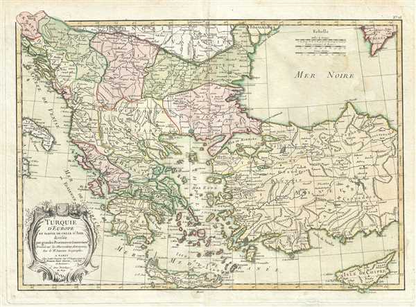
Turquie d'Europe et Partie de Celle d'Asie divisee par grandes Provinces et Gouvernemts.
sold
- Digital Map Information
- Suitable for large format printing
- DPI: 300
- File Size: 8.59 MB
- File Type: ZIP / TIFF
- ICC color profile embedded
- Delivered instantly via download link
This is a beautiful example of Janvier's 1783 decorative map of Turkey in Europe. Janvier's map covers from Croatia and the boot of Italy eastward as far as the Crimea, the Black Sea, Cappadocia, and ... (more details)
Decorative map of the British Isles.

Les Isles Britanniques Comprenant les Royaumes D'Angleterre, D'Ecosse et D'Irlande divisee en grands provinces.
sold
- Digital Map Information
- Suitable for large format printing
- DPI: 300
- File Size: 8.28 MB
- File Type: ZIP / TIFF
- ICC color profile embedded
- Delivered instantly via download link
This is a lovely example of Janvier's 1783 decorative map of the British Isles. Includes all of England, Scotland and Ireland as well as parts of adjacent France, Holland and Belgium. Divided ... (more details)