

Johnson's Japan Nippon, Kiusiu, Sikok, Yesso and the Japanese Kuriles.
sold
- Digital Map Information
- Suitable for large format printing
- Full resolution TIFF file
- ICC color profile embedded
- Delivered instantly via download link
This is Johnson's 1866 map of Japan. Compiled by A. J. Johnson from the map of Siebold with additions from the surveys and reconnaissance of the U.S. Japan expedition, this map covers the Japanese Islands from Kiusiu north to Yesso (Hokkaido). An inset map in the ... (more details)

Johnson's Africa.
sold
- Digital Map Information
- Suitable for large format printing
- Full resolution TIFF file
- ICC color profile embedded
- Delivered instantly via download link
This is a beautiful example of A. J. Johnson's highly decorative 1864 map of Africa. It covers the entire African continent as well as adjacent parts of Arabia and the Mediterranean. Throughout, Johnson identifies various cities, towns, rivers and assortment of ... (more details)

Johnson's Roman Empire, Imperium Romanorum Latissime Patens.
sold
- Digital Map Information
- Suitable for large format printing
- Full resolution TIFF file
- ICC color profile embedded
- Delivered instantly via download link
This is an attractive example of Johnson and Ward's 1866 map of the Roman Empire. It covers all of Europe as well as much of the Middle East, Persia and parts of North Africa and presents the Roman Empire following the Punic Wars, when it reached at its greatest ... (more details)

Johnson's Georgia and Alabama.
sold
- Digital Map Information
- Suitable for large format printing
- Full resolution TIFF file
- ICC color profile embedded
- Delivered instantly via download link
This is a beautiful example of Johnson and Ward's 1866 map of Georgia and Alabama. It offers a fascinating snapshot of these Confederate states during the American Civil War. The map shows both states in full with color coding according to county. In the early ... (more details)
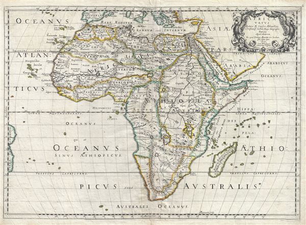
Africa Vetus.
sold
- Digital Map Information
- Suitable for large format printing
- DPI: 300
- File Size: 13.94 MB
- File Type: ZIP / TIFF
- ICC color profile embedded
- Delivered instantly via download link
An uncommon old color first edition example of Nicolas Sanson's map of Africa, prepared an issued separately in 1650. Sanson's map covers Africa in full with adjacent parts of Europe and Arabia represented in part. Sanson, a historian as well as a ... (more details)
Early promotional broadside map advertising a development in Oak Bluffs, Martha's Vineyard.

PLAN OF LAGOON HEIGHTS, Martha’s Vineyard, MASS.
sold
- Digital Map Information
- Suitable for large format printing
- File Size: 34.89 MB
- File Type: ZIP / TIFF
- ICC color profile embedded
- Delivered instantly via download link
A beautiful 1873 promotional map of Lagoon Height, the area of present day Oak Bluffs, Martha's Vineyard, Massachusetts. The map consists of a detailed street plan with housing lots and parks, as well as wonderful vignettes of Victorian era summer ... (more details)
Early map of the Hamptons with property owners.

Map of Long Island Based upon Recent U.S. Coast Surveys, Together with Local Maps on File. Supplemented by Careful Territorial Observations. [Suffolk County, Brookhaven, Rivrhead, Southampton].
sold
- Digital Map Information
- Suitable for large format printing
- File Size: 18.79 MB
- File Type: ZIP / TIFF
- ICC color profile embedded
- Delivered instantly via download link
This is the third section of a four part 1896 map series by E. Belcher Hyde, detailing central and eastern Long Island from Ronkonkoma to Matituck and Shinnecock Hills and from Fire Island north to Port Jefferson Harbor including the parts of ... (more details)
Early map of Long Island with property owners.

Map of Long Island Based upon Recent U.S. Coast Surveys, Together with Local Maps on File. Supplemented by Careful Territorial Observations. [Nassau County, Suffolk County, Huntington, Islip].
sold
- Digital Map Information
- Suitable for large format printing
- File Size: 35.48 MB
- File Type: ZIP / TIFF
- ICC color profile embedded
- Delivered instantly via download link
This is the central section of a four part 1896 map series by E. Belcher Hyde, detailing central Long Island from Hempstead and Oyster Bay to Islip and Smithtown and from Fire Island north to Lloyd's Neck and Huntington Bay, including the ... (more details)
Early map of western Long Island with property owners.

Map of Long Island Based upon Recent U.S. Coast Surveys, Together with Local Maps on File. Supplemented by Careful Territorial Observations. [Brooklyn, Queens, Nassau County].
sold
- Digital Map Information
- Suitable for large format printing
- File Size: 39.89 MB
- File Type: ZIP / TIFF
- ICC color profile embedded
- Delivered instantly via download link
This is a western section of a four part 1896 map series by E. Belcher Hyde, detailing western Long Island from Brooklyn to Hempstead and Freeport and from Glencove south as far as Jones Inlet, including Brooklyn, Queens and Nassau ... (more details)
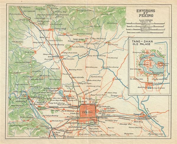
Environs of Peking.
sold
- Digital Map Information
- Suitable for large format printing
- Full resolution TIFF file
- ICC color profile embedded
- Delivered instantly via download link
This is a beautiful 1924 railway map of Beijing or Peking and its vicinity by the Imperial Japanese Government Railways. The map depicts Peking, the last of the four great ancient capitals of China, and its surroundings in great ... (more details)
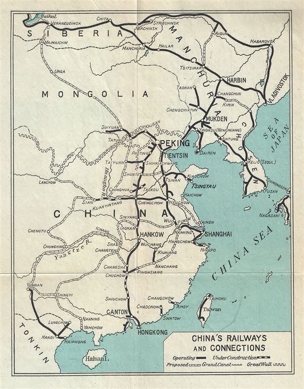
China's Railways and Connections.
sold
- Digital Map Information
- Suitable for large format printing
- Full resolution TIFF file
- ICC color profile embedded
- Delivered instantly via download link
This is a scarce 1924 railway map of China issued by the Imperial Japanese Government Railways. It covers all of China from Hainan north to Siberia and eastward from Korea to Yunnan Province. The Great Wall of China and the ... (more details)
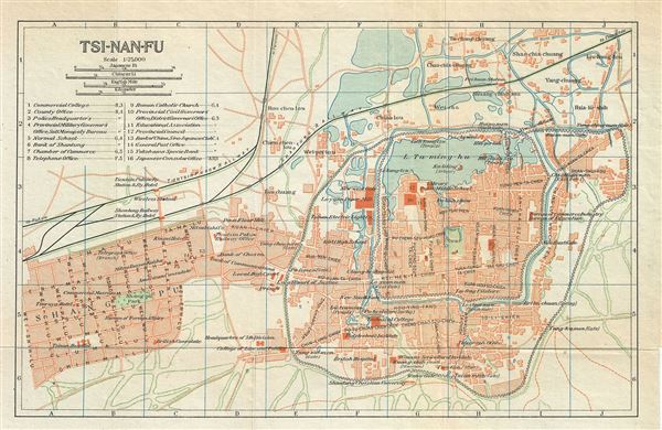
Tsi-Nan-Fu.
sold
- Digital Map Information
- Suitable for large format printing
- Full resolution TIFF file
- ICC color profile embedded
- Delivered instantly via download link
This is a beautiful 1924 railway map or plan of Jinan or Chi-nan-fu (Chinan) or Tsi-nan-fu (Tsinan), the capital of Shandong province in China, issued by the Imperial Japanese Government Railways. It depicts the city of ... (more details)
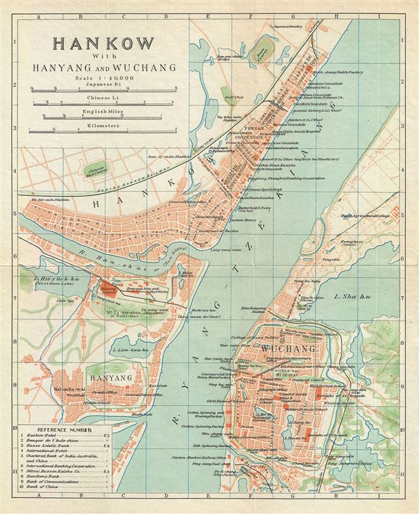
Hankow with Hanyang and Wuchang.
sold
- Digital Map Information
- Suitable for large format printing
- Full resolution TIFF file
- ICC color profile embedded
- Delivered instantly via download link
This is a beautiful 1924 map or plan of Hankow or Hankou, with Hanyang and Wuchang. This map, issued by the Imperial Japanese Government Railways, is centered on the intersection of the middle reaches of the Han and ... (more details)
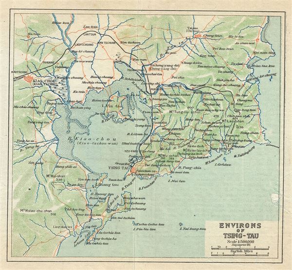
Environs of Tsing-Tau.
sold
- Digital Map Information
- Suitable for large format printing
- Full resolution TIFF file
- ICC color profile embedded
- Delivered instantly via download link
This is a beautiful 1924 map of Qingdao or Tsingtao or Chingtao and its vicinity, located in the eastern Shandong Province of China, issued by the Imperial Japanese Government Railways. The map depicts the city and ... (more details)
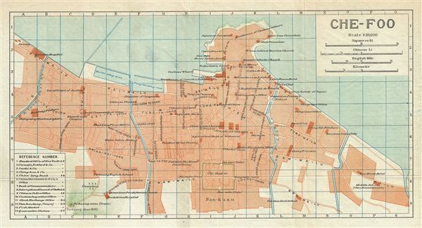
Che-foo.
sold
- Digital Map Information
- Suitable for large format printing
- Full resolution TIFF file
- ICC color profile embedded
- Delivered instantly via download link
This is a beautiful 1924 map of Yantai or Che-foo (Chefoo) located in northeastern Shandong province of China, issued by the Imperial Japanese Government Railways. It depicts the city of Yantai, the largest fishing ... (more details)

Nanking.
sold
- Digital Map Information
- Suitable for large format printing
- Full resolution TIFF file
- ICC color profile embedded
- Delivered instantly via download link
A beautiful 1924 map of Nanking or Nanjing in the Jiangsu Province of China, and one of the four great ancient capitals of China, by the Imperial Japanese Government Railways. The map depicts Nanjing in great ... (more details)

Soochow.
sold
- Digital Map Information
- Suitable for large format printing
- Full resolution TIFF file
- ICC color profile embedded
- Delivered instantly via download link
This is a beautiful 1924 map of Suzhou or Soochow or Suchow, part of the Yangtze River Delta region and located in the Jiangsu Province of China. The map was issued by the Imperial Japanese Government ... (more details)

Shanghai.
sold
- Digital Map Information
- Suitable for large format printing
- Full resolution TIFF file
- ICC color profile embedded
- Delivered instantly via download link
This is a beautiful 1924 map of Shanghai, China, by the Imperial Japanese Government Railways. It covers all of Shanghai including the greater metropolitan area and the downtown Bund region as well as ... (more details)

Hangchow.
sold
- Digital Map Information
- Suitable for large format printing
- Full resolution TIFF file
- ICC color profile embedded
- Delivered instantly via download link
A beautiful 1924 map of Hangchow or Hangzhou the capital, and largest city of the Zhejiang province of China by the Imperial Japanese Government Railways. The map is centered on the West Lake and ... (more details)

Foochow.
sold
- Digital Map Information
- Suitable for large format printing
- Full resolution TIFF file
- ICC color profile embedded
- Delivered instantly via download link
A beautiful 1924 map of Foo-Chow or Fuzhou by the Imperial Japanese Government Railways. The map covers Fuzhou, the capital and largest city in the Fujian province, in great detail, noting ... (more details)