
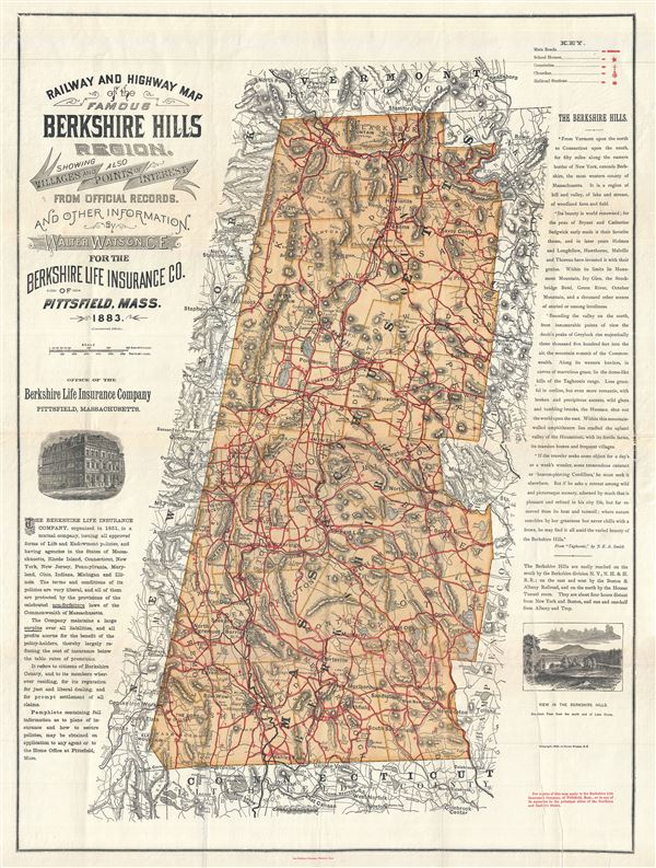
Railway and Highway Map of the Famous Berkshire Hills Region, Showing Villages and also Points of Interest.
sold
- Digital Map Information
- Suitable for large format printing
- File Size: 26.01 MB
- File Type: ZIP / TIFF
- ICC color profile embedded
- Delivered instantly via download link
This is a highly desirable 1896 map of the Berkshires or the Berkshire Hills in Massachusetts, by Walter Watson C. E. It covers Berkshire County, located in the western most part of the state of Massachusetts. Parts of the neighboring states of New York, Vermont ... (more details)

Lake Winnipesaukee, New Hampshire.
sold
- Digital Map Information
- Suitable for large format printing
- File Size: 20.55 MB
- File Type: ZIP / TIFF
- ICC color profile embedded
- Delivered instantly via download link
This is a beautiful 1905 bird's eye view style pocket map of Lake Winnipesaukee, New Hampshire by the Geo. H. Walker and Company, Boston. One of the more obscure and rare maps by George Walker, it covers the popular summertime destination from Little Asquam and ... (more details)

Map of Massachusetts Bay and Shore from Plymouth to Newburyport.
sold
- Digital Map Information
- Suitable for large format printing
- Full resolution TIFF file
- ICC color profile embedded
- Delivered instantly via download link
This is a beautiful and scarce 1898 map of the bay and shore of Massachusetts from Plymouth to Newburyport by George Walker. An uncommom map by Walker, it covers Boston and Vicinity, including the North Shore and South Shore, from Salisbury south to Plymouth ... (more details)

Map of the Coast of Maine (Eastern Part).
sold
- Digital Map Information
- Suitable for large format printing
- Full resolution TIFF file
- ICC color profile embedded
- Delivered instantly via download link
This is a scarce 1910 map of the coast of Maine by George Walker and Company. It covers the eastern coast of Maine from Grand Manan Island west as far as Penonscot Bay and Vinalhaven Island and north as far as Vanceboro. The map shows extensive detail ... (more details)

Boston and Surroundings.
sold
- Digital Map Information
- Suitable for large format printing
- Full resolution TIFF file
- ICC color profile embedded
- Delivered instantly via download link
This is a beautiful 1908 map or plan of the city of Boston, Massachusetts and its surroundings by the Walker Lith. and Publishing Company. It covers the city and suburbs from Blue Hills Reservations and Milton north to the Middlesex Fells Reservation ... (more details)
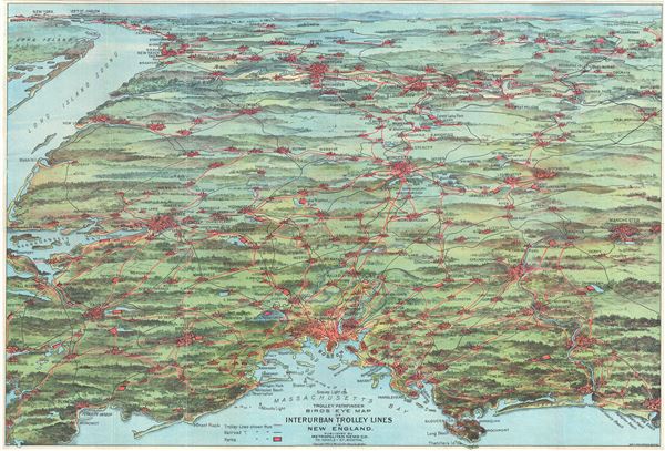
Trolley Pathfinder Birds Eye Map of Interurban Trolley Lines in New England.
sold
- Digital Map Information
- Suitable for large format printing
- Full resolution TIFF file
- ICC color profile embedded
- Delivered instantly via download link
This is a fascinating 1905 bird's eye view style pocket map of New England by George Walker issued by the Metropolitan News Company. Centered on Boston and oriented with north to the right, the map reveals New England from Portsmouth to New York ... (more details)
Most widely distributed European map detailing the Republic of Texas.

Central America II. Including Texas, Califnoria and th Northern States of Mexico.
sold
- Digital Map Information
- Suitable for large format printing
- DPI: 300
- File Size: 7.42 MB
- File Type: ZIP / TIFF
- ICC color profile embedded
- Delivered instantly via download link
A fine example of the uncommon 1842 Society for the Diffusion of Useful Knowledge, or S.D.U.K., map of the pre-Annexation Republic of Texas (1836 - 1846) and Upper California (California Alto). Illustrating Texas at its largest, this map extends ... (more details)

Germania.
sold
- Digital Map Information
- Suitable for large format printing
- Full resolution TIFF file
- ICC color profile embedded
- Delivered instantly via download link
A scarce 1742 miniature map of greater Germany by German historian Benjamin Hederichs. This map covers the entirety of those lands traditionally occupied by Germanic peoples, from the Blatic Coast to the Gulf of Venice and from Holland and ... (more details)

Asiae Nova Delineatio.
sold
- Digital Map Information
- Suitable for large format printing
- DPI: 300
- File Size: 1.88 MB
- File Type: ZIP / TIFF
- ICC color profile embedded
- Delivered instantly via download link
A scarce 1742 miniature map of Asia by German historian Benjamin Hederichs. This map covers the entirety of Asia from Europe to Japan and from the Arctic to New Holland or Australia. The mythic lake of Chiamay, speculated to be the source ... (more details)
California as an Island.
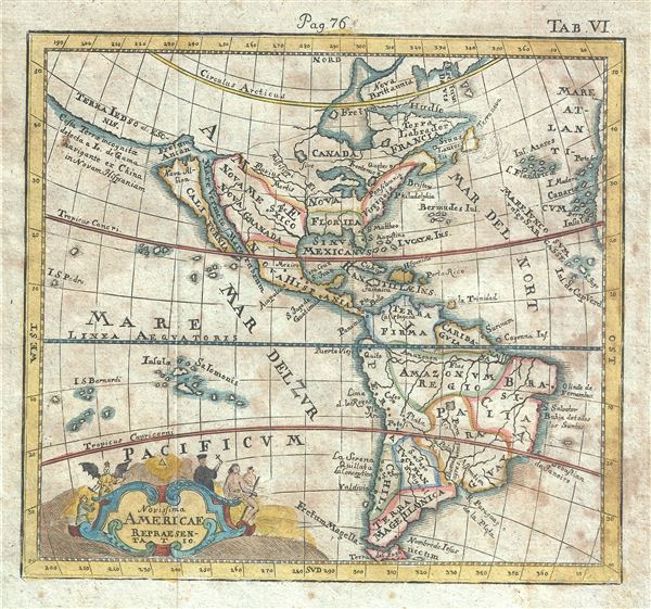
Novisima Americae Representatio.
sold
- Digital Map Information
- Suitable for large format printing
- DPI: 300
- File Size: 1.79 MB
- File Type: ZIP / TIFF
- ICC color profile embedded
- Delivered instantly via download link
A scarce 1742 miniature map of America by German historian Benjamin Hederichs. This map covers the entirety of America from the Arctic Circle to Tierra del Fuego, including all of North and South America, as then known. The map ... (more details)

Africae Accurata Descriptio.
sold
- Digital Map Information
- Suitable for large format printing
- Full resolution TIFF file
- ICC color profile embedded
- Delivered instantly via download link
A scarce 1742 miniature map of Africa by German historian Benjamin Hederichs. This map covers the entire continent of Africa as well as adjacent parts of Arabia and Europe. Following the conventions of the period Hederichs maps ... (more details)
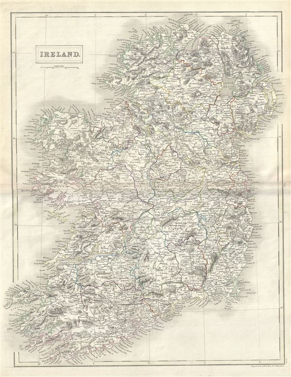
Ireland.
sold
- Digital Map Information
- Suitable for large format printing
- Full resolution TIFF file
- ICC color profile embedded
- Delivered instantly via download link
This is a fine example of Adam and Charles Black's 1844 map of Ireland. It covers from Donegal in the north to Cork in the south. The map shows all of Ireland divided by county. After the Norman Invasion the old provincial ... (more details)
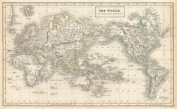
The World on Mercator's Projection.
sold
- Digital Map Information
- Suitable for large format printing
- Full resolution TIFF file
- ICC color profile embedded
- Delivered instantly via download link
This is a fine example of Adam and Charles Black's 1844 map of the world on Mercator's Projection. An interesting map of the world issued just as most of the Earth's non-polar shore has been explored. Vast stretches of ... (more details)
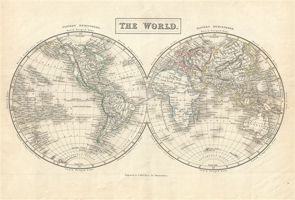
The World.
sold
- Digital Map Information
- Suitable for large format printing
- Full resolution TIFF file
- ICC color profile embedded
- Delivered instantly via download link
This is a fine example of Adam and Charles Black's 1844 map of the World in two hemispheres. Both the Western and Eastern Hemispheres are drawn and offer a fascinating snapshot of the world during a period of rapid ... (more details)
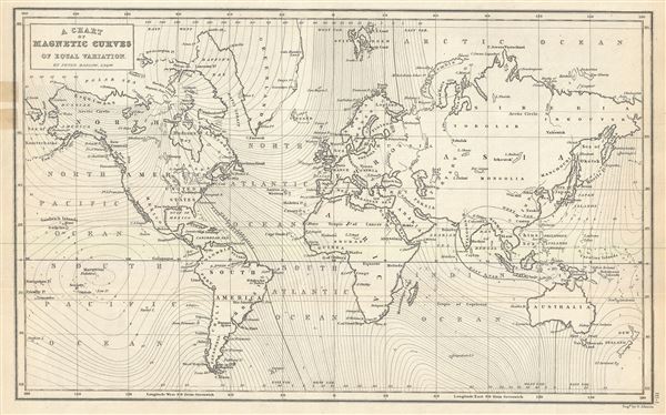
A Chart of Magnetic Curves of Equal Variation.
sold
- Digital Map Information
- Suitable for large format printing
- Full resolution TIFF file
- ICC color profile embedded
- Delivered instantly via download link
This is a fine example of Adam and Charles Black's 1844 chart of the World's Magnetic Curves of equal variation. The chart depicts the magnetic curves over the entire world, but does not show the isomagnetic lines ... (more details)
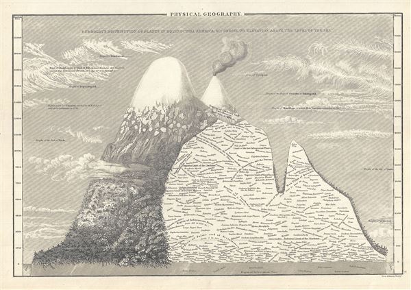
Physical Geography.
sold
- Digital Map Information
- Suitable for large format printing
- Full resolution TIFF file
- ICC color profile embedded
- Delivered instantly via download link
This is Adam and Charles Black's rare 1844 profile view of the Andes Mountains, particularly Ecuador's Mt. Chimborazo, based upon an influential 1805 illustration by the renowned German explorer and scientist ... (more details)
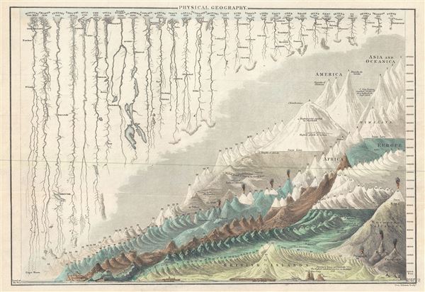
Physical Geography.
sold
- Digital Map Information
- Suitable for large format printing
- Full resolution TIFF file
- ICC color profile embedded
- Delivered instantly via download link
This is a beautiful example of Adam and Charles Black's 1844 comparative mountains and rivers of the world chart. Charts of this type were first introduced in England around 1823 and became a common feature ... (more details)

Ireland.
sold
- Digital Map Information
- Suitable for large format printing
- Full resolution TIFF file
- ICC color profile embedded
- Delivered instantly via download link
This is a beautiful example of Adam and Charles Black's 1844 map of Ireland. The map shows all of Ireland divided by county. It covers from Donegal in the north to Cork in the south. After the Norman ... (more details)
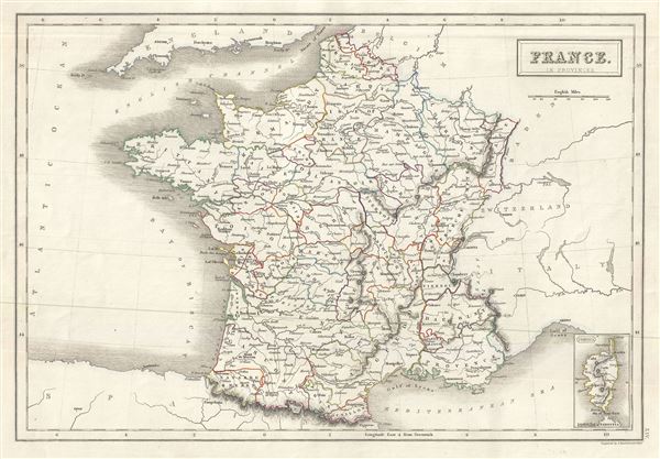
France in Provinces.
$100.00
Acquire
- Digital Map Information
- Suitable for large format printing
- Full resolution TIFF file
- ICC color profile embedded
- Delivered instantly via download link
This is a lovely example of Adam and Charles Black's 1844 map of France. The map covers the Kingdom of France showing its various divisions according to province. It covers from the Flanders in the ... (more details)

Holland.
sold
- Digital Map Information
- Suitable for large format printing
- Full resolution TIFF file
- ICC color profile embedded
- Delivered instantly via download link
This is a fine example of Adam and Charles Black's 1844 map of Holland or the Netherlands. The map covers the Kingdom of Netherlands, commonly referred to as Holland, from the North Sea to Belgium ... (more details)