
Burucker, Johann Michael (sold)
Unusual map of Bombay / Mumbai.
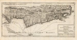
Charte des Theils der Küste von Indien Zwischen Bombay und Surate mit den Wohnörtern an dieser Küste
sold
- Digital Map Information
- Suitable for large format printing
- Full resolution TIFF file
- ICC color profile embedded
- Delivered instantly via download link
This is the 1786 German edition of Pierre-Marie-François de Pagès' map of the western Indian coast between Bombay (Mumbai) and Surat, newly engraved for the German translation of his Voyages. By combining a coastal chart with a detailed depiction of settlements and cultivated countryside, it situates the British harbor within a predominantly Maratha landscape. A distinctive line identifies Pagès' own route, connecting the geography to the travel narrative it accompanied. This map is significant as one of the earliest non-British maps of Bombay, predating its ascendancy as the center of British power in India. (more details)