Digital Image: 1703 Christoph Cellarius Map of Asia Minor
AsiaMinor-cellarius-1703_d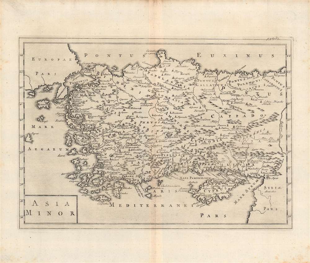

Title
Asia Minor.
1703 (undated) 10 x 14.25 in (25.4 x 36.195 cm) 1 : 3620000
1703 (undated) 10 x 14.25 in (25.4 x 36.195 cm) 1 : 3620000
Description
FOR THE ORIGINAL ANTIQUE MAP, WITH HISTORICAL ANALYSIS, CLICK HERE.
Digital Map Information
Geographicus maintains an archive of high-resolution rare map scans. We scan our maps at 300 DPI or higher, with newer images being 600 DPI, (either TIFF or JPEG, depending on when the scan was done) which is most cases in suitable for enlargement and printing.
Delivery
Once you purchase our digital scan service, you will receive a download link via email - usually within seconds. Digital orders are delivered as ZIP files, an industry standard file compression protocol that any computer should be able to unpack. Some of our files are very large, and can take some time to download. Most files are saved into your computer's 'Downloads' folder. All delivery is electronic. No physical product is shipped.
Credit and Scope of Use
You can use your digial image any way you want! Our digital images are unrestricted by copyright and can be used, modified, and published freely. The textual description that accompanies the original antique map is not included in the sale of digital images and remains protected by copyright. That said, we put significant care and effort into scanning and editing these maps, and we’d appreciate a credit when possible. Should you wish to credit us, please use the following credit line:
Courtesy of Geographicus Rare Antique Maps (https://www.geographicus.com).
How Large Can I Print?
In general, at 300 DPI, you should at least be able to double the size of the actual image, more so with our 600 DPI images. So, if the original was 10 x 12 inches, you can print at 20 x 24 inches, without quality loss. If your display requirements can accommodate some loss in image quality, you can make it even larger. That being said, no quality of scan will allow you to blow up at 10 x 12 inch map to wall size without significant quality loss. For more information, it is best consult a printer or reprographics specialist.
Refunds
If the high resolution image you ordered is unavailable, we will fully refund your purchase. Otherwise, digital images scans are a service, not a tangible product, and cannot be returned or refunded once the download link is used.
Cartographer
Christoph Cellarius (1638 - 1707) or, more commonly, Christopher Keller was a German scholar, historian and textbook publisher working in the later part of the 17th century. Cellarius is known to have been born in Schmalkalden and to have held academic positions in both Weimar and Halle. C. Cellarius's most important contribution was his 1683 publication of A Universal History Divided into an Ancient, Medieval, and New Period. It was in this work that the concept of history as divisible into three distinct periods (Ancient History, Mediaeval History, and Modern History) was introduced. Likely Cellarius never understood the impact that his structured system of historical nomenclature would have on the way future historians would interpret the past. Christopher Cellarius should not be confused with the more widely known cosmographer Andreas Cellarius More by this mapmaker...
Source
Cellarius, C., Notitia orbis antiqui sive geographia plenior..., Vol. 1, (Leipzig), 1703.