1852 Colton Commissioners' Plan / Map of Brooklyn and Williamsburg
BrooklynWilliamsburg-colton-1852$8,500.00

Title
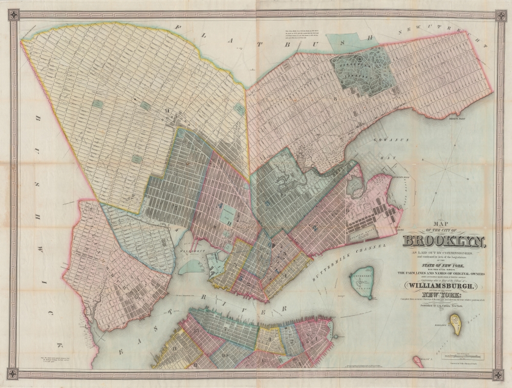
Map of the city of Brooklyn, as laid out by commissioners, and confirmed by acts of the Legislature of the state of New York, made from actual surveys the farm lines and names of original owners being accurately drawn from authentic sources. Containing also a map of the Village of Williamsburgh, and part of the city of New-York: compiled from accurate surveys and documents and showing the true relative position of all.
1852 (dated) 36 x 48 in (91.44 x 121.92 cm) 1 : 9600
1852 (dated) 36 x 48 in (91.44 x 121.92 cm) 1 : 9600
Description
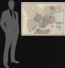
This is J. H. Colton's impressive large-scale 1852 map of Brooklyn and Williamsburg. In its 1839 first edition, it is the Brooklyn equivalent to both the 1811 Commissioner' Plan and Colton's great 1836 map of Manhattan, and as such can reasonably be considered the most important and best map of Brooklyn to appear in the 19th century. The present map, 1852, is, in so far as we can tell, the third edition, retaining much of the significance of the first, while also featuring fascinating updates illustrating the break-neck pace with which Brooklyn was then urbanizing.
Creating Brooklyn
This map was first issued in the wake of a February 28, 1839 New York State legislative act validating the work of Brooklyn Street Commissioners John S. Stoddard (surveyor and engineer), Alonzo. G. Hammond (commissioner), Samuel Cheever (commissioner), and Isaiah Tiffany (commissioner). These individuals were appointed four years earlier, in 1835, and dedicated the intervening years to completing a comprehensive plan for expanding urbanized Brooklyn by breaking up old estates and farms into streets, avenues, and property lots. The Act passed in 1839 confirmed their work as the official map of Brooklyn - this map by Colton closely followed, representing the earliest published official map of Brooklyn. In the first edition, Stoddard, Hammond, Cheever, and Tiffany are named. In subsequent editions, as here, they are named simply as 'the Commissioners'. It is likely that their names were removed due to criticism that made their names unpopular.A Bit of Controversy
The publication of this map in 1839 was the cause of considerable controversy. Hammond, who drew the map, initially submitted the copyright on his own behalf, before transferring it to Colton. It was argued that by doing so he violated the rights of the city of Brooklyn. He defended himself in the Long Island Star,While the laying out of the city was in progress, very many highly respectable citizens were in the frequent habit of calling upon Mr. Hammond at his office, and enquiring how they could obtain a map when the work was completed, and if one would be published? … Under these influences Messrs Hammond and Stoddard entered into an arrangement by which the former was to secure the copy right for their mutual benefit, and the latter was to furnish a manuscript, and to unite their exertions to procure the publication of such a map … In doing this no pecuniary motive had influence … and feared they might sustain a loss … [believing] that none but a map publisher … could safely publish with the prospect of covering expenses … they transferred all benefits of the copy right to Mr. Colton of New York, a justly celebrated publisher … The city of Brooklyn, as such, could never publish a map for the use of the citizens without expenditure far above their receipts. ('Long Island Star', March 14, 1839)
A Closer Look
Oriented to the southeast, coverage embraces only a small part of modern-day Brooklyn, including Downtown Brooklyn, Brooklyn Heights, Williamsburg, Bedford-Stuyvesant, Red Hook, Gowanus, Park Slope, Greenwood Cemetery, the Navy Yard, and Sunset Park. Southern Manhattan and Governors islands appear at the base of the map. Concentric circles in quarter-mile increments illustrate distances from the Battery, underscoring Brooklyn's deep and long-standing connection to Manhattan - even though at the time they remained separate cities. The map also meticulously notes swamp lands and drainage areas of natural ponds and rivers, including some that remain (if much changed) like Gowanus Creek and Bushwick Inlet, and others, like Freek and Denton's mill ponds, which have long been drained.Brooklyn Farm Lines
Like Manhattan during his same period, Brooklyn was undergoing a rapid transformation, where historic farms, some dating to the Dutch period, were being broken up into streets and lotted properties according to the Brooklyn Commissioners' Plan - equivalent to the more famous 1811 Manhattan Commissioners' Plan. During this process, large scale maps like this were critical in showing old 'farm' boundaries and estates and correctly attaching them to their heirs and the corresponding private surveys. Accordingly, his map is peppered with many of New York's most famous names on the properties they once controlled: Schermerhorn, Cornell, Debevoise, Van Cleef, Vandervoort, Nostrand, Lefferts, and many more. In many cases, the original 'farm' boundaries are ghosted in, along with the older roads since subsumed into the Commissioners' grid.Atlantic Railroad Tunnel - The First Subway?
This is one of the few contemporaneous maps to illustrate the Atlantic Tunnel (Cobble Hill Tunnel), a half-mile long railroad tunnel running under Atlantic Avenue from Boerum Place to the East River. Built in 1844, this might rightly be considered the world's oldest subway. The tunnel was meant to accommodate the Atlantic Railroad - a precursor of the Long Island Railroad, hence the naming of Atlantic Avenue. The tunnel was closed and sealed in 1861 when railroad locomotives were banned within Brooklyn. In the subsequent decades it was largely forgotten, but nonetheless, for those who remembered, rumors developed that it was a haunt of smugglers, bootleggers, German spies, and even vampires. The tunnel was rediscovered in 1980 by urban explorer Robert Diamond. For a time, there were tours of the tunnel, and it was added to the National Register of Historic Places in 1989.Publication History and Census
This map was engraved and printed by Stiles, Sherman, and Smith for J. H. Colton. The first issue appeared in 1839, followed by issues in 1846, 1849, 1851, and, as here, 1852. We have identified no surviving examples of the 1839 edition. The New York State Library appears to have an 1846 edition (acquired in 1850) - this being the earliest surviving example. The New York Public Library has 1849 and 1851 editions. We are aware of no other examples of this 1852 edition.CartographerS
Joseph Hutchins Colton (July 5, 1800 - July 29, 1893), often publishing as J. H. Colton, was an important American map and atlas publisher active from 1833 to 1897. Colton's firm arose from humble beginnings when he moved to New York in 1831 and befriended the established engraver, Samuel Stiles. He worked under Stiles as the 'Co.' in Stiles and Co. from 1833 to 1836. Colton quickly recognized an emerging market in railroad maps and immigrant guides. Not a cartographer or engraver himself, Colton's initial business practice mostly involved purchasing the copyrights of other cartographers, most notably David H. Burr, and reissuing them with updated engraving and border work. His first maps, produced in 1833, were based on earlier Burr maps and depicted New York State and New York City. Between 1833 and 1855, Colton proceeded to publish a large corpus of guidebooks and railroad maps, which proved popular. In the early 1850s, Colton brought his two sons, George Woolworth Colton (1827 - 1901) and Charles B. Colton (1832 - 1916), into the map business. G. W. Colton, trained as a cartographer and engraver, was particularly inspired by the idea of creating a large and detailed world atlas to compete with established European firms for the U.S. market. In 1855, G.W. Colton issued volume one of the impressive two-volume Colton's Atlas of the World. Volume two followed a year later. Possibly because of the expense of purchasing a two-volume atlas set, the sales of the Atlas of the World did not meet Colton's expectations, and so, in 1856, the firm also issued the atlas as a single volume. The maps contained in this superb work were all original engravings, and most bear an 1855 copyright. All of the maps were surrounded by an attractive spiral motif border that would become a hallmark of Colton's atlas maps well into the 1880s. In 1857, the slightly smaller Colton's General Atlas replaced the Atlas of the World. Most early editions of the General Atlas published from 1857 to 1859 do not have the trademark Colton spiral border, which was removed to allow the maps to fit into a smaller format volume. Their customers must have missed the border because it was reinstated in 1860 and remained in all subsequent publications of the atlas. There were also darker times ahead; in 1858, Colton was commissioned at a sum of 25,000 USD by the government of Bolivia to produce and deliver 10,000 copies of a large format map of that country. Although Colton completed the contract in good faith, delivering the maps at his own expense, he was never paid by Bolivia, which was at the time in the midst of a series of national revolutions. Colton would spend the remainder of his days fighting with the Bolivian and Peruvian governments over this payment, and in the end, after a congressional intervention, he received as much as 100,000 USD in compensation. Nonetheless, at the time, it was a disastrous blow. J. H. Colton and Company is listed as one of New York's failed companies in the postal record of 1859. This led Colton into the arms of Alvin Jewett Johnson and Ross C. Browning. The 1859 edition of Colton's General Atlas lists Johnson and Browning as the 'Successor's to J. H. Colton' suggesting an outright buyout, but given that both companies continued to publish separately, the reality is likely more complex. Whatever the case may have been, this arrangement gave Johnson and Browning access to many of Colton's map plates and gave birth to Johnson's New Illustrated (Steel Plate) Family Atlas. The Johnson's Atlas was published parallel to Colton's atlases well into the 1880s. The Colton firm itself subsequently published several other atlases including an Atlas of America, the Illustrated Cabinet Atlas, the Octavo Atlas of the Union, and Colton's Quarto Atlas of the World. They also published a large corpus of wall maps, pocket maps, and guides. The last known publications of the Colton firm date to 1897 and include a map and a view, both issued in association with the Merchant's Association of New York. Alice M. Colton married August R. Ohman (May 3, 1859 - April 22, 1934) on January 5, 1897. In 1898, Ohman joined the Colton firm, which continued to publish as Colton, Ohman & Co. until 1901. More by this mapmaker...
Samuel Stiles (July 15, 1796 - April 3, 1861) was a New York based engraver of maps and bank notes active in the middle part of the 19th century. Stiles was born in East Windsor, Connecticut, and there served his apprenticeship as a line-engraver under self-taught master Abner Reed. In 1821, following his apprenticeship, Stiles relocated to Hartford, Connecticut, with is former master, Abner Reed, to form the firm of Reed and Stiles. Reed and Stiles worked in portrait, historical, landscape, and map engraving on wood and copper. Another former Reed apprentice, Pelton, joined the firm in 1822, changing the name of the firm to Reed, Stiles, and Pelton. Around this time, he also joined the Connecticut State Militia where he was commissioned as a corporal in the same Calvary regiment as his brother Asabel Chapin Stiles. In 1824, he relocated to Utica, New York, where worked with Vistus Balch, also a former Reed apprentice. Stiles and Balch moved to New York together in 1828 to found Balch and Stiles, banknote engravers. In 1833, Samuel Stiles partnered with Joseph Hutchins Colton, then a young man, to found Stiles and Company – Colton being the 'company.' This partnership lasted until 1836 when he and Colton published their great plan of New York City, known as the 'Colton Map.' Colton went his own way and became a major American map publisher. Stiles moved a few blocks away and partnered with George E. Sherman and Colin Smith to found Stiles, Sherman and Smith. The partnership dissolved in 1840 and Stiles took up again with J. H. Colton, who was already becoming prominent. In 1841, he joined the firm of Danforth, Ball, and Company, Bank Note Engravers. This firm eventually merged into the American Bank Note Company. In 1859 Stiles became a founding member of the National Banknote Company, which incorporated as the American Banknote Company. He was the treasurer of this successful firm until his death in 1861. On a side note, Stiles married the daughter of Abner Reed, Charlotte Sophia Reed, in 1825. Their son, Henry Reed Stiles attained fame of his own as historian and genealogist. Learn More...
Sherman and Smith (fl. c. 1829 - 1855), sometimes working as Stiles, Sherman & Smith, were American engravers active in New York City during the middle part of the 19th century. The firm including John Calvin Smith (surveyor and engraver), George E. Sherman, and sometimes, Samuel Stiles. Their work primarily focused on government publications, including the maps and engravings prepared to illustrate the official records of the 1838-42 United States Exploring Expedition (U.S. Ex. Ex.), maps issued for the Army Corps of Topographical Engineers, and various U.S. Coast Survey Charts. They also engraved privately for Thomas Bradford and John Disturnell, among others. Sherman and Smith maintained offices at the corner of Broadway and Liberty Street in New York City and were highly regarded as the finest cartographic engravers in the city. Their non-cartographic legacies include George Inness, who apprenticed with them for two years before going on to become a well regarding American landscape painter of the Hudson River School. Learn More...
Condition
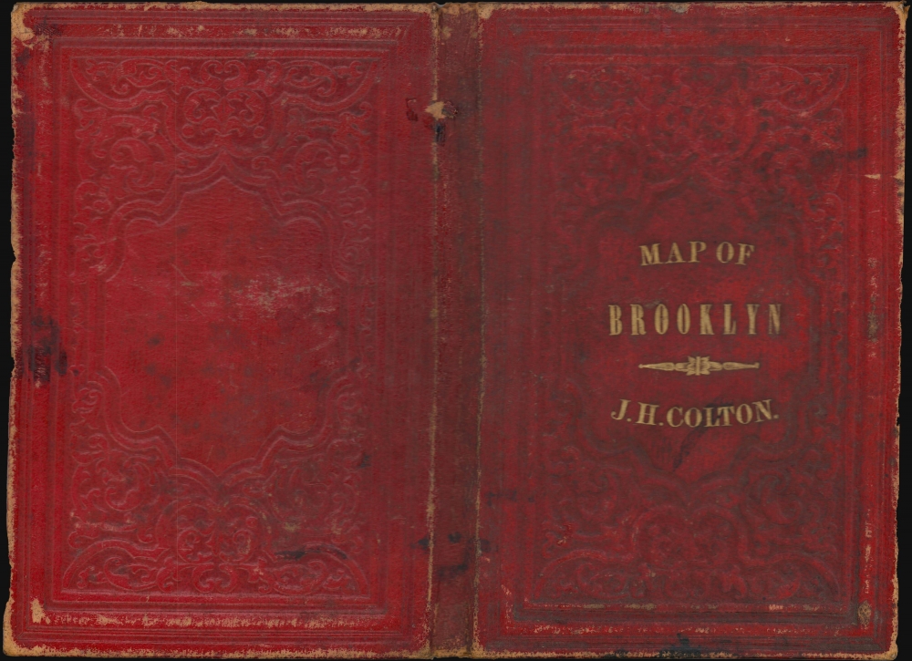
Very good. Steel plate printing on onion-skin paper. Wear and toning along some old fold lines. Archival verso reinforcement at most fold intersections - a few minor points of infill at the same. Accompanies original binder.
References
New York Public Library, Map Div. 01-1839. OCLC: 46538975.