
Sherman and Smith

Sherman and Smith (fl. c. 1829 - 1855), sometimes working as Stiles, Sherman & Smith, were American engravers active in New York City during the middle part of the 19th century. The firm including John Calvin Smith (surveyor and engraver), George E. Sherman, and sometimes, Samuel Stiles. Their work primarily focused on government publications, including the maps and engravings prepared to illustrate the official records of the 1838-42 United States Exploring Expedition (U.S. Ex. Ex.), maps issued for the Army Corps of Topographical Engineers, and various U.S. Coast Survey Charts. They also engraved privately for Thomas Bradford and John Disturnell, among others. Sherman and Smith maintained offices at the corner of Broadway and Liberty Street in New York City and were highly regarded as the finest cartographic engravers in the city. Their non-cartographic legacies include George Inness, who apprenticed with them for two years before going on to become a well regarding American landscape painter of the Hudson River School.
Navigating New Haven's Tricky Harbor.
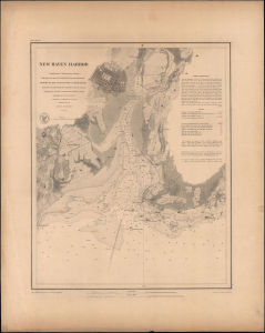
New Haven Harbor.
$500.00
Acquire
- Digital Map Information
- Suitable for large format printing
- Full resolution TIFF file
- ICC color profile embedded
- Delivered instantly via download link
This is a rare, separately issued example of the 1846 U.S. Coast Survey nautical chart or map of the harbor of New Haven, Connecticut, printed on thicker paper than the charts appearing in the Coast Survey's Annual Report. (more details)
Brooklyn equivalent of the 1811 Commissioners' Plan.
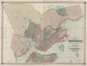
Map of the city of Brooklyn, as laid out by commissioners, and confirmed by acts of the Legislature of the state of New York, made from actual surveys the farm lines and names of original owners being accurately drawn from authentic sources. Containing also a map of the Village of Williamsburgh, and part of the city of New-York: compiled from accurate surveys and documents and showing the true relative position of all.
$8,500.00
Acquire
- Digital Map Information
- Suitable for large format printing
- DPI: 600
- File Size: 210.77 MB
- File Type: ZIP / TIFF
- ICC color profile embedded
- Delivered instantly via download link
This is J. H. Colton's impressive large-scale 1852 map of Brooklyn and Williamsburg. In its 1839 first edition, it is the Brooklyn equivalent to both the 1811 Commissioner' Plan and Colton's great 1836 map of Manhattan, and as such can reasonably be considered the most important and best map of Brooklyn to appear in the 19th century. The present map, 1852, is, in so far as we can tell, the third edition, retaining much of the significance of the first, while also featuring fascinating updates illustrating the break-neck pace with which Brooklyn was then urbanizing. (more details)
Detailing the transportation network of the Upper Midwest.
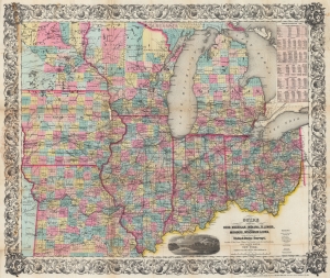
Guide Through Ohio, Michigan, Indiana, Illinois, Missouri, Wisconsin, and Iowa. Showing the Township lines of the United States Surveys, Locations of Cities, Towns, Villages, Post Hamlets, Canals, Rail and Stage Roads.
$1,200.00
Acquire
- Digital Map Information
- Suitable for large format printing
- File Size: 46.6 MB
- File Type: ZIP / TIFF
- ICC color profile embedded
- Delivered instantly via download link
This is an 1855 John Calvin Smith and John H. Colton map of Ohio, Michigan, Indiana, Illinois, Missouri, Wisconsin, and Iowa, along with part of Minnesota. The map captures a pivotal moment as mass emigration, developing industries, and displaced indigenous people transformed regional social, economic, and political spheres. (more details)
Uncommon separate issue map of New York.

Map of the State of New York Showing the location of Boundaries of Counties and Townships Cities, Towns and Villages: the Courses of Rail Roads, Canals and Stage Roads.
$125.00
Acquire
- Digital Map Information
- Suitable for large format printing
- Full resolution TIFF file
- ICC color profile embedded
- Delivered instantly via download link
This is a separate-issue 1858 J. Calvin Smith and J. Disturnell pocket map of New York. (more details)
One of the largest and most beautiful American commercial maps published in the 19th century.
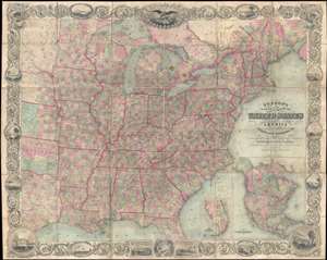
Map of the United States of America Including Canada, and a large portion of Texas, Showing Base Meridian and Township Lines of the U.S. Surveys, Including Lands alotted to the Indian Tribes west of the Mississippi, The various internal improvements.
$7,500.00
Acquire
- Digital Map Information
- Suitable for large format printing
- Full resolution TIFF file
- ICC color profile embedded
- Delivered instantly via download link
One of the most striking American large format wall maps ever issued. This is the 1862 American Civil War era case map of the United States by J. Calvin Smith and updated by J. H. Colton. The map covers from Austin Texas to the eastern seaboard and from Lake Superior to the Gulf of Mexico. Smith first introduced this map in 1843 buy the present much revised and updated example is the 1862 Civil War Colton edition. When it was introduced in 1843, this map was hailed as the largest, best, and most detailed map of the United States yet published. (more details)
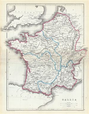
Gallia.
$100.00
Acquire
- Digital Map Information
- Suitable for large format printing
- File Size: 4.41 MB
- File Type: ZIP / TIFF
- ICC color profile embedded
- Delivered instantly via download link
A fine 1867 map of Gaul or Gallia or France by William Hughes. The map covers Gallia during the ancient Roman times and covers from the English Channel south as far as the Pyrenees Mountains and Hispania. It includes the modern day nations of France, Luxembourg, ... (more details)
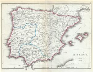
Hispania.
$100.00
Acquire
- Digital Map Information
- Suitable for large format printing
- File Size: 3.53 MB
- File Type: ZIP / TIFF
- ICC color profile embedded
- Delivered instantly via download link
This is a lovely 1867 map of Hispania or Spain and Portugal by William Hughes. The map depicts the Iberian Peninsula under the Roman Empire from the Atlantic Ocean to the Mediterranean Sea, including the Balearic Islands. The Roman provinces of Tarraconensis, ... (more details)
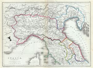
Italia (Northern Part).
$100.00
Acquire
- Digital Map Information
- Suitable for large format printing
- File Size: 3.89 MB
- File Type: ZIP / TIFF
- ICC color profile embedded
- Delivered instantly via download link
This is a fine 1867 William Hughes map of northern Italy during ancient Roman times. The map depicts the northern part of Italy from Lake Geneva in Switzerland to Lake Bolsena in Italy. The map identifies a host of important cities and towns and uses ancient ... (more details)
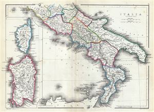
Italia (Southern Part).
$100.00
Acquire
- Digital Map Information
- Suitable for large format printing
- File Size: 4.06 MB
- File Type: ZIP / TIFF
- ICC color profile embedded
- Delivered instantly via download link
This is a fine 1867 William Hughes map of southern Italy during ancient Roman times. The map depicts the southern part of Italy from Lake Bolsena to Reggio in southern Italy. The map does not detail Sicily. An inset along the left border features the ... (more details)