Digital Image: 1747 Boitard Celestial Map of the Constellations from the Farnese Atlas
Celestial-boitard-1747_d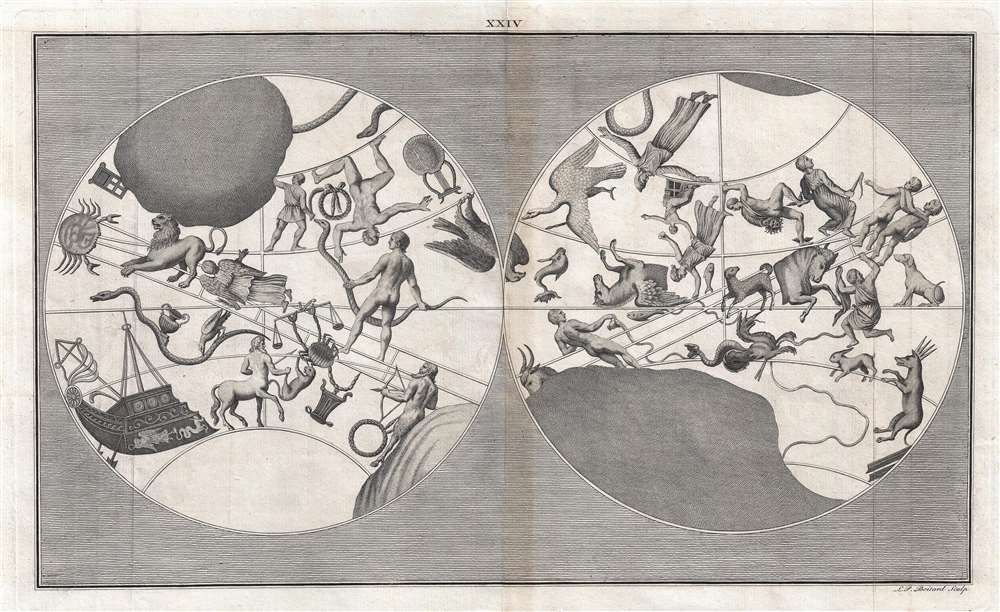

Title
XXIV.
1747 (undated) 12 x 20.5 in (30.48 x 52.07 cm)
1747 (undated) 12 x 20.5 in (30.48 x 52.07 cm)
Description
FOR THE ORIGINAL ANTIQUE MAP, WITH HISTORICAL ANALYSIS, CLICK HERE.
Digital Map Information
Geographicus maintains an archive of high-resolution rare map scans. We scan our maps at 300 DPI or higher, with newer images being 600 DPI, (either TIFF or JPEG, depending on when the scan was done) which is most cases in suitable for enlargement and printing.
Delivery
Once you purchase our digital scan service, you will receive a download link via email - usually within seconds. Digital orders are delivered as ZIP files, an industry standard file compression protocol that any computer should be able to unpack. Some of our files are very large, and can take some time to download. Most files are saved into your computer's 'Downloads' folder. All delivery is electronic. No physical product is shipped.
Credit and Scope of Use
You can use your digial image any way you want! Our digital images are unrestricted by copyright and can be used, modified, and published freely. The textual description that accompanies the original antique map is not included in the sale of digital images and remains protected by copyright. That said, we put significant care and effort into scanning and editing these maps, and we’d appreciate a credit when possible. Should you wish to credit us, please use the following credit line:
Courtesy of Geographicus Rare Antique Maps (https://www.geographicus.com).
How Large Can I Print?
In general, at 300 DPI, you should at least be able to double the size of the actual image, more so with our 600 DPI images. So, if the original was 10 x 12 inches, you can print at 20 x 24 inches, without quality loss. If your display requirements can accommodate some loss in image quality, you can make it even larger. That being said, no quality of scan will allow you to blow up at 10 x 12 inch map to wall size without significant quality loss. For more information, it is best consult a printer or reprographics specialist.
Refunds
If the high resolution image you ordered is unavailable, we will fully refund your purchase. Otherwise, digital images scans are a service, not a tangible product, and cannot be returned or refunded once the download link is used.
Cartographer S
Joseph Spence (April 28, 1699 – August 20, 1748) was an English historian, literary scholar, and anecdotist, who spent the majority of his life traveling throughout Europe. During these travels, he wrote many of his most distinguished pieces, and received inspiration for other literary works and lectures he went on to give at Oxford. Alexander Pope became a life-long friend to Spence and heavily influenced his work. Due in part to this friendship, Spence was elected the Oxford Chair of Poetry in 1728, and went on to become a professor of modern history at Oxford in 1742. After publishing Polymetis, Spence used his profits to fulfill his love of gardening, and he continued to produce literary works (both published and unpublished) until his death. More by this mapmaker...
Louis-Philippe Boitard (fl. 1733 - 1758) was a French-born engraver active in London during the middle part of the 18th century. He was born in Paris and relocated to London with his father François Boitard (1670 – 1719), a baroque painter, as a young man. Boitard mastered engraving under the tutelage of Raymond Lafage. His most notable work is the compilation and engraving of 41 plates in total for Joseph Spence's Polymetis. At the time of his death he was based in England. Learn More...
Source
Spence, J., Polymetis, (London: Dodsley) 1747.