Digital Image: 1660 Jansson / Van Loon Map of China and Korea
ChinaKorea-jansson-1660_d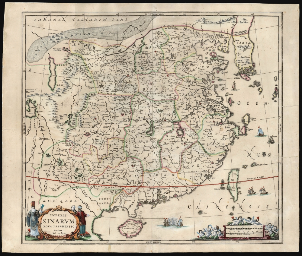

Title
Imperii Sinarum Nova Descriptio.
1660 (undated) 18.25 x 20.5 in (46.355 x 52.07 cm) 1 : 6000000
1660 (undated) 18.25 x 20.5 in (46.355 x 52.07 cm) 1 : 6000000
Description
FOR THE ORIGINAL ANTIQUE MAP, WITH HISTORICAL ANALYSIS, CLICK HERE.
Digital Map Information
Geographicus maintains an archive of high-resolution rare map scans. We scan our maps at 300 DPI or higher, with newer images being 600 DPI, (either TIFF or JPEG, depending on when the scan was done) which is most cases in suitable for enlargement and printing.
Delivery
Once you purchase our digital scan service, you will receive a download link via email - usually within seconds. Digital orders are delivered as ZIP files, an industry standard file compression protocol that any computer should be able to unpack. Some of our files are very large, and can take some time to download. Most files are saved into your computer's 'Downloads' folder. All delivery is electronic. No physical product is shipped.
Credit and Scope of Use
You can use your digial image any way you want! Our digital images are unrestricted by copyright and can be used, modified, and published freely. The textual description that accompanies the original antique map is not included in the sale of digital images and remains protected by copyright. That said, we put significant care and effort into scanning and editing these maps, and we’d appreciate a credit when possible. Should you wish to credit us, please use the following credit line:
Courtesy of Geographicus Rare Antique Maps (https://www.geographicus.com).
How Large Can I Print?
In general, at 300 DPI, you should at least be able to double the size of the actual image, more so with our 600 DPI images. So, if the original was 10 x 12 inches, you can print at 20 x 24 inches, without quality loss. If your display requirements can accommodate some loss in image quality, you can make it even larger. That being said, no quality of scan will allow you to blow up at 10 x 12 inch map to wall size without significant quality loss. For more information, it is best consult a printer or reprographics specialist.
Refunds
If the high resolution image you ordered is unavailable, we will fully refund your purchase. Otherwise, digital images scans are a service, not a tangible product, and cannot be returned or refunded once the download link is used.
Cartographer S
Jan Jansson or Johannes Janssonius (1588 - 1664) was born in Arnhem, Holland. He was the son of a printer and bookseller and in 1612 married into the cartographically prominent Hondius family. Following his marriage he moved to Amsterdam where he worked as a book publisher. It was not until 1616 that Jansson produced his first maps, most of which were heavily influenced by Blaeu. In the mid 1630s Jansson partnered with his brother-in-law, Henricus Hondius, to produce his important work, the eleven volume Atlas Major. About this time, Jansson's name also begins to appear on Hondius reissues of notable Mercator/Hondius atlases. Jansson's last major work was his issue of the 1646 full edition of Jansson's English Country Maps. Following Jansson's death in 1664 the company was taken over by Jansson's brother-in-law Johannes Waesberger. Waesberger adopted the name of Jansonius and published a new Atlas Contractus in two volumes with Jansson's other son-in-law Elizée Weyerstraet with the imprint 'Joannis Janssonii haeredes' in 1666. These maps also refer to the firm of Janssonius-Waesbergius. The name of Moses Pitt, an English map publisher, was added to the Janssonius-Waesbergius imprint for maps printed in England for use in Pitt's English Atlas. More by this mapmaker...
Johannes van Loon (c. 1611 - 1686), also known as Jan van Loon, was a Dutch mapmaker, mathematician, and engraver active in Amsterdam during the middle part of the 17th century. Van Loon issued the exceptional nautical atlas Klaer-Lichtende Noort-Ster ofte Zee Atlas in 1661. His is also known to have engraved several plates of Cellarius's Harmonia Macrocosmica Seu Atlas and to have contributed maps to nautical atlases and pilot books by Jacobsz, Jan Jansson, Johannes Janssonius van Waesbergen, and Robijin. Little is known of his personal life. Learn More...
Martino Martini (September 20, 1614 - June 6, 1661) was an Italian Jesuit missionary, historian, and cartographer, working mainly on ancient Imperial China. He is acclaimed as the father of Chinese geographical science, as he was ‘the first to study the history and geography of China with rigorous scientific objectivity.' Born in Trento, in the Bishopric of Trent, he finished school in 1631. After, he entered the Society of Jesus and was sent to study classical letters and philosophy at the Roman College, Rome, from 1634 until 1637. He completed his theological studies in Portugal from 1637 until 1639 and was ordained as a priest in Lisbon in 1639. He left for China in 1640, arriving in 1642 in Portuguese Macau. He studied Chinese before, in 1642, moving to Hangzhou, Zhejiang Province. He spent much of his time traveling and gathering scientific information, particularly concerning the geography. In April 1644, soon after his arrival in China, the Ming capital Beijing fell to Li Zicheng’s rebels and then to the Manchus. Martini had been allied with the short-lived regime of Zhu Yujian, Prince of Tang, who declared himself the (Southern) Ming Longwu Emperor after the fall of the last legitimate Ming, the Chongzhen Emperor. When Wenzhou, where Martini was on a mission for Zhu Yujian, was about to fall to the Manchus, Martini convinced them to allow him to change sides. Before the Manchu troops entered the city, Martini created a large red poster stating, 'Here lives a doctor of the divine Law who has come from the Great West.' Below the poster he arranged tables with European books, astronomical instruments, and other objects surrounding an altar with an image of Jesus. The commander of the Manchu troops was so impressed by the display that he politely asked Martini to change sides. In 1651, Martini left China as the Delegate of the Chinese Mission Superior. Among the works he brought with him was Lo Hongxian's (羅洪先; 1504 - 1564) 1555 revision of Zhu Siben's (朱思本;1273 - 1333) 1312 manuscript atlas of the Chinese Provinces, Guang Yu Tu (廣與圖; 'Enlarged Territorial Atlas'). En route, his ship was captured by the Dutch, who apparently also saw Martini's value: they took him first to Java, and then to Amsterdam, where he arrived in 1654. During this intervening period, Martini translated the Zhu Siben atlas into Latin, and added his own description of China. The Blaeu mapmaking firm swiftly published Martini's map as Novus Atlas Sinensis, and later published Martini's description of China both on its own and within the Blaeu Atlas. After his circuitous journey, he reached Rome in the spring of 1655. He carried with him a long and detailed communication from the Jesuit missionaries in China, defending the so-called Chinese Rights (veneration of ancestors and other practices allowed to new Christians). After five months of discussions and debates, the Propaganda Fide issued a degree in favor of the Jesuits, although the controversy did not abate. Learn More...
Source
Jansson, J., Atlas Novus., (Amsterdam: Jansson) c. 1660.
References
OCLC, 7454099. Van der Krogt, P. C. J., Koeman's Atlantes Neerlandici, (3 Vols), #8410:1C.