Digital Image: 1902 Freytag Topographic Map of the Dolomites, Italy - Austria Borderland
Dolomites-freytag-1902_d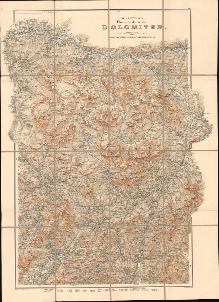

Title
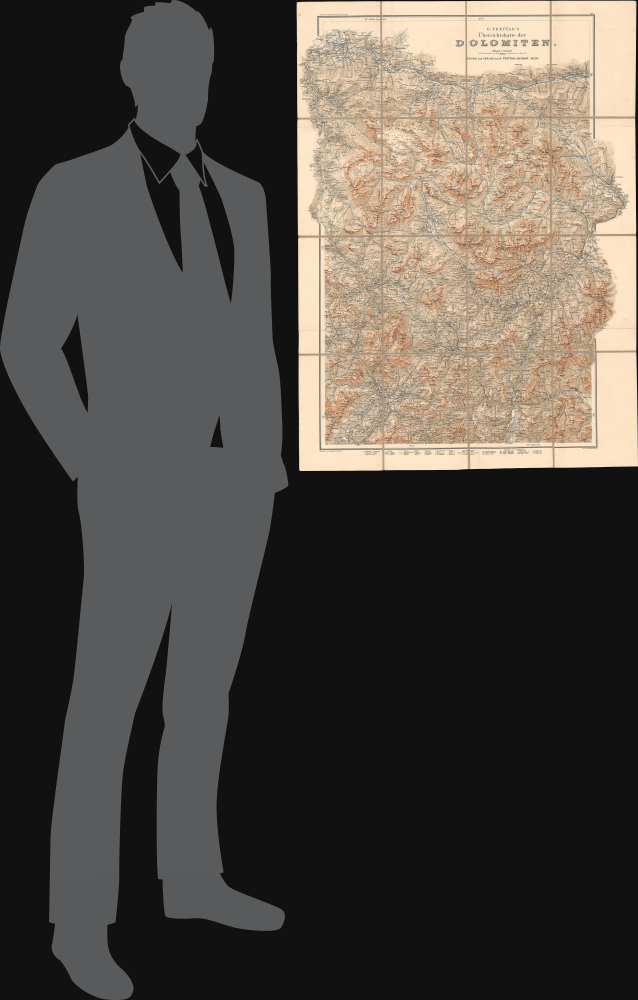
G. Freytag's Übersichtskarte der Dolomiten. Blatt 2.
1902 (undated) 30.75 x 22.5 in (78.105 x 57.15 cm) 1 : 100000
1902 (undated) 30.75 x 22.5 in (78.105 x 57.15 cm) 1 : 100000
Description
FOR THE ORIGINAL ANTIQUE MAP, WITH HISTORICAL ANALYSIS, CLICK HERE.
Digital Map Information
Geographicus maintains an archive of high-resolution rare map scans. We scan our maps at 300 DPI or higher, with newer images being 600 DPI, (either TIFF or JPEG, depending on when the scan was done) which is most cases in suitable for enlargement and printing.
Delivery
Once you purchase our digital scan service, you will receive a download link via email - usually within seconds. Digital orders are delivered as ZIP files, an industry standard file compression protocol that any computer should be able to unpack. Some of our files are very large, and can take some time to download. Most files are saved into your computer's 'Downloads' folder. All delivery is electronic. No physical product is shipped.
Credit and Scope of Use
You can use your digial image any way you want! Our digital images are unrestricted by copyright and can be used, modified, and published freely. The textual description that accompanies the original antique map is not included in the sale of digital images and remains protected by copyright. That said, we put significant care and effort into scanning and editing these maps, and we’d appreciate a credit when possible. Should you wish to credit us, please use the following credit line:
Courtesy of Geographicus Rare Antique Maps (https://www.geographicus.com).
How Large Can I Print?
In general, at 300 DPI, you should at least be able to double the size of the actual image, more so with our 600 DPI images. So, if the original was 10 x 12 inches, you can print at 20 x 24 inches, without quality loss. If your display requirements can accommodate some loss in image quality, you can make it even larger. That being said, no quality of scan will allow you to blow up at 10 x 12 inch map to wall size without significant quality loss. For more information, it is best consult a printer or reprographics specialist.
Refunds
If the high resolution image you ordered is unavailable, we will fully refund your purchase. Otherwise, digital images scans are a service, not a tangible product, and cannot be returned or refunded once the download link is used.
Cartographer S
Freytag and Berndt (1770 - Present) is a map, atlas, guidebook, and travel literature publisher. Its roots reach back to when Francesco Artaria founded a lithographic works in Vienna in 1770. In February 1879, Gustav Freytag founded a cartographic publishing house. Freytag and Berndt merged with the cartographic division of Artaria in 1920. After World War II, Freytag-Berndt und Artaria experienced expanded publication to become one of the most important cartographic publishers in Central Europe. Today, Freytag and Berndt publishes street maps, city map, hiking maps, and cycling maps and employs fifty cartographers and editors at their headquarters in Vienna. More by this mapmaker...
Hans Rohn (February 25, 1868 - December 23, 1955), born Johann Rohn, was a Viennese cartographer, lithographer, and painter best known for his stunning depictions of the European Alps, being a pioneer in the genre of Alpine cartography which flourished in the 20th century. Born in Hundstrum, then a suburb of Vienna, Rohn's talent for drawing was discovered at a young age by the landscape painter and family friend Ferdinand Mayer. In 1882, Rohn began an apprenticeship with the Viennese cartographer and lithographer Gustav Freytag (1852 - 1938). Freytag nurtured Rohn's talent for depicting rocks and terrain and allowed him to develop his own style that resulted in remarkably realistic lithographic prints that appeared almost three dimensional (he eschewed hachure lines, for instance, instead using his artistic instincts to illustrate relief). Freytag had Rohn accompany him on exploratory trips to the Alps to produce the company's very successful Special-Touristenkarten and Touristen-Wanderkarte der Dolomiten series, and also encouraged him to formally study painting and photography. In addition to his cartographic work for Freytag, Rohn also painted landscapes during their Alpine expeditions. In 1889, Rohn entered the Akademie der bildenden Künste to begin a four-year course of study. His teachers included painters Carl Rahl, Siegmund L'Allemand, Leopold Carl Müller; and the portrait and landscape painter Franz Rumpler, who had a particular influence on Rohn. His classmates included painters who would go on to be leading figures in the Vienna Secession movement, related to Art Nouveau. In 1895, Rohn met Theresia Czokally who would become his wife; they had two children together. After finishing his studies at the Akademie der bildenden Künste, Rohn returned to Freytag (now known as Freytag and Berndt) and continued to hone his craft depicting terrain. He also ventured into making three-dimensional raised relief plaster maps of mountainous regions of the Austro-Hungarian Empire. In the first two decades of the 20th century, Rohn did the lithographic 'engraving' for a series of maps produced for early Alpine Clubs, covering multiple sub-ranges of the Alps. These were very highly regarded and established his reputation as the master of 'rock engraving' (Felszeichnung or Felssignatur). By the 1920s, he was a leading figure in the developing field of Alpine cartography and influencing a new generation of artists and cartographers, such that the period between 1902 and 1936 is often referred to as the Rohn Era of Alpine cartography. His success allowed him to build a new home for his family in Melk, a picturesque town on the Danube west of Vienna. Even late in life, he continued to produce stunning new maps of mountainous regions as far away as Persia. Learn More...
References
OCLC 248936957, 312443299.