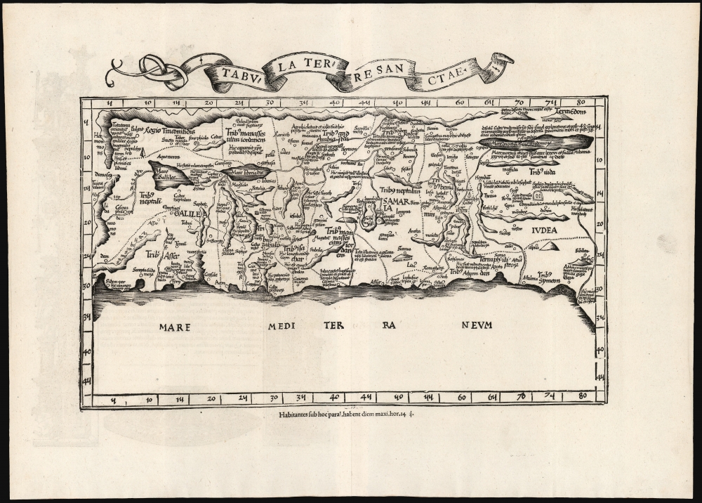
1535 Fries / Sanuto-Vesconte Map of the Holy Land - Medieval Mapping of the Levant
HolyLand-fries-1522$2,250.00

Title
Tabula Terre Sanctae.
1522 (undated) 11.25 x 16.25 in (28.575 x 41.275 cm) 1 : 750000
1522 (undated) 11.25 x 16.25 in (28.575 x 41.275 cm) 1 : 750000
Description
This is the Lorenz Fries 1535 edition of Pietro Vesconte's 14th-century manuscript map of Palestine. It is one of the earliest obtainable iterations of a c. 1320 manuscript map compiled to accompany Marino Sanudo's letters promoting a new crusade. Thus, it is one of the earliest surviving maps to support a specific military effort. Relating to this, Vesconte's map was the earliest surviving map to present the region in a Biblical context, naming the areas occupied by the Tribes of Israel, thus opening a long history of presenting the Levant in a religio-historical context.
Recontextualized in Print
Despite not being a Ptolemaic map, for centuries this work appeared only in printed editions of Ptolemy's Geographia, as here. In the 15th century, Nicolaus Donnus Germanus - the great editor and standardizer of the surviving Ptolemies - encountered and copied the Vesconte map. He began to incorporate the Sanudo/Vesconte map in his manuscript Ptolemies. Since all but one of that century's printed Ptolemies were derived from Germanus' originals, this map was later accepted as one of the canonical Ptolemaic maps. It, along with the 14th century Claudius Clavus map of Scandinavia, were the first 'modern' maps added to Ptolemy's foundational text.A Closer Look
Fries' iteration of the Sanudo-Vesconte map is oriented to the southeast and presents the Mediterranean coastline from Sidon to Gaza, and reaches as far east as a range of mountains separating the Holy Land from what, on early maps, was termed 'Desert Arabia'. The River Jordan and the Dead Sea are shown (with both the names 'Dead Sea' and 'Sea of Sodom'). The Lake of Merom is oversized and misnamed Galilee, and Sea of Galilee is named the Sea of Tiberias, a term still in use. (These naming conventions are shared by all versions of this map derived from Nicolaus Donnus Germanus' manuscript originals.) Important cities - especially Jerusalem - are marked and named, as are tombs of Biblical figures and wonders (a well of living water, for instance, near Tyre). Isolated mountains are shown in profile with extended ranges and heights indicated in a 'bread loaf' form. The whole is divided into the lands occupied by the Biblical Tribes of Israel.The Basis of the Map
Vesconte's 14th-century manuscript has no clear precursor. His sources include both the ancient descriptions of Josephus (c. 37 - c. 100) and the firsthand medieval reports of Burchard of Mount Sion (fl. late 13th century). The latter was one of the last Westerners to write about a visit to Jerusalem before it fell to Sultan al-Ashraf Khalil in 1291. His reports would have been of particular interest to Sanudo, who, like Burchard, proposed a new crusade. Sanudo, Vesconte, and Burchard's primary interest in the Holy Land was its Biblical; thus, the map included the holy sites that the proposed crusade was intended to seize.Promoting a New Crusade
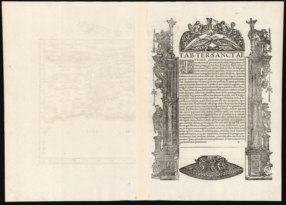
The map was not initially intended for the religious edification of the armchair pilgrim but rather as part of a practical set of suggestions in anticipation of an actual attempt to capture Jerusalem. While it would have been of little use to actual soldiers in the field, its purpose, and that of the plans accompanying it, was to convince the leaders of Western Europe - Pope John XXII and King Charles IV of France - of the necessity of the new crusade. It appeared in the Venetian diplomat Marino Sanudo's Liber secretorum fidelium crucis (Book of Secrets for True Crusaders), which detailed his proposed effort to take the Holy Land for the Christian West.Publication History and Census
This map was first issued in the 1522 Lorenz Fries Strasbourg edition of Ptolemy's Geographia. A further edition was produced in that same city in 1525. Afterward, two further editions of 1535 and 1541 were published in Lyons and Vienne-in-the-Dauphane, respectively. The editor of the 1535 edition, Michael Villanovus (Servetus), was tried for heresy in 1553 and burned at the stake. Reportedly, Calvin ordered copies of the Servetus edition burned. Consequently, maps from the 1535 edition (of which this is a representative) are scarce. Overall, the four editions of Fries' Ptolemy are well represented in institutional collections. We see seven separate examples of the map in OCLC in its various editions.CartographerS
Lorenz Fries (c. 1490 – 1531) was a German cartographer, cosmographer, astrologer, and physician based in Strasbourg. Little is known of Fries' early life. He may have studied in Padua, Piacenza, Montpellier, and Vienna, but strong evidence of this is unfortunately lacking. The first recorded mention of Fries on a 1513 Nuremberg broadside. Fries settled in Strasbourg in March of 1519, where he developed a relationship with the St. Die scholars, including, among others, Walter Lud, Martin Ringmann, and Martin Waldseemüller. There, he also befriended the printer and publisher Johann Grüninger. Although his primary profession was as a doctor, from roughly 1520 to 1525, he worked closely with Grüninger as the geographic editor of various maps and atlases based upon the work of Martin Waldseemüller. Although his role is unclear, his first map seems to have been a 1520 reissue of Waldseemüller's world map of 1507. Around this time, Fries also began working on Grüninger's reissue of Waldseemüller's 1513 edition of Ptolemy's Geographie Opus Novissima. That edition included three new maps by Fries based upon the Waldseemüller world map of 1507 – two of these, his maps of East Asia and Southeast Asia, are quite significant as the first specific maps of these regions issued by a European publisher. In 1525, Fries decided to leave Strasbourg and surrendered his citizenship, relocating to Trier. In 1528, he moved to Basel. Afterward, he relocated to Metz where he most likely died. In addition to his cartographic work, Fries published tracts on medicine, religion, and astrology. More by this mapmaker...
Marino Sanudo (or Sanuto) Torsello (c. 1270 – 1343) was a Venetian statesman and geographer. He is best known for his efforts to instigate a new crusade to the Holy Land. This lifelong task resulted in his book, 'Liber Secretorum Fidelium Crucis (Book of Secrets for True Crusaders) which would be supplented by an array of the earliest surviving portolan charts of the Mediterranean coast and the Black Sea, executed by Pietro Vesconte. Sanudo was born to an aristocratic trading family in Venice around 1270; his father was a member of the Venetian Senate. In his youth Sanuto traveled broadly, visiting in time Acre, Greece, Romania, Palestine, Egypt, Armenia, Cyprus and Rhodes. He would eventually join the entourage of the Doge of Venice; after 1305 he attended Cardinal Riccardo Petroni in Rome.
He was a vigorous correspondent, particularly with travelers whose reach had extended beyond his own.
Perhaps related to his early experiences in Acre - which fell rapidly to Muslim forces shortly after his visit there - Sanuto was a lifelong advocate of a crusade to capture the Holy Lands for the west. While he was certainly not alone among such instigators, his emphasis on strategy, practical financial backing, and detailed modern cartography set his proposals apart. His long term approach - with a preparatory blockade of and capture of Egypt to secure the invasion's flank - was never implemented. Nevertheless his book, often revised and updated, would find its way into the hands of not only the Pope but also King Charles IV of France. At least eleven manuscript copies are known to survive. Its complement of maps by Vesconte are the earliest medieval maps intended for military purposes. Learn More...
Pietro Vesconte (fl. 1310-1330) was a Genoese cartographer and geographer. His early portolan charts set the standard for such works produced in both Italy and Spain throughout the fourteenth and fifteenth centuries. Very little is known of his life. He was born in Genoa, but produced the bulk of his work in Venice. His charts - among the first of any to be signed and dated - remain among the earliest to accurately chart the coasts of the Mediterranean Sea and the Black Sea; his works contain some of the earliest attempts to chart the British Isles. In addition to his separate charts, he is known to have authored no fewer than four manuscript navigational 'atlases,' consisting of particular navigational charts that could be joined to make a larger, general one. His work was groundbreaking in its accuracy: the mappamundae that characterize this period were not characterized by precision, being more in the way of mnemonic aids for the study of the world by people unlikely to actually travel it. Many of his works, however, focused on the Holy Land, and these were produced in order to encourage a crusade to those regions. Learn More...
Source
Ptolemy, C., Geographicae Enarrationis..., (Lyons: Servetus) 1535.
Condition
Excellent. Few tiny wormholes not impacting printed image, else fine.
References
OCLC 165598600. Nebenzahl, K., Maps of the Holy Land #19. Laor, E., Maps of the Holy Land: Cartobibliography of Printed Maps, 1475 - 1900, #612.