
Fries, Lorenz (Laurentius Phrisius)
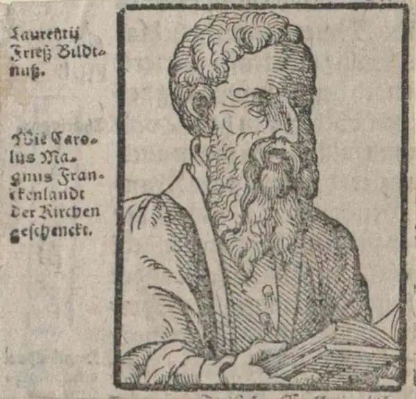
Lorenz Fries (c. 1490 – 1531) was a German cartographer, cosmographer, astrologer, and physician based in Strasbourg. Little is known of Fries' early life. He may have studied in Padua, Piacenza, Montpellier, and Vienna, but strong evidence of this is unfortunately lacking. The first recorded mention of Fries on a 1513 Nuremberg broadside. Fries settled in Strasbourg in March of 1519, where he developed a relationship with the St. Die scholars, including, among others, Walter Lud, Martin Ringmann, and Martin Waldseemüller. There, he also befriended the printer and publisher Johann Grüninger. Although his primary profession was as a doctor, from roughly 1520 to 1525, he worked closely with Grüninger as the geographic editor of various maps and atlases based upon the work of Martin Waldseemüller. Although his role is unclear, his first map seems to have been a 1520 reissue of Waldseemüller's world map of 1507. Around this time, Fries also began working on Grüninger's reissue of Waldseemüller's 1513 edition of Ptolemy's Geographie Opus Novissima. That edition included three new maps by Fries based upon the Waldseemüller world map of 1507 – two of these, his maps of East Asia and Southeast Asia, are quite significant as the first specific maps of these regions issued by a European publisher. In 1525, Fries decided to leave Strasbourg and surrendered his citizenship, relocating to Trier. In 1528, he moved to Basel. Afterward, he relocated to Metz where he most likely died. In addition to his cartographic work, Fries published tracts on medicine, religion, and astrology.
AKA: Laurentius Phrisius
Anatolia as known to Ancient Rome.
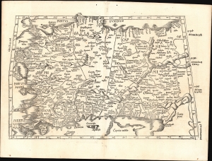
[Tabula I. Asiae].
$1,000.00
Acquire
- Digital Map Information
- Suitable for large format printing
- Full resolution TIFF file
- ICC color profile embedded
- Delivered instantly via download link
This is Laurent Fries' 1525 edition of Martin Waldseemüller's Ptolemaic map of Anatolia, one of the earliest generally acquirable maps of what would become modern-day Turkey. (more details)
Reconciling ancient geography with new discoveries.
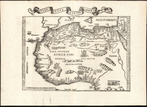
Tabu. Nova Partis Aphri.
$1,900.00
Acquire
- Digital Map Information
- Suitable for large format printing
- Full resolution TIFF file
- ICC color profile embedded
- Delivered instantly via download link
This is Laurent Fries' 1535 edition of the earliest acquirable modern mapping of Africa north of the Equator. This is one of the earliest printed maps to incorporate contemporary Portuguese discoveries while preserving classical Ptolemaic geography. (more details)
One of the Earliest Modern Maps of Africa.
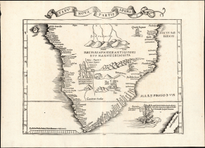
Tabu. Nova Partis Aphri.
$2,000.00
Acquire
- Digital Map Information
- Suitable for large format printing
- Full resolution TIFF file
- ICC color profile embedded
- Delivered instantly via download link
This is Laurent Fries' 1535 edition of the earliest acquirable modern mapping of South Africa, among the first to reveal the discoveries of the Portuguese explorers Dias and De Gama. This map represents an effort to reconcile two contrasting depictions of southern Africa by Martin Waldseemüller: the 1513 Tabula Moderna Secunde Porcionis Aphrice, and the 1516 Carta Marina. In the past, it has been erroneously described as a more decorative version of the former, but closer study reveals it as cartographically distinct and independently significant. (more details)
One of the Earliest Modern Maps Ceylon / Sri Lanka.
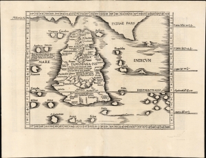
[Tabula XII. Asiae.]
$750.00
Acquire
- Digital Map Information
- Suitable for large format printing
- Full resolution TIFF file
- ICC color profile embedded
- Delivered instantly via download link
This is Laurent Fries' 1525 edition of Martin Waldseemüller's Ptolemaic map of Sri Lanka. This island - here named Taprobana - represented, for Ptolemy, the limit of European geographic knowledge in the east. The smallest area to have appeared in Ptolemaic canon, later geographers wrestled with the identity of the island depicted. Many correctly identified the island as Sri Lanka, though Munster, Mercator, and others speculated that the better candidate was Sumatra. (more details)
Foundation of the mapping of Arabia.
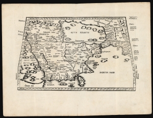
[Tabula Sexta Asiae].
$2,750.00
Acquire
- Digital Map Information
- Suitable for large format printing
- Full resolution TIFF file
- ICC color profile embedded
- Delivered instantly via download link
This is Laurent (Lorenz) Fries' 1522 map of Arabia, among the earliest acquirable maps of the Arabian Peninsula. Although presenting 2nd-century Ptolemaic geography, this map remained accurate and relevant and one of the best maps of the peninsula available. (more details)
A Medieval Holy Land.
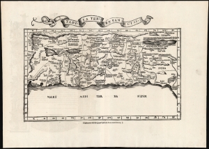
Tabula Terre Sanctae.
$2,250.00
Acquire
- Digital Map Information
- Suitable for large format printing
- Full resolution TIFF file
- ICC color profile embedded
- Delivered instantly via download link
This is the Lorenz Fries 1535 edition of Pietro Vesconte's 14th-century manuscript map of Palestine. It is one of the earliest obtainable iterations of a c. 1320 manuscript map compiled to accompany Marino Sanudo's letters promoting a new crusade. Thus, it is one of the earliest surviving maps to support a specific military effort. Relating to this, Vesconte's map was the earliest surviving map to present the region in a Biblical context, naming the areas occupied by the Tribes of Israel, thus opening a long history of presenting the Levant in a religio-historical context. (more details)