Digital Image: 1846 Mitchell Map of Iowa (First Edition!)
Iowa2-mitchell-1846_d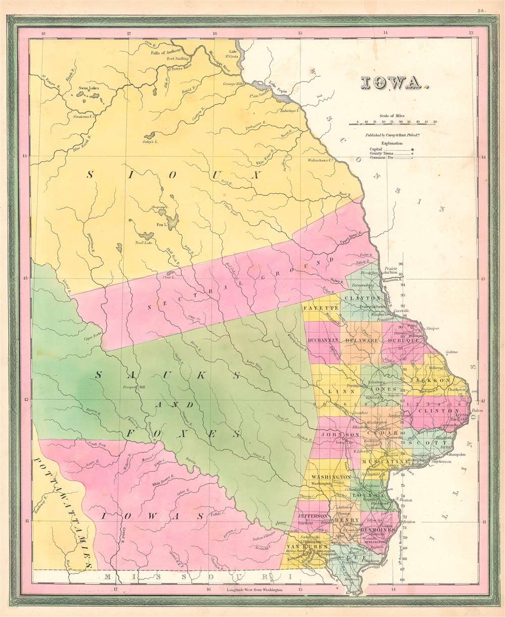

Title
Iowa.
1846 (undated) 16.5 x 13.5 in (41.91 x 34.29 cm) 1 : 1400000
1846 (undated) 16.5 x 13.5 in (41.91 x 34.29 cm) 1 : 1400000
Description
FOR THE ORIGINAL ANTIQUE MAP, WITH HISTORICAL ANALYSIS, CLICK HERE.
Digital Map Information
Geographicus maintains an archive of high-resolution rare map scans. We scan our maps at 300 DPI or higher, with newer images being 600 DPI, (either TIFF or JPEG, depending on when the scan was done) which is most cases in suitable for enlargement and printing.
Delivery
Once you purchase our digital scan service, you will receive a download link via email - usually within seconds. Digital orders are delivered as ZIP files, an industry standard file compression protocol that any computer should be able to unpack. Some of our files are very large, and can take some time to download. Most files are saved into your computer's 'Downloads' folder. All delivery is electronic. No physical product is shipped.
Credit and Scope of Use
You can use your digial image any way you want! Our digital images are unrestricted by copyright and can be used, modified, and published freely. The textual description that accompanies the original antique map is not included in the sale of digital images and remains protected by copyright. That said, we put significant care and effort into scanning and editing these maps, and we’d appreciate a credit when possible. Should you wish to credit us, please use the following credit line:
Courtesy of Geographicus Rare Antique Maps (https://www.geographicus.com).
How Large Can I Print?
In general, at 300 DPI, you should at least be able to double the size of the actual image, more so with our 600 DPI images. So, if the original was 10 x 12 inches, you can print at 20 x 24 inches, without quality loss. If your display requirements can accommodate some loss in image quality, you can make it even larger. That being said, no quality of scan will allow you to blow up at 10 x 12 inch map to wall size without significant quality loss. For more information, it is best consult a printer or reprographics specialist.
Refunds
If the high resolution image you ordered is unavailable, we will fully refund your purchase. Otherwise, digital images scans are a service, not a tangible product, and cannot be returned or refunded once the download link is used.
Cartographer S
Samuel Augustus Mitchell (March 20, 1792 - December 20, 1868) began his map publishing career in the early 1830s. Mitchell was born in Bristol, Connecticut. He relocated to Philadelphia in 1821. Having worked as a school teacher and a geographical writer, Mitchell was frustrated with the low quality and inaccuracy of school texts of the period. His first maps were an attempt to rectify this problem. In the next 20 years Mitchell would become the most prominent American map publisher of the mid-19th century. Mitchell worked with prominent engravers J. H. Young, H. S. Tanner, and H. N. Burroughs before attaining the full copyright on his maps in 1847. In 1849 Mitchell either partnered with or sold his plates to Thomas, Cowperthwait and Company who continued to publish the Mitchell's Universal Atlas. By about 1856 most of the Mitchell plates and copyrights were acquired by Charles Desilver who continued to publish the maps, many with modified borders and color schemes, until Mitchell's son, Samuel Augustus Mitchell Junior, entered the picture. In 1859, S.A. Mitchell Jr. purchased most of the plates back from Desilver and introduced his own floral motif border. From 1860 on, he published his own editions of the New General Atlas. The younger Mitchell became as prominent as his father, publishing maps and atlases until 1887, when most of the copyrights were again sold and the Mitchell firm closed its doors for the final time. More by this mapmaker...
Edward L. Carey (April 7, 1805 - June 16, 1845) was an American publisher, aesthete, art lover, and the co-founder, along with Abraham Hart, of the prominent publishing firm Carey and Hart. Carey was the son of American publisher Mathew Carey (1760 - 1839) and Bridget Flahaven Carey. He initially worked for his brother, Henry Charles Carey who, along with relative and partner Isaac Lea, purchased their father's publishing house in 1822, rebranding it as Carey and Lea. Eventually, Edward Carey became a junior partner in the firm, acquiring half of the shares belonging to Lea, and the imprint briefly changed to Carey, Lea, and Carey. On November 1, 1829, Edward Carey detached himself from his brother's firm and formed a partnership with Abraham Hart (1810 - 1885), an employee of Carey, Hart, and Carey. This firm, known as Carey and Hart, was successful for twenty-five years, publishing works by Henry Wadsworth Longfellow, William Cullen Bryant, and Eliza Leslie. Carey suffered from declining health during the last three years of his life. According to William Gilmore Sims, Carey died 'after suffering for some years from a tedious affliction of the spine.' Carey died on June 16, 1845 at the age of 40. Before his death, he was elected President of the Academy of Fine Arts, but declined the position due to his health. Learn More...
Abraham Hart (December 15, 1810 - July 22, 1885) was an American publisher of Jewish-Dutch descent based in Philadelphia. As a boy, Hart became an employee of the publishing firm Carey, Lea, and Carey. In 1829, when Edward Carey (1805 - 1845) left his older brother Mathew Carey's firm, Edward and Hart joined forces, forming Carey and Hart. This firm became very well-known and was successful for twenty-five years, publishing works by Henry Wadsworth Longfellow, William Cullen Bryant, and Eliza Leslie. Hart married Rebecca Cohen Isaacks in 1831. Carey died at the age of 40 in 1845, but Hart continued the publishing firm until he retired in 1854, which marked the end of the Carey and Hart imprint. After retiring, Hart involved himself with industrial enterprises, and served both the Centennial Button-hole Machine Company and the American Button-hole Machine Company in an executive capacity. Hart was also an active member of the Jewish community in Philadelphia, serving for a time as president of the Jewish Congregation Mickvéh Israel, and assisting in Jewish educational and charitable enterprises. Learn More...
Source
Mitchell, S.A., A New Universal Atlas Containing Maps of the various Empires, Kindoms, States, and Republics of the World…(Philadelphia: Mitchell) 1846.
The New Universal Atlas is one of the great American atlases of the mid-19th century. Samuel Augustus Mitchell first issued the atlas in 1846 when he acquired the map plates and copyright for Tanner's New Universal Atlas from its publisher, Carey and Hart. The first transitional 1846 edition was published jointly with Carey and Hart, but a second edition was published in the same year with the Tanner imprint erased. This edition of the atlas also introduced the signature S. A. Mitchell green and pink color scheme. Most of the maps from the early editions of the atlas were engraved by H. N. Burroughs or C. S. Williams, often bearing their copyright. Burroughs maps also tended to have what map collector David Rumsey refers to as the 'Cary and Hart' borders, which featured a narrow vine motif. These borders were replaced, along with the Burroughs imprint, with the more traditional Mitchell strap work border used in the atlases until 1856. Mitchell published editions until late in 1850, when he sold the rights to Thomas, Cowperthwait and Company of Philadelphia. Under Cowperthwait, the atlases continued to be published and bear the Mitchell name until 1856, when the plates were again sold, this time to Charles Desilver. Desilver reworked the plates with new border art and a revised color scheme in the style of J. H. Colton. Desilver issued editions from 1857 to 1860, when the atlas was phased out in favor of Samuel Augustus Mitchell Jr.'s New General Atlas.