1862 Walling / Chace Wall Map of Maine
Maine-wallingchase-1862$3,000.00


Title
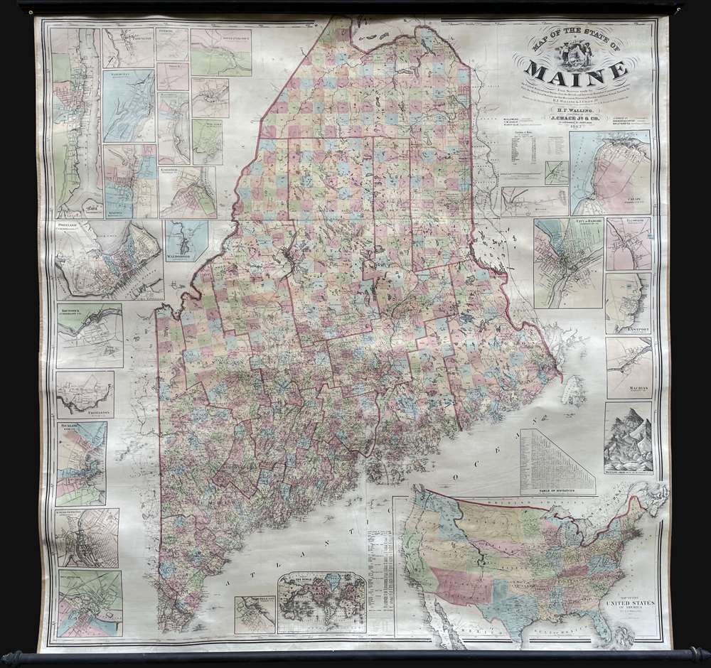
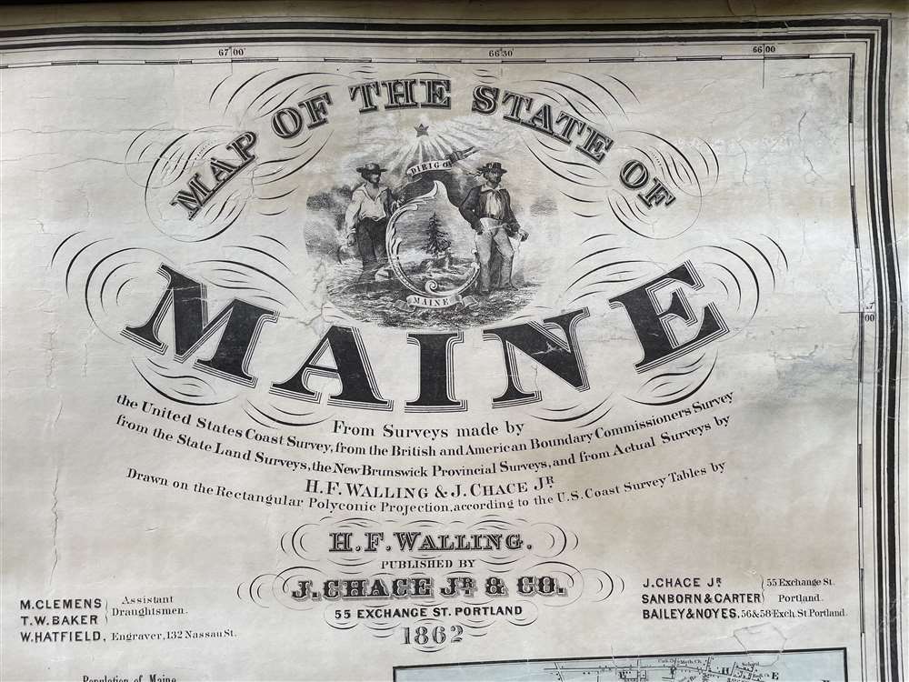
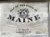
Map of the State of Maine.
1862 (dated) 64.25 x 62.5 in (163.195 x 158.75 cm) 1 : 316800
1862 (dated) 64.25 x 62.5 in (163.195 x 158.75 cm) 1 : 316800
Description
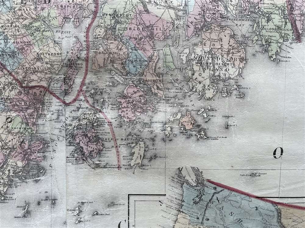
An impressive large-scale 1862 Civil War era wall map of Maine by Henry Francis Walling and Jacob Chace Jr. This the first major map of Maine to follow the 1844 map of Jeremiah Greenleaf. The map represents the culmination of Walling and Chace's decades of work in Maine. For years, they compiled and published Maine city and county maps, giving them access to unprecedented up-to-date cartographic data, all of which is represented here.
A Closer Look
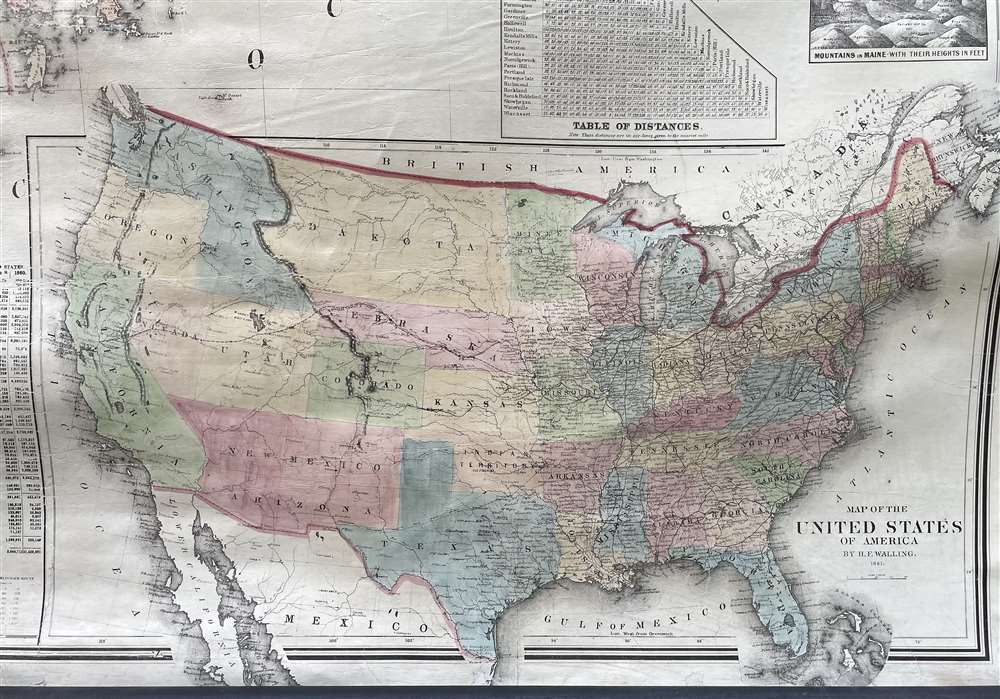
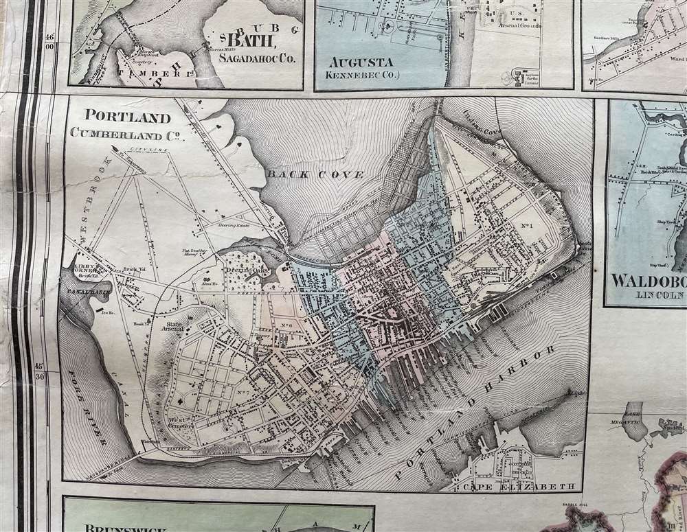
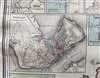
Cities illustrated via inset include Portland, Calais, Presque Isle, Houlton, Ellsworth, Bangor, Eastport, Machias, Bath, Farmington, Dover and Foxcroft, Paris Hill, Skowhegan, Waterville, Hallowell, Wiscasset, Gardiner, Augusta, Waldboro, Brunswick, Thomaston, Rockland, Auburn, and Lewiston, and Saco and Biddeford. Additional insets highlight the United States as a whole - reflecting the Civil War Confederate state of Arizona -, the world, and charts denoting distances and the relative heights of great mountains.Publication History and Census
This map was compiled by Walling and Chase with the assistance of M. Clemens and T. W. Baker. It was engraved by W. Hatfield. The large inset ma of the United States is attributed to D. Griffing Johnson. We note examples of this map in several major collections, but examples in exceptional condition, as here, are rare to the market.CartographerS
Henry Francis Walling (June 11, 1825 - April 8, 1889) was an American civil engineer, cartographer, surveyor, and map publisher active from the middle to late 19th century. Walling was born in Providence, Rhode Island. He studied/worked at the Providence Athenaeum before discovering a talent for mathematics and surveying. Walling took a position with Samuel Barrett Cushing (1846 - 1888), a Providence-based civil engineer with whom he issued in 1846 a revision of James Steven's Topographical Map of the State of Rhode-Island. Walling established himself independently around 1850 and immediately began preparing a series of town plans focusing on Bristol County, near Providence. Buoyed by widespread interest in his plans, Walling expanded his operations to Massachusetts, where, by 1857, he had produced no less than 50 town plans. Apparently, Walling's business model involved a contract with town officials to produce a certain number of maps, after which he acquired the right to print and sell additional copies on his own account. This work eventually led to Walling's appointment as Massachusetts "Superintendent of the State Map", a designation that began appearing on his maps around 1855. While Walling's work focused heavily on city and county maps, he successfully published three scarce state maps: Maine, Vermont, and Rhode Island. In 1856, Walling relocated his headquarters to New York City, where he had better access to quality lithographers. The Civil War (1861 - 1865) proved difficult for Walling, and diminished sales may have forced him into a partnership with Ormando W. Gray, with whom he published numerous state, county, and national atlases in the 1860s and 1870s. Around 1880, Walling took a post with the U.S. Coast Survey, with whom he worked on various charts until requesting a transfer in 1883 to the newly formed U.S. Geological Survey. Walling remained with the Geological Survey until his untimely death of a heart attack in April 1889. More by this mapmaker...
Jacob Chace Jr. (January 27, 1819 - February 18, 1903) was an American surveyor, civil engineer, educator, and map publisher. Born in North Hoosick, New York, Chace became one of the most prolific creators and publishers of county maps of the northeastern United States in the mid-19th century. He was involved in the production of large-format county maps, published mostly between 1854 and 1860. Many of these counties were in Maine, but he also produced maps of Vermont and New York. The historical record is unclear about when Chace died. Many references state that he died in 1864 while Ambrose F. Church was working for him to create a map of Nova Scotia. However, references to a Jacob Chace surveying towns for maps of Virginia and North Carolina appear in newspaper columns in the 1870s and 1880s. Chace's name is sometimes misspelled on maps and references as 'Chase'. Chace died in Omaha, Nebraska, on February 18, 1903. Learn More...
David Griffing Johnson (1808 - April 9, 1863), aka 'Griffin', is a mysterious but significant American engraver and mapmaker active in Portland, Maine, New Orleans, and New York City in the decades preceding the American Civil War (1861 - 1865). Our knowledge of him is scant. He was likely born in Connecticut. We believe him one and the same with David G. Johnson, a map engraver, who first appears in Portland, Maine in 1824, where he had an office at No. 4, Market Square in Gilbert’s Block. He was not a native to that city, instead arriving in 1824 with the intent to establish himself as the city's premier engraver. This seems not to have worked out, but he did produce a few maps, portraits, nautical charts, and novelties. He left Portland in 1830, eventually settling in New York, where we can place him in 1831. In New York he promoted himself as a portrait painter and engraver from 1831 to 1835. He appears to have had little success during this period, but did engrave the plates for the 1833 A Treatise on Topographical Anatomy. Shortly thereafter, he relocated to New Orleans. He was in New Orleans from at least 1838 to 1843, where he set up an engraving and daguerreotype studio. While there, he engraved E. H. Springbett and L. I. Pilié's 1839 Topographical Map of the City and Environs of New Orleans, of which we can frustratingly find no surviving examples but several references. We note correspondence in 1840 between Johnson and Samuel F. B. Morse (inventor of the telegraph and daguerreotype pioneer) asking for advice on daguerreotyping, suggesting that Johnson had difficulty with the process. He returned to New York in 1843, remaining until about 1847, when he issued a map with J. H. Colton. At some point, likely in 1848, D. Griffing Johnson headed west. His 1853 world map and his 1857 North America map both feature a large view of Sutter's Mill with the note, 'Drawn on the spot by D. G. Johnson in 1849'. It is thus believed he was at Sutter’s Mill when gold was discovered or shortly thereafter. There is record of a D. G. Johnson arriving in New York in 1849 on a ship from Jamaica - possibly a transit point having sailed around South America? He was in New York throughout the 1850s to about 1862 or 1863, producing several maps, including a large world wall map in 1853, a North America map in 1853 with 'Thayer, Bridgman and Fanning', and an 1854 North America map with A. J. Johnson, an 1860 world map with Jacob Monk, and an 1862 map of Maine with Henry Francis Walling and Jacob Chace Jr. In 1855 he had an office at 7 Nassau Street, New York. In 1859 he successfully defended himself in New York courts on charges of copyright violation by fellow mapmaker Robert Persall Smith. Regarding D. G. Johnson’s disappearance sometime after 1863, we can only speculate. If our reasoning stands, when was active in Maine in 1824 he would have been at least in his early 20s. Thus by 1863, he would have been in his late 60s, so it is likely he died, but records have been elusive. References: Groce, G.C,. and Wallace, D. H., The New-York Historical Society's Dictionary of Artists in America, 1864 - 1860, p. 353. Smith, M.G., and Tucker, M. L., Photography in New Orleans: The Early Year, 1840 - 1865, p 21-22. Palmquist, P. and Kailbourn, T. R., Pioneer Photographers from Mississippi to the Continental Divide, p. 357. Shettleworth, Earle G., 'Portland, Maine, Engravers of the 1820s', part II, 105 - 109, in Old-Time New England, Volume 61, Number 224 (Spring, 1971). Fales, Marthaq Gandy, 'An Unrecorded Portland Engraver', pages 77-79 in Old-Time New England, Volume 57, Number 207 (Winter, 1967). Learn More...
Condition
Very good. Full professional restoration.
References
Rumsey 152.000. Phillips (America) p. 385.