Digital Image: 1904 Landis Missionary Wall Map of Japan and Taiwan
MissionMapJapan-landis-1904_d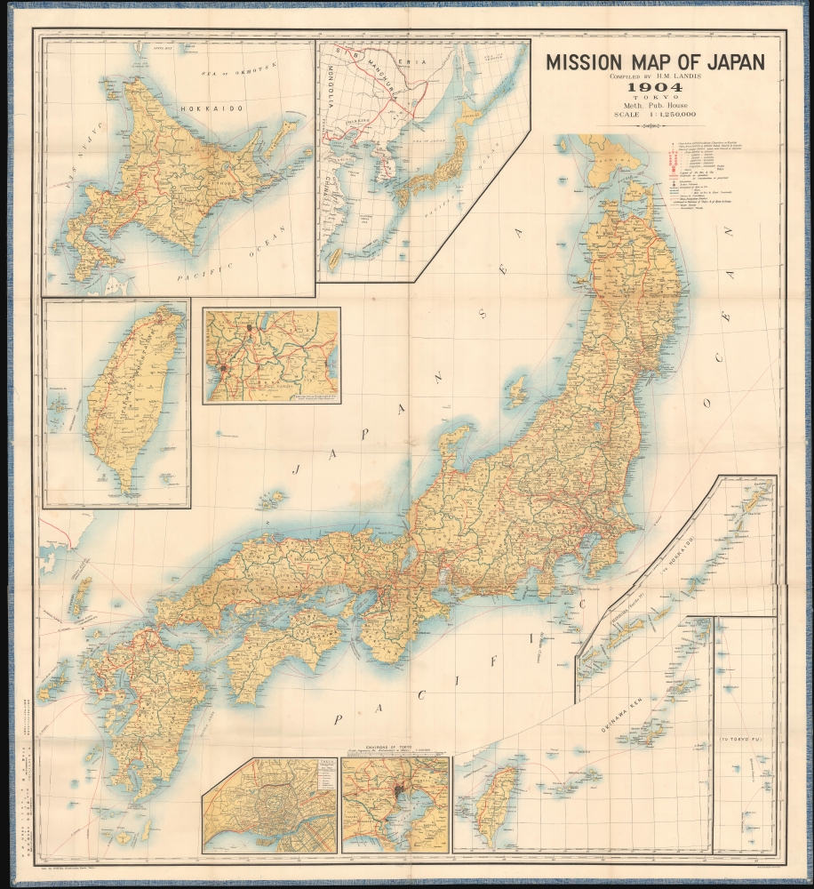

Title
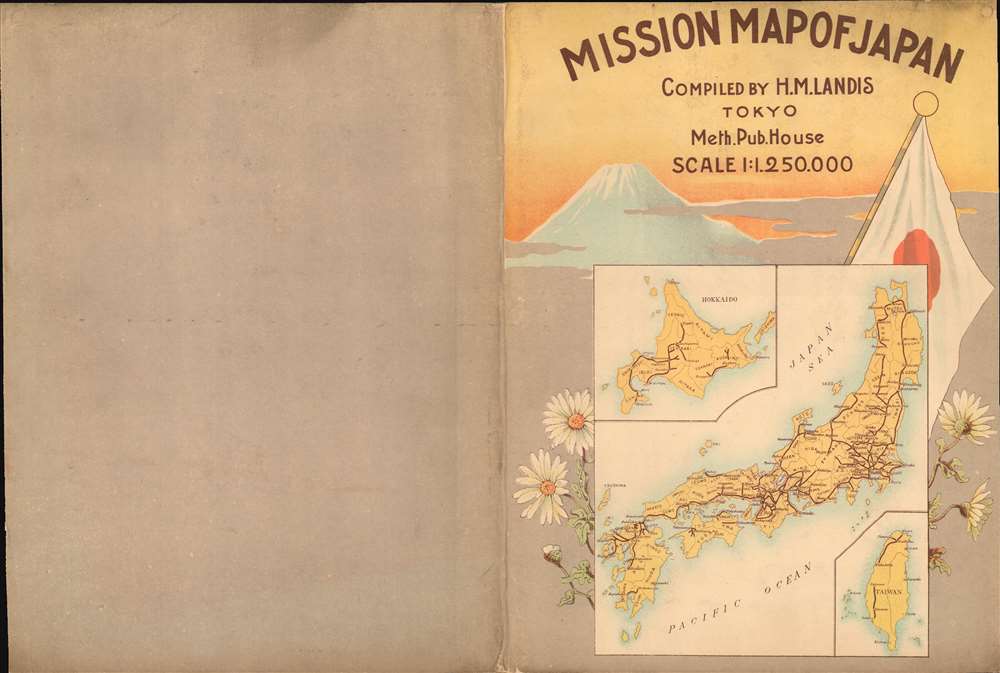
Mission Map of Japan.
1904 (dated) 51.5 x 47 in (130.81 x 119.38 cm) 1 : 1250000
1904 (dated) 51.5 x 47 in (130.81 x 119.38 cm) 1 : 1250000
Description
FOR THE ORIGINAL ANTIQUE MAP, WITH HISTORICAL ANALYSIS, CLICK HERE.
Digital Map Information
Geographicus maintains an archive of high-resolution rare map scans. We scan our maps at 300 DPI or higher, with newer images being 600 DPI, (either TIFF or JPEG, depending on when the scan was done) which is most cases in suitable for enlargement and printing.
Delivery
Once you purchase our digital scan service, you will receive a download link via email - usually within seconds. Digital orders are delivered as ZIP files, an industry standard file compression protocol that any computer should be able to unpack. Some of our files are very large, and can take some time to download. Most files are saved into your computer's 'Downloads' folder. All delivery is electronic. No physical product is shipped.
Credit and Scope of Use
You can use your digial image any way you want! Our digital images are unrestricted by copyright and can be used, modified, and published freely. The textual description that accompanies the original antique map is not included in the sale of digital images and remains protected by copyright. That said, we put significant care and effort into scanning and editing these maps, and we’d appreciate a credit when possible. Should you wish to credit us, please use the following credit line:
Courtesy of Geographicus Rare Antique Maps (https://www.geographicus.com).
How Large Can I Print?
In general, at 300 DPI, you should at least be able to double the size of the actual image, more so with our 600 DPI images. So, if the original was 10 x 12 inches, you can print at 20 x 24 inches, without quality loss. If your display requirements can accommodate some loss in image quality, you can make it even larger. That being said, no quality of scan will allow you to blow up at 10 x 12 inch map to wall size without significant quality loss. For more information, it is best consult a printer or reprographics specialist.
Refunds
If the high resolution image you ordered is unavailable, we will fully refund your purchase. Otherwise, digital images scans are a service, not a tangible product, and cannot be returned or refunded once the download link is used.
Cartographer S
Henry Mohr Landis (March 9, 1857 - September 6, 1921) was an American missionary active in Tokyo, Japan in the late 19th and early 20th centuries. Landis was born in to a Mennonite family in Colebrookdale, Berks County, Pennsylvania. He completed his primary studies at the Keystone State Normal School (Kutztown, PA) and went on to take a degree in mathematics from Princeton, from which graduated in 1883). He received the J. S. K. Mathematical Fellowship to study in Berlin, Germany for one year. Returning to the U.S., Landis entered the Princeton University Seminary in 1884, graduating in 1887, when he was licensed and ordained by the Presbytery of New Brunswick, New Jersey. He then traveled to Japan as a missionary, arriving in Yokohama on July 2, 1888. He was closely associated with the Meiji Gakuin School, where he was a professor of Logic and Psychology from 1888 to 1893, and a professor of the New Testament from 1893 to 1919. In 1890 he designed the Meiji Gakuin Memorial Hall, still a part of the Meiji Gakuin campus. Poor health forced him to return to the United States in 1919, but he was back in Japan by 1921. Landis remained in Koriyama, Japan, until his death from 'paralysis' in 1921. He is interred on the Temple Ground at Meiji Gakuin. More by this mapmaker...
Hoeisha (方英舎; fl. c. 1890 -1910) was a Japanese lithographer active in Tokyo in the late Meiji Period (late 19th - early 20th centuries). His offices were located in the Kanda Mitoshirocho district of Tokyo. His work exhibits sophisticated chromolithographic technique and suggest he was able to print at both small and large scale. There is a small collection of chromolithograph postcards by Hoeisha at the Boston Museum of Fine Arts. He is associated with only one large map, an impressive missionary map of Japan issued with Henry Mohr Landis. Learn More...
References
OCLC 494854790.