Digital Image: 1924 Tourist Map of New South Wales, Australia
NewSouthWales-landdept-1924_d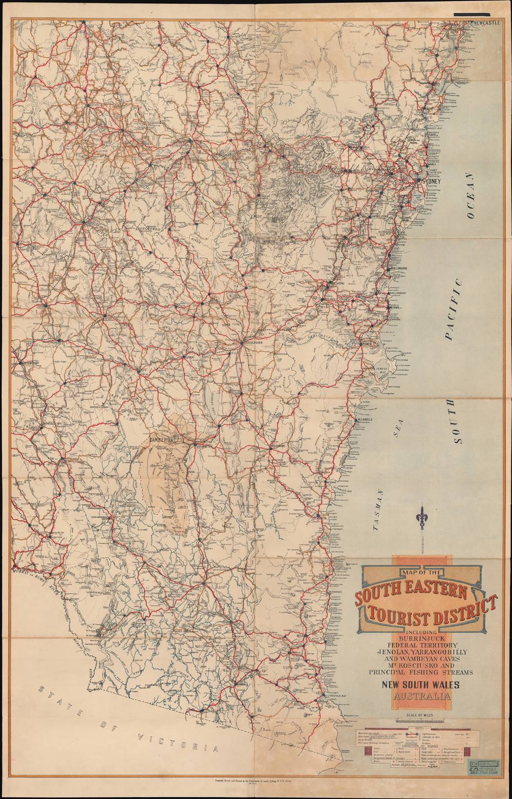


Title
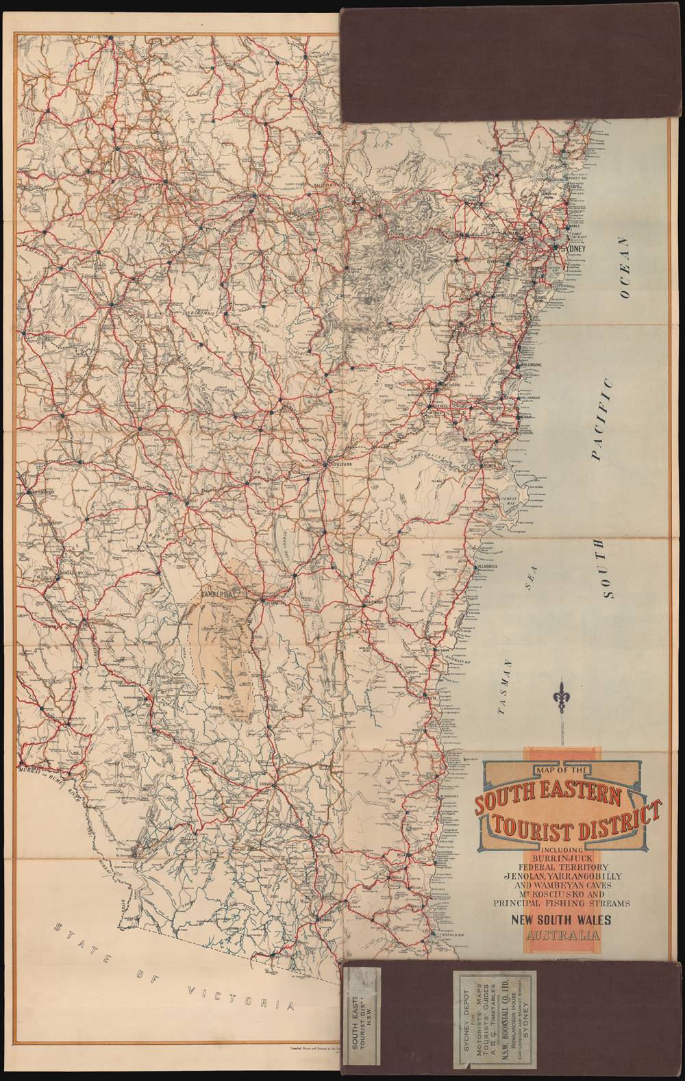
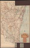
Map of the South Eastern Tourist District.
1924 (dated) 35.5 x 22.75 in (90.17 x 57.785 cm) 1 : 633600
1924 (dated) 35.5 x 22.75 in (90.17 x 57.785 cm) 1 : 633600
Description
FOR THE ORIGINAL ANTIQUE MAP, WITH HISTORICAL ANALYSIS, CLICK HERE.
Digital Map Information
Geographicus maintains an archive of high-resolution rare map scans. We scan our maps at 300 DPI or higher, with newer images being 600 DPI, (either TIFF or JPEG, depending on when the scan was done) which is most cases in suitable for enlargement and printing.
Delivery
Once you purchase our digital scan service, you will receive a download link via email - usually within seconds. Digital orders are delivered as ZIP files, an industry standard file compression protocol that any computer should be able to unpack. Some of our files are very large, and can take some time to download. Most files are saved into your computer's 'Downloads' folder. All delivery is electronic. No physical product is shipped.
Credit and Scope of Use
You can use your digial image any way you want! Our digital images are unrestricted by copyright and can be used, modified, and published freely. The textual description that accompanies the original antique map is not included in the sale of digital images and remains protected by copyright. That said, we put significant care and effort into scanning and editing these maps, and we’d appreciate a credit when possible. Should you wish to credit us, please use the following credit line:
Courtesy of Geographicus Rare Antique Maps (https://www.geographicus.com).
How Large Can I Print?
In general, at 300 DPI, you should at least be able to double the size of the actual image, more so with our 600 DPI images. So, if the original was 10 x 12 inches, you can print at 20 x 24 inches, without quality loss. If your display requirements can accommodate some loss in image quality, you can make it even larger. That being said, no quality of scan will allow you to blow up at 10 x 12 inch map to wall size without significant quality loss. For more information, it is best consult a printer or reprographics specialist.
Refunds
If the high resolution image you ordered is unavailable, we will fully refund your purchase. Otherwise, digital images scans are a service, not a tangible product, and cannot be returned or refunded once the download link is used.
Cartographer S
New South Wales Department of Lands (c. 1880 – 2008) was the land management bureaucracy of the New South Wales government. It played a critical role in the development of the colony (or state, after 1901), allocating land to immigrants and managing the natural resources of the area. Even today, more than half of the land in New South Wales is 'crown land,' either protected land or lands with public use, such as airports or military bases. In recent years, moves have been made to restructure the bureaucracy and sell more crown lands for development purposes. Over the course of its existence, the Department published thousands of maps. More by this mapmaker...
The New South Wales Bookstall Company (1879 – 1957), often stylized as NSW Bookstall Company, started as a string of bookstalls at railway stations, founded by Henry Lloyd. After some forays into publishing under Llyod, the company began publishing on a mass scale under a new owner, A.C. Rowlandson, at the end of the 19th century. True to the company's origins, their publications were mainly intended for a mass market, richly illustrated and portable for ease of use by travelers and commuters. Rowlandson was credited with importing a wide range of foreign books and newspapers while also promoting Australian authors, to the point that he and his company played an important part in the formation of a national identity. The company declined after Rowlandson's death and the company had stopped publishing new titles by the late 1940s; its distribution and bookstall operations ended in 1959. Learn More...
References
OCLC 1004374875.