Digital Image: 1841 Smith, Elder and Co. Map of the New Zealand Colony
NewZealand-smithelder-1841-2_d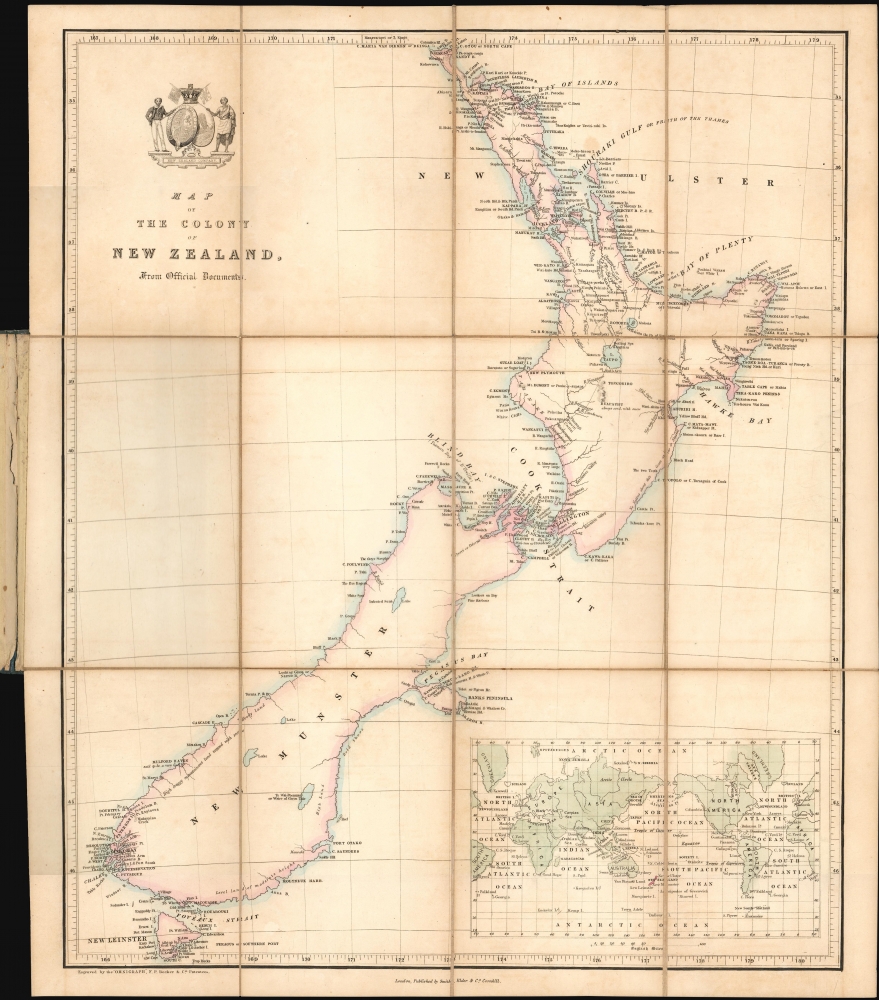

Title
Map of the Colony of New Zealand from Official Documents.
1841 (undated) 17.25 x 13.25 in (43.815 x 33.655 cm) 1 : 3600000
1841 (undated) 17.25 x 13.25 in (43.815 x 33.655 cm) 1 : 3600000
Description
FOR THE ORIGINAL ANTIQUE MAP, WITH HISTORICAL ANALYSIS, CLICK HERE.
Digital Map Information
Geographicus maintains an archive of high-resolution rare map scans. We scan our maps at 300 DPI or higher, with newer images being 600 DPI, (either TIFF or JPEG, depending on when the scan was done) which is most cases in suitable for enlargement and printing.
Delivery
Once you purchase our digital scan service, you will receive a download link via email - usually within seconds. Digital orders are delivered as ZIP files, an industry standard file compression protocol that any computer should be able to unpack. Some of our files are very large, and can take some time to download. Most files are saved into your computer's 'Downloads' folder. All delivery is electronic. No physical product is shipped.
Credit and Scope of Use
You can use your digial image any way you want! Our digital images are unrestricted by copyright and can be used, modified, and published freely. The textual description that accompanies the original antique map is not included in the sale of digital images and remains protected by copyright. That said, we put significant care and effort into scanning and editing these maps, and we’d appreciate a credit when possible. Should you wish to credit us, please use the following credit line:
Courtesy of Geographicus Rare Antique Maps (https://www.geographicus.com).
How Large Can I Print?
In general, at 300 DPI, you should at least be able to double the size of the actual image, more so with our 600 DPI images. So, if the original was 10 x 12 inches, you can print at 20 x 24 inches, without quality loss. If your display requirements can accommodate some loss in image quality, you can make it even larger. That being said, no quality of scan will allow you to blow up at 10 x 12 inch map to wall size without significant quality loss. For more information, it is best consult a printer or reprographics specialist.
Refunds
If the high resolution image you ordered is unavailable, we will fully refund your purchase. Otherwise, digital images scans are a service, not a tangible product, and cannot be returned or refunded once the download link is used.
Cartographer S
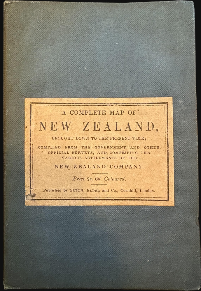
Smith, Elder, and Company (1816 - 1917) was a publishing firm based in London that was founded by two Scottish men: George Smith (1789 - 1846) and Alexander Elder (1790 - 1876). Founded in 1816, Smith, Elder and Company’s first three years in business were spent selling pens, paper, pencils, ink, account books, and other similar items, along with both new and used books, journals, and musical scores. A major portion of their clientele was officers from the East India Company, which significantly helped build the firm’s financial strength. Three years later the firm entered the publishing world when they released Sermons and Expositions on Interesting Portions of Scripture by John Morison. A third partner, Patrick Stewart, joined the company in 1824, and the company moved to Cornhill. The firm continued publishing small works, particularly editions meant to be bought as gifts, until 1843 when George Smith’s son, George Murray Smith (March 18, 1824 – April 6, 1901), who had joined the firm in 1838 and worked his way up through the ranks to become head of the small publishing arm of the business, agreed to publish the first volume of Modern Painters by John Ruskin, which launched a very lucrative thirty-year relationship between the publishing house and Ruskin. Other major successes followed, but very few would compare to George Murray Smith’s decision to publish Charlotte Brontë’s Jane Eyre, which created a deep, personal friendship between the publisher and author. Smith also managed to entice many renowned authors to publish with the firm, including Robert Browning, William Makepeace Thackeray, and Anthony Trollope. Smith, Elder, and Company began publishing their well-received literary journal The Cornhill in 1859, which published serialized novels by both Trollope and Thackeray in its first year. The first issue reportedly sold 120,000 copies. The firm continued to see success in the late 19th century. But, after Reginald Smith, George Murray Smith’s son-in-law, died on December 26, 1916, no one was left to continue running the company. All book rights and remaining stock were bought by John Murray in May 1917. More by this mapmaker...
Francis Paul Becker (fl. 1837 - 1861) was a British artist and engraver who founded F.P. Becker and Company. He also patented 'omnigraphy', a process by which individual letters were punched and not engraved into the plate. Learn More...
Aaron Arrowsmith (1750-1823), John Arrowsmith (1790-1873), and Samuel Arrowsmith. The Arrowsmith family were noted map engravers, publishers, geographers, and cartographers active in the late 18th and early 19th century. The Arrowsmith firm was founded by Aaron Arrowsmith, who was trained in surveying and engraving under John Cary and William Faden. Arrowsmith founded the Arrowsmith firm as a side business while employed by Cary. The firm specialized in large format individual issue maps containing the most up to date and sophisticated information available. Arrowsmith's work drew the attention of the Prince of Wales who, in 1810, named him Hydrographer to the Prince of Wales, and subsequently, in 1820, Hydrographer to the King. Aaron Arrowsmith was succeeded by two sons, Aaron and Samuel, who followed him in the map publication business. The Arrowsmith firm eventually fell to John Arrowsmith (1790-1873), nephew of the elder Aaron. John was a founding member of the Royal Geographical Society. The firm is best known for their phenomenal large format mappings of North America. Mount Arrowsmith, situated east of Port Alberni on Vancouver Island, British Columbia, is named for Aaron Arrowsmith and his nephew John Arrowsmith. Learn More...
References
OCLC 949719967.