Digital Image: 1768 Montresor Map of Nova Scotia and Cape Breton Island
NovaScotia-montresor-1768_d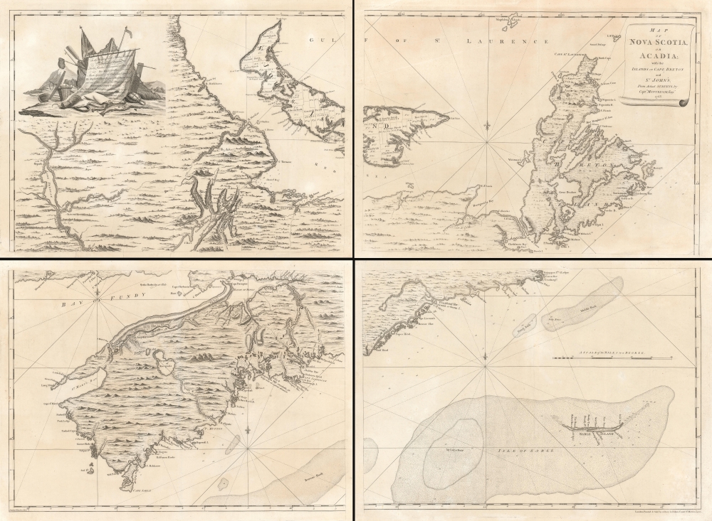


Title
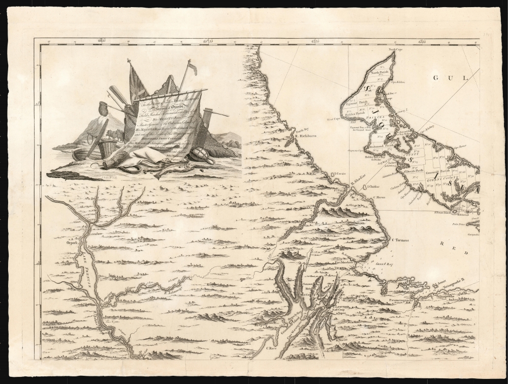
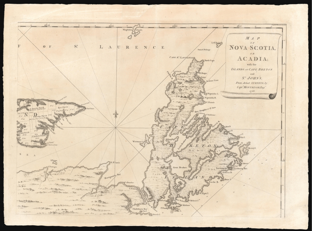
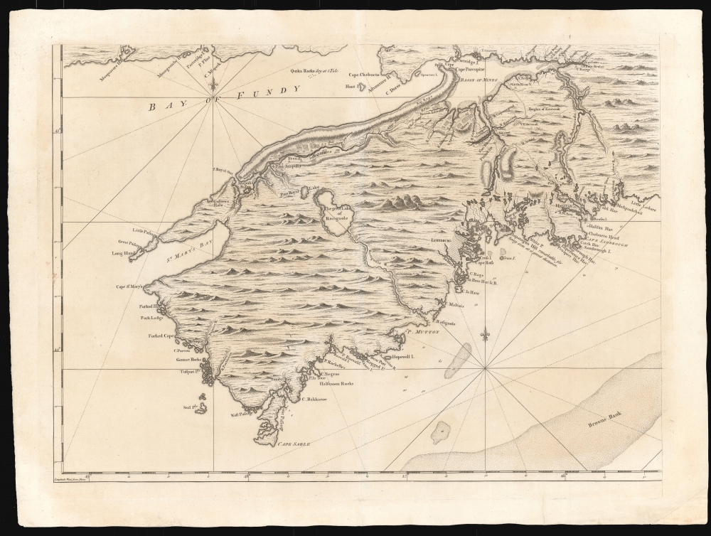
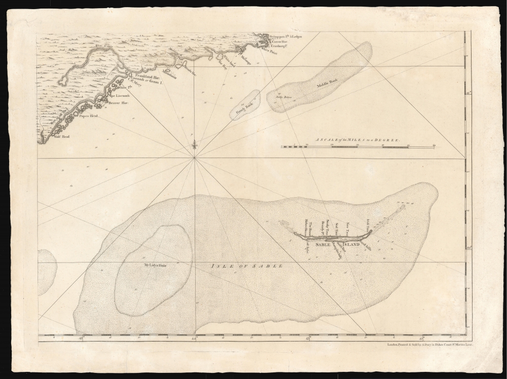
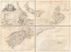
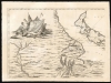
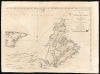
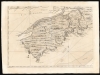
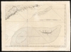
Map of Nova Scotia or Acadia with the Islands of Cape Breton and St. John's.
1768 (undated) 39.5 x 55 in (100.33 x 139.7 cm) 1 : 390000
1768 (undated) 39.5 x 55 in (100.33 x 139.7 cm) 1 : 390000
Description
FOR THE ORIGINAL ANTIQUE MAP, WITH HISTORICAL ANALYSIS, CLICK HERE.
Digital Map Information
Geographicus maintains an archive of high-resolution rare map scans. We scan our maps at 300 DPI or higher, with newer images being 600 DPI, (either TIFF or JPEG, depending on when the scan was done) which is most cases in suitable for enlargement and printing.
Delivery
Once you purchase our digital scan service, you will receive a download link via email - usually within seconds. Digital orders are delivered as ZIP files, an industry standard file compression protocol that any computer should be able to unpack. Some of our files are very large, and can take some time to download. Most files are saved into your computer's 'Downloads' folder. All delivery is electronic. No physical product is shipped.
Credit and Scope of Use
You can use your digial image any way you want! Our digital images are unrestricted by copyright and can be used, modified, and published freely. The textual description that accompanies the original antique map is not included in the sale of digital images and remains protected by copyright. That said, we put significant care and effort into scanning and editing these maps, and we’d appreciate a credit when possible. Should you wish to credit us, please use the following credit line:
Courtesy of Geographicus Rare Antique Maps (https://www.geographicus.com).
How Large Can I Print?
In general, at 300 DPI, you should at least be able to double the size of the actual image, more so with our 600 DPI images. So, if the original was 10 x 12 inches, you can print at 20 x 24 inches, without quality loss. If your display requirements can accommodate some loss in image quality, you can make it even larger. That being said, no quality of scan will allow you to blow up at 10 x 12 inch map to wall size without significant quality loss. For more information, it is best consult a printer or reprographics specialist.
Refunds
If the high resolution image you ordered is unavailable, we will fully refund your purchase. Otherwise, digital images scans are a service, not a tangible product, and cannot be returned or refunded once the download link is used.
Cartographer S
John Montresor (April 22, 1736 – June 1799) was a British military engineer and cartographer. He was born in Gibraltar to military engineer James Gabriel Montresor. Although educated in England, he learned the rudiments of his future trade from his father, working as his assistant. The two came to America in 1754. The next year the young Montresor served as ensign on the disastrous Braddock expedition, in which the British failed to capture the French Fort Duquesne (Pittsburgh) during the French and Indian War (1754 - 1763). Montresor was wounded in the debacle, but nonetheless recede a promotion to Lieutenant. Upon recovering, Montresor went on to serve in northern New York, and accompanied British forces to Halifax. In 1758, commissioned to the Corps of Engineers, he was present at the sieges of Louisbourg and of Quebec (where he drew one of the last known portraits of the doomed General Wolfe.) Following the defeat of the French, the language-handy Montresor was sent as far afield as Cape Breton to elicit oaths of allegiance from Francophone Canadians. During this period, he surveyed and prepared maps of Acadia, the Saint Lawrence River, and of the Kennebec River. He designed and built fortifications in the vicinity of Niagara Falls. As resistance to the Stamp Act built and the Revolution loomed, he surveyed the boundaries between New York and New Jersey. In 1765 in a New York embroiled with Stamp Act riots, Montresor was tasked to draft a plan of the city in order to assist in quelling a full insurrection should it occur. The climate being hostile, Montresor carried out his surveys covertly. The onset of the War found him in Boston; he marched in relief of the British troops who fought at Concord, and took part in the Battles of Long Island and in the 1777 campaigns in New Jersey and Philadelphia, where he launched the attack that destroyed his own Mud Island defenses. Despite his twenty three years of service, he watched as others were repeatedly promoted ahead of him as chief engineer, and he was never promoted beyond Captain. Embittered, he resigned from the military in 1779. More by this mapmaker...
Samuel Holland (1728 - December 28, 1801) was a surveyor and cartographer of extraordinary skill and dedication. Holland was born in the Netherlands in 1728 and, at 17, joined the Dutch Army where he attained the rank of Lieutenant. Around 1754 Holland emigrated to England where he joined the newly forming Royal American Regiment. His skills as a cartographer and surveyor brought him to the attention of his superiors who offered him steady promotions. In 1760 he prepared an important survey of the St. Lawrence River system. It was during this survey that Holland met a young James Cook, who he mentored in the art of surveying. Cook, best known for his exploration of the Pacific, developed many of his own revolutionary nautical surveying techniques based the systems he learnt from Holland. In 1762 Holland caught the attention of the Commission of Trade and Plantations, who governed the British Crown Colonies in America. Under the umbrella of the Trade Commission Holland prepared surveys of the Hudson River Valley and other New York properties. In 1764 he was named Surveyor General for the Northern District, the position in which he did much of his most important work. Holland is also known for surveying done in an attempt to sort out the New York - New Jersey border conflict. Following his work in New York Holland relocated to Canada where, with his new wife of just 21 years, he sired seven children. Like many early surveyors working for colonial governments, Holland was poorly compensated and is known to have supplemented his income by selling the results of his surveys, and those of other surveyors to which he had privileged access, to private publishers, among them the London firm of Laurie and Whittle, who published his work under the pseudonym of 'Captain N. Holland.' Samuel Holland died in Quebec in 1801. Learn More...