Digital Image: 1767 Jaillot Large-Scale Map of Paris (unrecorded state!)
Paris-jaillot-1767_d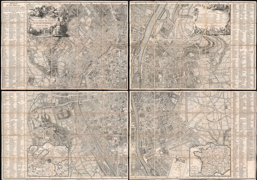

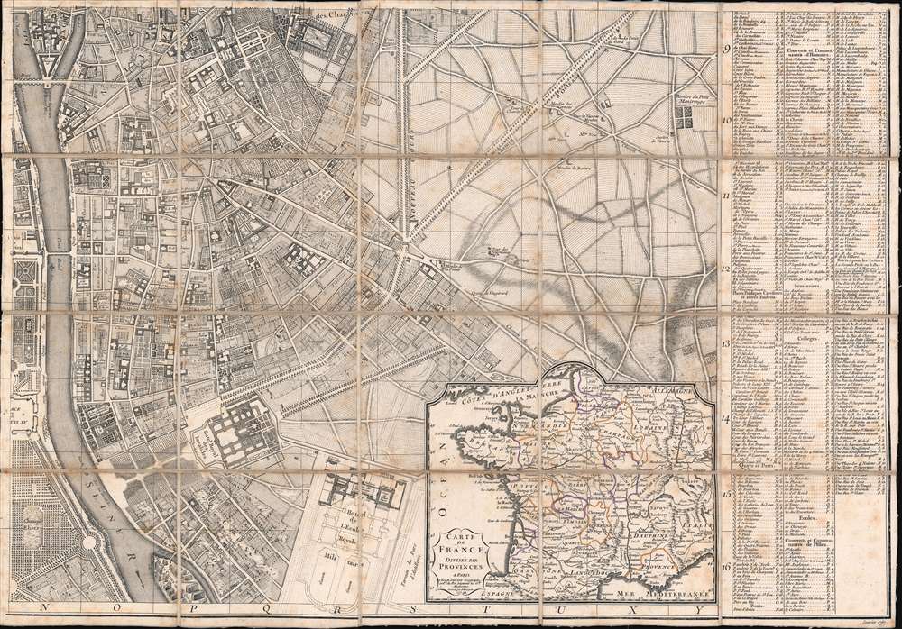


Title
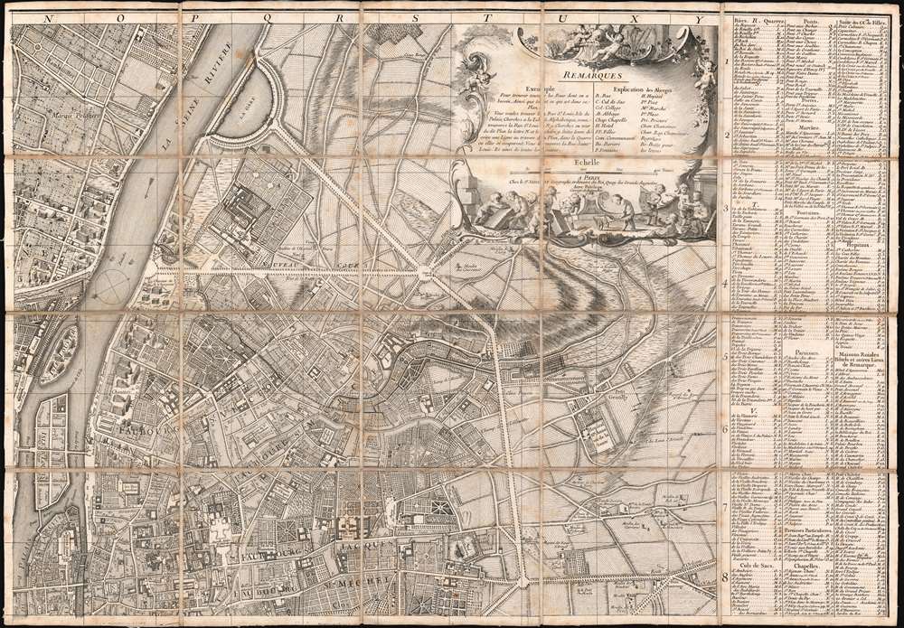
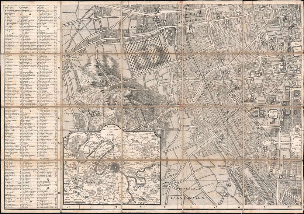
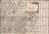
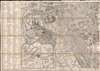
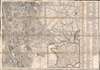
Plan de la Ville de Paris et de ses Faubourgs dédié au Roi.
1767 (dated) 40 x 57 in (101.6 x 144.78 cm) 1 : 6780
1767 (dated) 40 x 57 in (101.6 x 144.78 cm) 1 : 6780
Description
FOR THE ORIGINAL ANTIQUE MAP, WITH HISTORICAL ANALYSIS, CLICK HERE.
Digital Map Information
Geographicus maintains an archive of high-resolution rare map scans. We scan our maps at 300 DPI or higher, with newer images being 600 DPI, (either TIFF or JPEG, depending on when the scan was done) which is most cases in suitable for enlargement and printing.
Delivery
Once you purchase our digital scan service, you will receive a download link via email - usually within seconds. Digital orders are delivered as ZIP files, an industry standard file compression protocol that any computer should be able to unpack. Some of our files are very large, and can take some time to download. Most files are saved into your computer's 'Downloads' folder. All delivery is electronic. No physical product is shipped.
Credit and Scope of Use
You can use your digial image any way you want! Our digital images are unrestricted by copyright and can be used, modified, and published freely. The textual description that accompanies the original antique map is not included in the sale of digital images and remains protected by copyright. That said, we put significant care and effort into scanning and editing these maps, and we’d appreciate a credit when possible. Should you wish to credit us, please use the following credit line:
Courtesy of Geographicus Rare Antique Maps (https://www.geographicus.com).
How Large Can I Print?
In general, at 300 DPI, you should at least be able to double the size of the actual image, more so with our 600 DPI images. So, if the original was 10 x 12 inches, you can print at 20 x 24 inches, without quality loss. If your display requirements can accommodate some loss in image quality, you can make it even larger. That being said, no quality of scan will allow you to blow up at 10 x 12 inch map to wall size without significant quality loss. For more information, it is best consult a printer or reprographics specialist.
Refunds
If the high resolution image you ordered is unavailable, we will fully refund your purchase. Otherwise, digital images scans are a service, not a tangible product, and cannot be returned or refunded once the download link is used.
Cartographer S
Bernard-Antoine Jaillot (???? – 1749) was a French map publisher active in Paris in the first half of the 18th century. He is part of the prestigious Jaillot cartographic dynasty, his father is Bernard-Jean-Hyacinthe Jaillot (1673 - 1739), and grandfather Alexis-Hubert Jaillot (c. 1632- 1712). As both father and son published as 'B. Jaillot' or 'Bernard Jaillot', and both worked in the same style from the same offices on a Quai d'Augustins, they are often conflated and their separate work can be distinguished only by date and other tangential data. Like his father, Bernard-Antoine also held the position of Géographe Ordinaire du Roi. BnF data suggests he was born in the 18th century, but it is unlikely, has there are major publications positively attributed from 1717, which would be unlikely. More by this mapmaker...
Antoine Coquart (1703 - 1762) was a French engineer, topographical engraver, and draftsman active in Paris in the first half of the 18th century. Along with Claude Lucas (1685 - 1765), Coquart engraved the great Bretez/Turgot Plan of Paris in 1736 and the subsequent 1748 Jaillot Plan of Paris. He also engraved plates for the 1712 L'Histoire Traite de la Police by Delamare. Learn More...
Pierre Bourgoin (???? - 17??) was a French line and letter engraver active in Paris in the early to mid-18th century. His is best known for engraving map for great French cartographer Jean-Baptiste Bourguignon d 'Anville (1697 - 1782). Learn More...
Pierre-Alexandre Aveline (1702 - 1760) was a French engraver, portraitist, illustrator, and printmaker active in Paris during the first half of the 18th century. Aveline came from a dynasty of artist, including his father Pierre Aveline (1656 - 1722) and brother Antoine Aveline (1691 - 1743). He mastered copperplate engraving under his father and joined the Académie de peinture et de sculpture (Royal Academy of Painting and Sculpture) in 1737. In cartographic circles he was known for his excellent cartouche work. In addition, he well-known for producing finely engraved reproductions of poplar French paintings. Learn More...
References
Boutier, J, Les Plans de Paris, #240. Bonnardot, Alfred, Études archéologiques sur les anciens plans de Paris des XVIe, XVIIe et XVIIIe siècles, (Paris) 1851, pages, 205-206, 211.