Digital Image: 1747 Basire Map and Chart of Sierra Leone
SierraLeone-basire-1747_d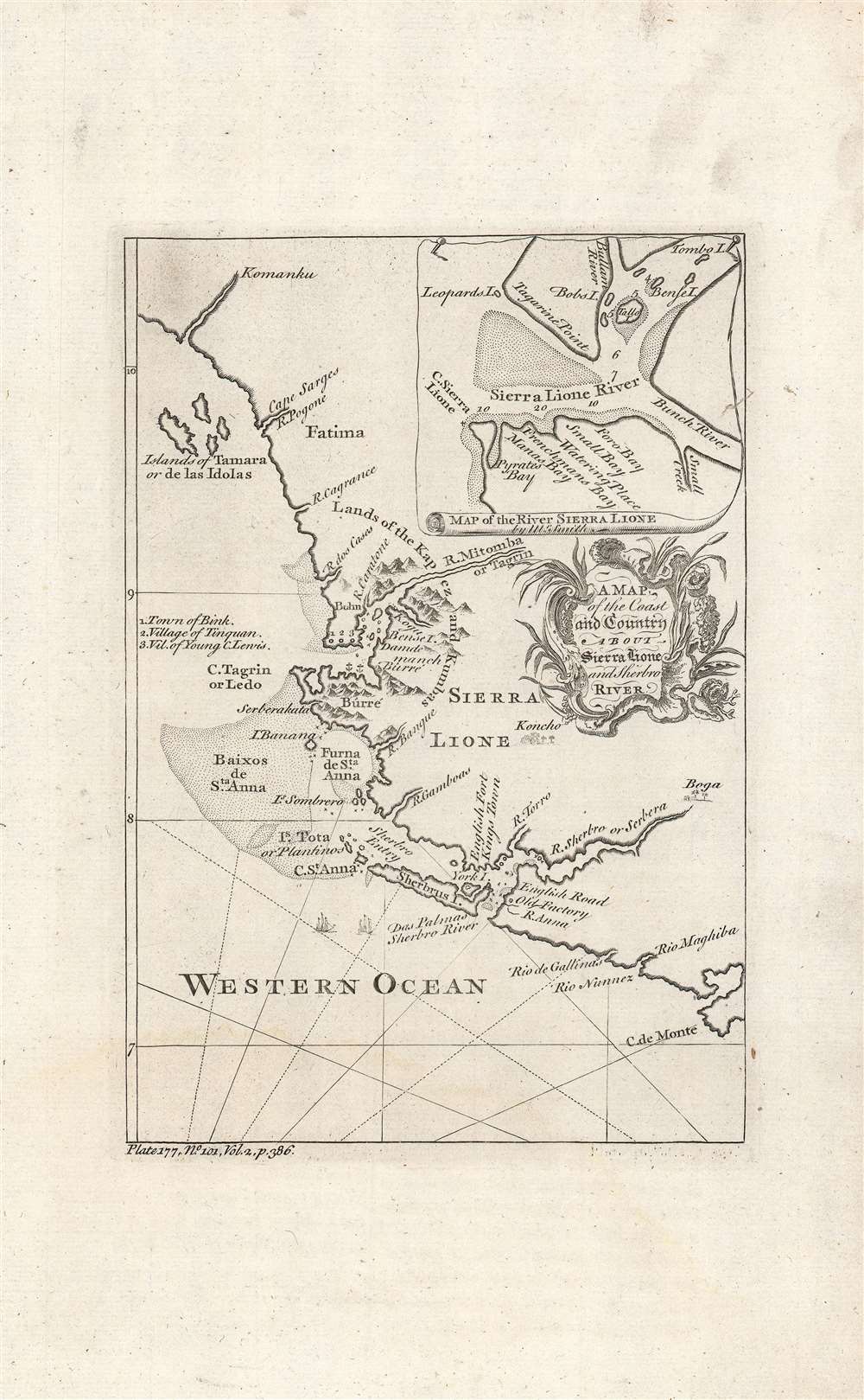

Title
A map of the coast and country about Sierra Lione and Sherbro River.
1747 (undated) 8.75 x 6 in (22.225 x 15.24 cm) 1 : 1750000
1747 (undated) 8.75 x 6 in (22.225 x 15.24 cm) 1 : 1750000
Description
FOR THE ORIGINAL ANTIQUE MAP, WITH HISTORICAL ANALYSIS, CLICK HERE.
Digital Map Information
Geographicus maintains an archive of high-resolution rare map scans. We scan our maps at 300 DPI or higher, with newer images being 600 DPI, (either TIFF or JPEG, depending on when the scan was done) which is most cases in suitable for enlargement and printing.
Delivery
Once you purchase our digital scan service, you will receive a download link via email - usually within seconds. Digital orders are delivered as ZIP files, an industry standard file compression protocol that any computer should be able to unpack. Some of our files are very large, and can take some time to download. Most files are saved into your computer's 'Downloads' folder. All delivery is electronic. No physical product is shipped.
Credit and Scope of Use
You can use your digial image any way you want! Our digital images are unrestricted by copyright and can be used, modified, and published freely. The textual description that accompanies the original antique map is not included in the sale of digital images and remains protected by copyright. That said, we put significant care and effort into scanning and editing these maps, and we’d appreciate a credit when possible. Should you wish to credit us, please use the following credit line:
Courtesy of Geographicus Rare Antique Maps (https://www.geographicus.com).
How Large Can I Print?
In general, at 300 DPI, you should at least be able to double the size of the actual image, more so with our 600 DPI images. So, if the original was 10 x 12 inches, you can print at 20 x 24 inches, without quality loss. If your display requirements can accommodate some loss in image quality, you can make it even larger. That being said, no quality of scan will allow you to blow up at 10 x 12 inch map to wall size without significant quality loss. For more information, it is best consult a printer or reprographics specialist.
Refunds
If the high resolution image you ordered is unavailable, we will fully refund your purchase. Otherwise, digital images scans are a service, not a tangible product, and cannot be returned or refunded once the download link is used.
Cartographer S
Isaac Basire (September 20, 1704 - August 24 1768) was a London engraver, first in a family line of prolific and well-respected engravers. His most well-known work is the frontispiece to an edition of Bailey's 1755 dictionary but he was primarily a map engraver. He was born in London to on J. Basire, a Huguenot emigre from Rouen. His son James (1730-1802), grandson James (1769-1822), and great-grandson James (1796-1869) all continued the family trade. Assigning specific works to particular members of the family is not a straightforward task, as all four Basires were engravers, one often as apprentice to his father. Thus the work of the four frequently overlapped. More by this mapmaker...
Thomas Astley (died 1759) was a bookseller and publisher in London active predominantly between 1734 and 1747. His early history is a cipher and we know nothing of his education or training. He was a member of the Worshipful Company of Stationers, so there must have been an apprenticeship. Between 1727 and 1742 he printed and sold books from a Saint Paul's Churchyard address; starting in 1745 he sold his work from Paternoster Row. He is most remembered for his four-volume, 1745-48 Voyages and Travels which continued in the tradition of travel books by Hakluyt, Purchas, John Atkins, Jean Barbot, Willem Bosman, Theodor de Bry, Francis Moore, Jean-Baptiste Labat, Godefroi Loyer, Thomas Phillips, William Smith, and Nicolas Villaut de Bellefond - to the extent of recapitulating those earlier works. Astley's Voyages included maps engraved by George Child and Nathaniel Parr. Astley was an early publisher of the 'London Magazine,' founded in 1732 to compete with and oppose the Tory 'Gentlemen's political opposition and rivalry to the Tory 'Gentleman's Magazine.' Astley's publication in the magazine of the treason trial of the Jacobite Simon Lord Lovat led to Astley's arrest and punishment with fines (trials of peers in the House of Lords were meant to be secret). Though he regained his freedom upon his examination by the House of Lords (having pointed out that he was merely reprinting what had already been made public in the penny press) Astley was removed as publisher of the Magazine; there were no further volumes added to his Voyages and Travels. He died in 1759 survived by his wife and daughter (both named Susanna) who inherited his remaining stock and his pension from the Company of Stationers. Learn More...
Source
Green, J. (Mead, Braddock), A New General Collection of Voyages and Travels, (London) 1747.
References
OCLC 698719288.