Digital Image: 1754 Drummond Map of Northern Syria
Syria-drummond-1754_d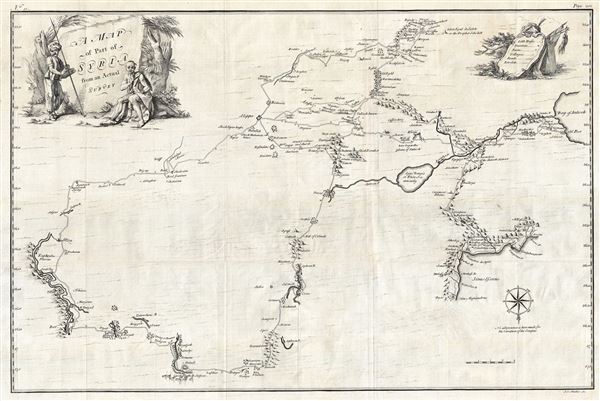

Title
A Map of Part of Syria from an Actual Survey.
1754 (undated) 19.5 x 30 in (49.53 x 76.2 cm) 1 : 194000
1754 (undated) 19.5 x 30 in (49.53 x 76.2 cm) 1 : 194000
Description
FOR THE ORIGINAL ANTIQUE MAP, WITH HISTORICAL ANALYSIS, CLICK HERE.
Digital Map Information
Geographicus maintains an archive of high-resolution rare map scans. We scan our maps at 300 DPI or higher, with newer images being 600 DPI, (either TIFF or JPEG, depending on when the scan was done) which is most cases in suitable for enlargement and printing.
Delivery
Once you purchase our digital scan service, you will receive a download link via email - usually within seconds. Digital orders are delivered as ZIP files, an industry standard file compression protocol that any computer should be able to unpack. Some of our files are very large, and can take some time to download. Most files are saved into your computer's 'Downloads' folder. All delivery is electronic. No physical product is shipped.
Credit and Scope of Use
You can use your digial image any way you want! Our digital images are unrestricted by copyright and can be used, modified, and published freely. The textual description that accompanies the original antique map is not included in the sale of digital images and remains protected by copyright. That said, we put significant care and effort into scanning and editing these maps, and we’d appreciate a credit when possible. Should you wish to credit us, please use the following credit line:
Courtesy of Geographicus Rare Antique Maps (https://www.geographicus.com).
How Large Can I Print?
In general, at 300 DPI, you should at least be able to double the size of the actual image, more so with our 600 DPI images. So, if the original was 10 x 12 inches, you can print at 20 x 24 inches, without quality loss. If your display requirements can accommodate some loss in image quality, you can make it even larger. That being said, no quality of scan will allow you to blow up at 10 x 12 inch map to wall size without significant quality loss. For more information, it is best consult a printer or reprographics specialist.
Refunds
If the high resolution image you ordered is unavailable, we will fully refund your purchase. Otherwise, digital images scans are a service, not a tangible product, and cannot be returned or refunded once the download link is used.
Cartographer S
Alexander Drummond (?? - August 9, 1769) was a Scottish diplomat active in the Middle East during the mid-18th century. Drummond was the son of George Drummond of Newton and the younger brother of George Drummond, Lord Provost of Edinburgh. Little is known of his early years but he seems to have traveled extensively in the 1740s before being commissioned as the British Consul at Aleppo, a position he occupied form 1754 to 1756. Drummond was an amateur surveyor and a student of antiquity. His few maps are generally of some significance, as many shed new light and incorporate original survey work on then little know parts of the world. His maps of Cyprus proved exceptionally influential and in the accompanying literature Drummond is among the first to recommend a British takeover of the island. He seems to have travelled extensively throughout Syria during this time and returned to England with some of the most sophisticated mappings of Syria then available - many of which he published in his journals. Drummond died in Edinburgh on August 9, 1769. More by this mapmaker...
Johann Sebastian Muller (1715 - June, 1792), also known as John Sebastian Miller, was a German born generalist engraver active in London during the middle part of the 18th century. Muller was born in Nuremberg, Germany. He must have shown little aptitude for his father's profession, gardening, instead training as an engraver under Martin Tyroff. He moved to London with his Brother, Tobias Muller (Miller) in 1744. He took work with art-dealer Arthur Pond before starting to engrave on his own account around 1748. His work was exhibited at the Society of Artists in 1767. Muller was not specifically a map engraver, and his cartographic corpus is, thus, small and limited to a series of map engraved for William Drummond to illustrate his travels in the Levant, specifically Cyprus and Syria. Nonetheless, the maps from this volume are significant works that significantly influenced subsequent cartography in their respective regions. Muller was survived by two sons, John Frederick Miller and James Miller, both of whom also became engravers. Learn More...
Source
Drummond, A., Travels through the different Countries of Germany, Italy, Greece, and parts of Asia, as far as the Euphrates, (London: Strahan) 1754.