Digital Image: 1835 Bruguière Comparative Chart of the World's Great Waterfalls
Waterfalls-andriveaugoujon-1835_d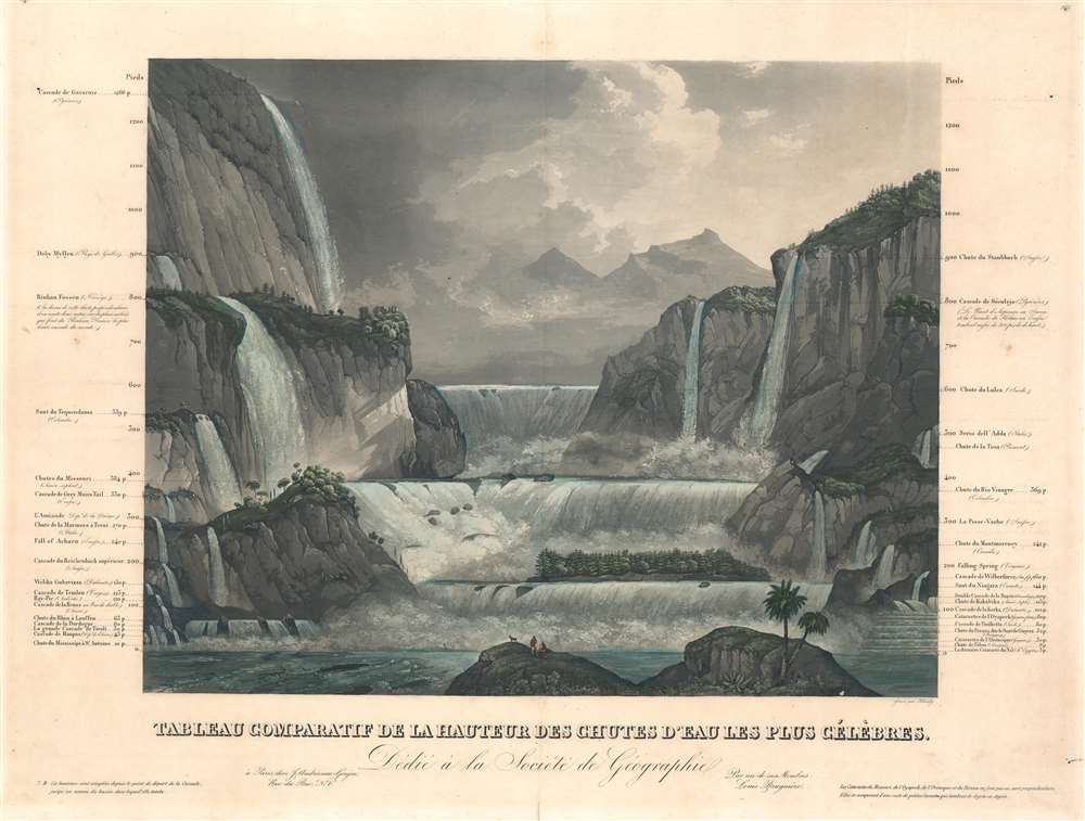

Title
Tableau Comparatif de la Hauteur des Chutes d'Eau Les Plus Célèbres.
1835 (undated) 17.75 x 23.5 in (45.085 x 59.69 cm)
1835 (undated) 17.75 x 23.5 in (45.085 x 59.69 cm)
Description
FOR THE ORIGINAL ANTIQUE MAP, WITH HISTORICAL ANALYSIS, CLICK HERE.
Digital Map Information
Geographicus maintains an archive of high-resolution rare map scans. We scan our maps at 300 DPI or higher, with newer images being 600 DPI, (either TIFF or JPEG, depending on when the scan was done) which is most cases in suitable for enlargement and printing.
Delivery
Once you purchase our digital scan service, you will receive a download link via email - usually within seconds. Digital orders are delivered as ZIP files, an industry standard file compression protocol that any computer should be able to unpack. Some of our files are very large, and can take some time to download. Most files are saved into your computer's 'Downloads' folder. All delivery is electronic. No physical product is shipped.
Credit and Scope of Use
You can use your digial image any way you want! Our digital images are unrestricted by copyright and can be used, modified, and published freely. The textual description that accompanies the original antique map is not included in the sale of digital images and remains protected by copyright. That said, we put significant care and effort into scanning and editing these maps, and we’d appreciate a credit when possible. Should you wish to credit us, please use the following credit line:
Courtesy of Geographicus Rare Antique Maps (https://www.geographicus.com).
How Large Can I Print?
In general, at 300 DPI, you should at least be able to double the size of the actual image, more so with our 600 DPI images. So, if the original was 10 x 12 inches, you can print at 20 x 24 inches, without quality loss. If your display requirements can accommodate some loss in image quality, you can make it even larger. That being said, no quality of scan will allow you to blow up at 10 x 12 inch map to wall size without significant quality loss. For more information, it is best consult a printer or reprographics specialist.
Refunds
If the high resolution image you ordered is unavailable, we will fully refund your purchase. Otherwise, digital images scans are a service, not a tangible product, and cannot be returned or refunded once the download link is used.
Cartographer S
Louis Bruguière (fl. c. 1820 - 1835) was a French mountaineer and geologist active in Europe in the first half of the 19th century. Bruguière is best known for his geological classification tables for the Alps which he laid out in his famous book, Orographie de l'Europe. He was a friend and correspondent of Alexander von Humboldt. In the 1830s he produced a series of 'Tableau Comparatif' charts for the publisher Andriveau-Goujon. More by this mapmaker...
Sigismond Himely (June 7, 1801 - 1872) was a Swiss painter, viewmaker, acquaint engraver active in Paris during the middle part of the 19th century. Hinley was born in La Neuveville, Bern, Switzerland, but moved to Paris to study painting with Copley Fielding (1787 - 1855) and Jean-Victor Bertin (1775 - 1842). He exhibited in the Paris Salons between 1824 and 1869. He is known for his work engraving aquatints for English watercolorists and his names is associated with numerous historical views, city bird's-eye panoramas, architectural illustrations, and ethnographic images, among them rare illustrations of Asia, Africa, and the Americas. Learn More...
Eugène Andriveau-Goujon (1832 - 1897) was a map publisher and cartographer active in 19th century Paris. The firm was created in 1825 when Eugène Andriveau married the daughter of map publisher Jean Goujon - thus creating Andriveau-Goujon. Maps by Andriveau-Goujon are often confusing to identify as they can be alternately singed J. Goujon, J. Andriveau, J. Andriveau-Goujon, E. Andriveau-Goujon, or simply Andriveau-Goujon. This refers to the multiple generations of the Andriveau-Goujon dynasty and the tendency to republish older material without updating the imprint. The earliest maps to have the Andriveau-Goujon imprint were released by Jean Andriveau-Goujon. He passed the business to his son Gilbert-Gabriel Andriveau-Goujon, who in 1858 passed to his son, Eugène Andriveau-Goujon, under whose management the firm was most prolific. Andriveau-Goujon published numerous fine pocket maps and atlases throughout the 19th century and often worked with other prominent French cartographers of the time such as Brue and Levasseur. The firm's stock was acquired by M. Barrère in 1892. Learn More...
Source
Classic and Universal Atlas of Ancient and Modern Geography, (Paris: Andriveau-Goujon) 1835.