
1963 U.S.G.S. / Aramco Geological Map of Arabia, Oil and Gas History

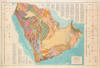
Geologic Map of the Arabian Peninsula. Miscellaneous Geologic Investigations Map I-270 A.
Foundational Map of the Saudi Oil Industry.
Foundational Map of the Saudi Oil Industry.
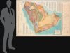
This is a 1963 very large-format (50 x 71.5 in.) geological map of the Arabian Peninsula, prepared by the Arabian American Oil Co. (Aramco) and the U.S. Geological Survey. Beyond its stunning visual qualities, it is significant as the foundational map of the modern Saudi oil and gas industry, serving as a basis for later studies and an essential piece in any collection focusing on modern Arabia and/or the oil and gas industry. Moreover, this example comes with esteemed provenance, having previously belonged to the Egyptian geologist Soliman Mahmoud Soliman, a professor at Ain Shams University.A Closer Look
The map covers the entire Arabian Peninsula, from Jerusalem and Amman in the north to the Bab al-Mandeb Strait in the south. Color shading and abbreviations, explained in the margins, provide tremendous detail on the peninsula's geologic formations. Text at the top-right and bottom-left provides additional information on the terrain and geology of various countries in the peninsula. Beyond geological information, the map records railways, highways, pipelines, cities and settlements, extant oil fields (in northeastern Saudi Arabia), waterways, elevation at various points (particularly in western Saudi Arabia), and international boundaries (several in dispute).Historical Context
As the product of the first comprehensive geological survey of the Arabian Peninsula, this map became a landmark in the history of the region's oil and gas industry, particularly in Saudi Arabia. The map resulted from a joint effort by a U.S. Geological Survey team led by Glen F. Brown, the Arabian American Oil Company (Aramco), and the Saudi Ministry of Petroleum and Mineral Resources (established in 1960). The map unified decades of proprietary Aramco surface mapping, aerial surveys, and well-log data with USGS reconnaissance across the region. For the Saudi petroleum industry, the map marked a critical turning point from localized, surface-anticline prospecting, such as the early strikes at Dammam and Ghawar, to systematic, basin-scale exploration. It allowed petroleum geologists to model petroleum systems across entire sedimentary sub-basins, project prolific Jurassic and Cretaceous carbonate reservoirs into frontier regions like the Rub' al-Khali, and trace hydrocarbon migration pathways with unprecedented accuracy. Beyond exploration logistics, it also provided the newly established Saudi Ministry of Petroleum and Mineral Resources with an authoritative scientific baseline to evaluate its sovereign resource base, audit Aramco's concession relinquishments, and plan national energy infrastructure, anchoring Saudi Arabia's rapid ascent as a global petroleum superpower. As a result, Saudi Arabia roughly doubled its share of global oil production by the mid-1970s.Publication History and Census
This map was prepared by the U.S. Geological Survey in a joint project with Aramco geologists and published in 1963. It was printed in both English and Arabic editions, with the latter at a scale of 1:4,000,000 rather than 1:2,000,000. OCLC records fifteen institutions holding this edition of the map.This example is notable for its provenance, indicated by two signatures that appear at the top right, both of the same name ( سليمان محمود سليمان). This is almost certainly Dr. Soliman Mahmoud Soliman, a contemporary faculty member at the Department of Geology at Ain Shams University in Cairo, who received his doctorate from Stanford University in 1958. Dr. Soliman's research touched on multiple topics, including the potential for exploitation of petroleum resources in the region, as published in articles that appeared in English-language reports of the Arab Petroleum Congresses of the era.
Cartographers
Arabian American Oil Company (Aramco; predecessor established 1933; name used 1944 - 1988) was an American-owned petroleum exploration and production company operating in Saudi Arabia, headquartered in Dhahran from 1952, whose survey departments made substantial contributions to the geographic and geological mapping of the Arabian Peninsula during the mid-20th century. Its origins lay in the petroleum concession granted to Standard Oil Company of California in 1933 and administered through its subsidiary, California Arabian Standard Oil Company. Commercial oil production began at Dammam No. 7 in 1938, and the company adopted the Arabian American Oil Company name in 1944. Standard Oil Company of New Jersey and Socony-Vacuum acquired interests in 1948, broadening its American ownership; its headquarters moved from New York to Dhahran in 1952. Cartographic work developed alongside geological exploration, combining ground reconnaissance, astronomical observations, triangulation, leveling, and aerial photography. Beginning in 1949, aerial mapping supplied the photographic foundation for increasingly systematic geographic coverage, while company surveyors established horizontal and vertical control. Aramco's Arabian Affairs Division also evaluated place names, consulting Saudi informants and working toward consistent Arabic and English nomenclature. In the mid-1950s, Aramco joined the United States Geological Survey in a cooperative mapping program sponsored by the Saudi government and the United States Department of State. The program provided for 21 quadrangles at 1:500,000, with separate geographic and geological versions and bilingual nomenclature. Aramco assumed responsibility for compiling the sedimentary regions, while the Geological Survey principally covered the western Arabian Shield. Geographic sheets appeared from 1956 to 1962 and geological sheets from 1956 to early 1964; the collaboration also produced a preliminary peninsula-wide geographic map in 1958, a revised edition in 1963, and the Geologic Map of the Arabian Peninsula at 1:2,000,000 in 1963. These publications made extensive company exploration data available for scientific and economic use beyond petroleum operations. Saudi government participation in Aramco began in 1973 and reached complete ownership in 1980. In 1988, the newly established Saudi Arabian Oil Company, known as Saudi Aramco, succeeded to Aramco's responsibilities. Further Details...
The United States Geological Survey (March 3, 1879 - present), commonly abbreviated USGS, is an American federal scientific bureau and civilian mapping agency within the Department of the Interior, established in Washington, D.C., and subsequently headquartered in Reston, Virginia. Congress created the Survey to classify public lands and investigate the geological structure, mineral resources, and products of the national domain, replacing separate western investigations with a permanent scientific organization. Its first director, Clarence King (1842 - 1901), organized geological investigations and recruited experienced scientists and topographers from earlier federal surveys. Under his successor, John Wesley Powell (1834 - 1902), director from 1881 to 1894, topographic mapping expanded from support for individual geological investigations into a nationwide undertaking. Congressional authorization in 1882 to continue preparation of a geological map of the United States extended the Survey's work into the eastern states, while systematic topographic mapping received authorization in 1884. Henry Gannett (1846 - 1914), the Survey's chief geographer, helped establish enduring methods and standards for this work. Its topographic quadrangles represented terrain through contour lines alongside drainage, settlements, roads, and other features, furnishing a common geographic foundation for scientific investigation and practical land use. During the 20th century, the Survey's mapping evolved from field surveying and compilation toward aerial photography, photogrammetry, and digital geographic information systems. A formal program begun in 1947 to map the conterminous United States at 1:24,000 scale culminated in nationwide coverage in 1992, comprising more than 55,000 maps. The Survey also produced geological and thematic maps and assembled national geographic information. In 2009 it introduced US Topo, a digitally generated successor to its traditional topographic quadrangles. Its continuing cartographic work includes The National Map, digital topographic products, and public access to historical quadrangles, alongside broader investigations of water, ecosystems, mineral and energy resources, and natural hazards. Further Details...
Condition
Very good. Light soiling right side, through side panel. Some closed-edge tears to the right side, repaired and stabilized on verso.
References
OCLC 781823958, 748856666, et al.