
1662 Nicolas Sanson Atlas of Asia

This item has been sold.
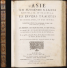
L'Asie en Plusiers Cartes Novelles, et Exactes; et en Divers Traictes de Geographie, et D'Histoire....
Elegant Edition of the First French Atlas of Asia.
Elegant Edition of the First French Atlas of Asia.
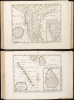
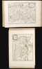
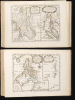
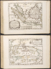
This is a handsome example of the first French atlas of Asia, printed in 1662 by Nicolas Sanson, the father of French mapmaking. An encyclopedic atlas, the work contains 17 maps and 100 pages of historical and descriptive text. It was intended to educate the curious reader about the wonders of parts of the world they would likely never see themselves.A Closer Look
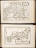
The maps contained in the atlas are as follows:- L'Asie - The full continent of Asia.
- Turquie en Asie - The eastern Mediterranean and the Ottoman Empire, including the Black Sea and the western part of the Caspian Sea.
- Anatolie - Asia Minor, including the island of Cyprus.
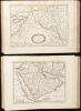
- Sorie, et Diarbeck - The Fertile Crescent: Syria, the Holy Land, and Mesopotamia, including present-day Iraq.
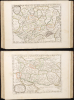
- Turcomanie, Georgie, Commanie - The region between the Black Sea and the Caspian, including present-day Georgia, Azerbaijan, and Armenia.
- L'Arabie Petrée, Deserte, et Heureuse - The Arabian Peninsula, including the Red Sea, the Persian Gulf, and the neighboring regions of Syria, Iraq, and Iran.
- L'Empire du Sophy des Perses - The Persian Empire, including present-day Iran, Pakistan, and part of Afghanistan.
- L'Empire du Grand Mogol - The Mogul Empire, comprised of India from the Deccan Plateau northwards, embracing Pakistan, Afghanistan, and much of Central Asia.
- Presqu'Isle de l'Inde deça le Gange - The Indian Peninsula, as far north as the Gulfs of Khambhat and Bengal, with an inset map of the Kingdom of Malabar in southwest India.
- Partie de l'Inde au delà du Gange - South Asia east of the Ganges: Burma, Thailand, Vietnam, and coastal China west of Hong Kong.
Presqu'Isle de l'Inde au delà du Gange - The Nicobar Islands, Malay Peninsula, and Sumatra. - Royaume de la Chine - China, including part of Cochinchina, the Philippines, the western limits of Japan, and a broad, insular Korea.
- La Grande Tartarie - The Tatar Empire, later the eastern parts of the Russian Empire and Siberia; includes Turkestan, Uzbekistan, and northern China.
- Description des Isles du Japon - The main islands of Japan, including the southern coast of Hokkaido, correctly naming the town of Matsumae.
- Les Iles Philippines - Including China's Hainan Island in the north and part of Borneo to the south.
Islas de los Ladrones - The Mariana Islands. - Les Isles Molucques - The East Indies and the Spice Islands.
- Les Isles de la Sonde - Sumatra, Java, Borneo, and the neighboring islands.
- Ceylon et les Maldives - Including a detailed inset of Sri Lanka.
Publication History and Census
The maps of this atlas were engraved by Abraham Peyrounin for inclusion in this atlas's 1652 edition, and were retained unchanged in the Paris editions of the work. The present example, of the 1662 edition, has been noted in catalog entries to exhibit frequent variations in pagination and binding: here, for example, the two leaves comprising pages 73 to 76 have been omitted in the binding of the work. All of the maps are present. In its 1683 edition, alongside the volumes dedicated to the other three continents, the book is well-represented in institutional collections. We do not see the 1662 in OCLC at all. A handful of examples have appeared on the market over the past 25 years, but none of this edition.Cartographers
Nicolas Sanson (December 20, 1600 - July 7, 1667) and his descendants were the most influential French cartographers of the 17th century and laid the groundwork for the Golden Age of French Cartography. Sanson was born in Picardy, but his family was of Scottish Descent. He studied with the Jesuit Fathers at Amiens. Sanson started his career as a historian where, it is said, he turned to cartography as a way to illustrate his historical studies. In the course of his research some of his fine maps came to the attention of King Louis XIII who, admiring the quality of his work, appointed Sanson Geographe Ordinaire du Roi. Sanson's duties in this coveted position included advising the king on matters of geography and compiling the royal cartographic archive. In 1644, he partnered with Pierre Mariette, an established print dealer and engraver, whose business savvy and ready capital enabled Sanson to publish an enormous quantity of maps. Sanson's corpus of some three hundred maps initiated the golden age of French mapmaking and he is considered the 'Father of French Cartography.' His work is distinguished as being the first of the 'Positivist Cartographers,' a primarily French school of cartography that valued scientific observation over historical cartographic conventions. The practice result of the is less embellishment of geographical imagery, as was common in the Dutch Golden Age maps of the 16th century, in favor of conventionalized cartographic representational modes. Sanson is most admired for his construction of the magnificent atlas Cartes Generales de Toutes les Parties du Monde. Sanson's maps of North America, Amerique Septentrionale (1650), Le Nouveau Mexique et La Floride (1656), and La Canada ou Nouvelle France (1656) are exceptionally notable for their important contributions to the cartographic perceptions of the New World. Both maps utilize the discoveries of important French missionaries and are among the first published maps to show the Great Lakes in recognizable form. Sanson was also an active proponent of the insular California theory, wherein it was speculated that California was an island rather than a peninsula. After his death, Sanson's maps were frequently republished, without updates, by his sons, Guillaume (1633 - 1703) and Adrien Sanson (1639 - 1718). Even so, Sanson's true cartographic legacy as a 'positivist geographer' was carried on by others, including Alexis-Hubert Jaillot, Guillaume De L'Isle, Gilles Robert de Vaugondy, and Pierre Duval. Further Details...
Abraham Peyrounin (c. 1620 - c. 1666) was a French engraver active in Paris during the middle part of the 17th century. Peyrounin is best known for engraving maps for the preeminent French geographers of the period, Nicolas Sanson and his partner Pierre Mariette. Further Details...
Condition
Very good. 4to. (250 x 180 mm). [ii], 104 pp. Second edition. (100 pages (with binder's errors in pagination, dropping pp. 73-76.) Complete complement of 17 double-page engraved maps in original outline color. Contemporary mottled calf, corner edges neatly repaired, minor dampstaining mainly on text and on blank verso of maps, last blank leaf torn on lower fore-edge. A contemporary signature on first blank leaf.
References
OCLC 1355271094. (1652) Rumsey 11574.000. (1652) Pastoreau, M. Les Atlas Francais, Sanson IIIC. Phillips, P., A list of geographical atlases in the Library of Congress#494 (1683).