
1895 Stadelmann City Plan of Basel, Map of Surroundings

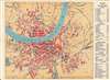
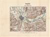
Plan de la ville de Bale / Basel und Umgebung.
A global city, avant la lettre.
$150.00
Choose a Collection:
- Digital Map Information
- Suitable for large format printing
- Full resolution TIFF file
- ICC color profile embedded
- Delivered instantly via download link
This Item
Enquire
A global city, avant la lettre.
This is Cölestin Stadelmann's c. 1895 city plan or map of Basel, Switzerland. The front (recto) is a bilingual city plan of Basel (Bâle), while the back (verso) contains a German-language map of the environs of Basel, a reflection of Basel's multilingual environment and international character.A Closer Look
This map most likely combined an existing German map with the French-language index at right, a convenience for French visitors. A grid in the margins corresponds to the index, which lists hotels, churches, and public buildings such as museums, libraries, hospitals, and botanical gardens. It is oriented towards the northeast, the compass using abbreviations for German ('ost' instead of the French 'est'). Some pencil markings by the original owner are present towards bottom-left. The verso presents a map of the environs of Basel along the Rhine River at the intersection of France, Germany, and Switzerland.Basel claims several firsts, such as the world's first public art museum, the Kunstmuseum, the first bridge to cross the Rhine (here as 'Alte Brücke,' built in the 1220s and renovated in 1903 - 1905), and the world's first international railway station, the Centralbahnhof.
Soon after this map's publication, a new railway station just to the south of the Centralbahnhof was constructed to accommodate the high and increasing demand. The massive new station, the Schweizer Bundesbahnhof, is today the busiest international border station in Europe. Not long afterwards, the Badischer Bahnhof north of the river was also moved and expanded.
The city's international flavor and Switzerland's liberal atmosphere made it an ideal site for financial, diplomatic, and political gatherings, including the first World Zionist Congress, organized by Theodor Herzl in 1897.
Publication History and Census
This map was drawn by Cölestin Stadelmann, a local cartographer, and lithographed by A. Lierow. It is not known to be held in any institutional collections and has no known history on the market. A map held by Utrecht University is cataloged (OCLC 946127667) with an English title but looks to match the description of the present map. Stadelmann produced several German-language maps of Basel in the 1880s and 1890s, which may have been the basis for the maps on the recto and verso.Cartographers
Cölestin Stadelmann (fl. C. 1883 – 1903) was a Basel-based cartographer who primarily worked on maps of his home city and its environs. Further Details...
A. Lierow (fl. c. 1889 – 1906) was a Swiss lithographer specializing in the production of maps. After operating under the name 'A. Lierow,' the firm changed its name around the turn of the century to 'Lierow & Sohn.' Further Details...
Condition
Very good. Some pencil markings on recto towards lower-left.