
1945 Defence Overprint Map of Kalkar, Germany, and Environs for Operation Blockbuster


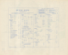
Germany 1:25,000 Sheet No. 4203 Defence Overprint 6 Feb. 1945.
Advancing to the Rhine.
- Digital Map Information
- Suitable for large format printing
- Full resolution TIFF file
- ICC color profile embedded
- Delivered instantly via download link
Advancing to the Rhine.
This is a February 1945 World War II (1939 - 1945) Defence Overprint map of eastern Germany, illustrating the town of Kalkar (Calcar) and its immediate vicinity. Published on February 6, 1945, this map was part of the planning for Operation Blockbuster, the final Allied offensive in the Rhineland.A Closer Look
The blue overprinting is the most critical aspect of this map; it highlights German positions as recorded from aerial photography up to January 24, 1945. The angled lines along the left side mark German trenches; the little arches are likely minefields. The arrows within the trenches mark machine gun emplacements. Other gun positions marked with circles indicate anti-aircraft guns, which are labeled as either occupied or unoccupied. (Unoccupied positions are accompanied by a 'U'.) The phrase 'liable to flood' appears several times on the sheet. This warning must have been ever-present in the minds of the Canadian soldiers fighting Operation Blockbuster because the Germans had effectively used flooding as a delaying tactic only weeks before.Operation Blockbuster
Operation Blockbuster took place from February 26 through early March 1945 and was the final stage of the larger Operation Veritable. Operation Veritable and Operation Grenade were the northern and southern parts, respectively, of an Allied pincer movement to capture German soldiers between the Rivers Meuse and Rhine. These operations were part of the Rhineland Campaign, which took place in the Netherlands and Germany. Progress south during Operation Veritable had been slower than planned, so the Canadian commander opted for a fresh start and codenamed the new offensive Operation Blockbuster. Blockbuster began three days after Operation Grenade, which had been delayed for two weeks after the Germans opened the sluice gates on the Roer dams on February 9, 1945, when Grenade was supposed to begin. After weeks of fighting, Operation Blockbuster concluded with the capture of Xanten on March 8, 1945, and Veen on March 9. With the capture of Veen, the German Army had been pushed out of the Rhineland, and the Allies had reached the banks of the Rhine in Germany.Publication History and Census
The base map was created by the Geographical Section, General Staff, and published by the War Office in 1944. This edition of the map was created and published by an engineering company in the field on February 6, 1945. This is the only known surviving example of the present sheet. Various Defense Overprint maps are cataloged in institutional collections in the United States and Europe and occasionally appear on the market.Cartographer
The British War Office (1857 - 1964) was a department of the British Government responsible for the administration of the Royal Army until 1964, when its functions were transferred to the Ministry of Defense. The War Office was to the Royal Army what the Admiralty was to the Royal Navy, and later, the Air Ministry. Within the War Office, the General Staff Topographical Section was responsible for thousands of maps issued for British intelligence and military use. The Topographical Section was renamed Geographical Section in April 1907. Many, once their military use passed, were offered through licensed agents to the general public. The sole London agent for War Office material was Edward Stanford. Further Details...
Condition
Vey good. Light creasing.