
1841 Depot de la Marine Chart of the Chagos Archipelago, Indian Ocean

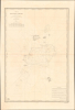
Carte des Iles Chagos. No. 945.
Largest Atoll Structure in the World.
- Digital Map Information
- Suitable for large format printing
- File Size: 28.38 MB
- File Type: ZIP / TIFF
- ICC color profile embedded
- Delivered instantly via download link
Largest Atoll Structure in the World.
This is a scarce, large-format 1841 French Dépôt-général de la marine nautical chart of the Chagos Archipelago in the Indian Ocean. It was produced at a time when Britain and France were vying for influence in the Indian Ocean, part of a wider, cautious global imperial competition in the wake of the Napoleonic Wars.A Closer Look
Coverage includes the seven atolls and islands of the Chagos Archipelago: the Salomon Islands, Nelsons Island, Peros Banhos, the Three Brothers, Eagle Islands, Egmont Islands, and Danger Island, and Diego-Garcia, along with several prominent banks and reefs such as Speakers Bank, Pitt Bank, and Blenheim Reef. The Great Chagos Bank, at center, is the world's largest coral atoll. Soundings (in meters) are noted throughout, as are bottoms, rocks, and hazards. At bottom-right is a translation of a description from Moresby about the currents and tides around the Chagos Archipelago, which he explains are fairly predictable and follow seasonal variations (the trade winds). A table below the title provides conversion between feet, meters, and brasses.Historical Context
Much of French imperial history in the 19th century was the result of competition with and a sense of inferiority vis-à-vis the British. France held several overseas territories but lacked anything on the order of the wealth and prestige the British gained from their effective control of India. These concerns led the French to consider establishing their own string of colonies in the Indian Ocean, eventually extending to the East Indies and China. In fact, this desire was in theory only solidifying earlier French claims: in addition to Réunion, which was and has remained part of France, the French also laid claim to Seychelles, Mauritius, and the Chagos Archipelago in the 18th century as part of a larger Isle de France colony, but these territories were seized by Britain in the course of the Napoleonic Wars (Réunion was occupied but returned to France at the end of the conflict).Seeking to recover some of their lost prestige and power, in 1840, France gained a protectorate over the island of Nosy Be and part of the mainland of Madagascar and stationed troops there the following year. In 1841, the territory of Mayotte was purchased from the King of Boina on Madagascar, and has been part of France ever since. These moves were a prelude to more aggressive actions later in the 19th century, including a protectorate over all of Madagascar in 1882, followed by its complete colonization in 1897, and claims on several atolls around Madagascar for France (the 'Scattered Islands' of Îles Éparses).
The Anglo-French rivalry in the Indian Ocean was a strange one, part of a long period of tense friendship sometimes called the 'Entente Cordiale'. The leading voice for colonial expansion in France at the time, Foreign Minister (and at times Prime Minister) François Guizot (1787 - 1874), was Anglophone and an Anglophile by instinct (he translated Gibbon's The History of the Decline and Fall of the Roman Empire into French), who saw Britain as a partner rather than an enemy. Aside from a desire to keep the peace (the Napoleonic Wars still fresh in their minds), the two countries worked together in this era to expand commercial exchanges and suppress the slave trade (though not slavery itself). They even cooperated on some military actions, including a joint blockage of the Rio de la Plata. Even after Guizot's tenure, the French were loath to challenge the British directly, knowing they would be at a significant disadvantage in any naval confrontation. As in Asia more broadly, the French settled into a secondary role in the Indian Ocean, with Réunion and Madagascar as strongholds, jealously watching the ever-expanding writ of Great Britain.
Even today, the Chagos Archipelago remains strategically important. In the 1960s, Britain arranged to buy the archipelago from the newly independent Mauritius and then lease it (more specifically, Diego Garcia) to the U.S. to establish a naval station as part of the two countries' Cold War-era mutual defense arrangement. The naval station remains in use but has long been a sore spot in relations between the U.S.-U.K. and Mauritius, particularly due to the removal of several hundred inhabitants from the archipelago in the 1960s, though recent negotiations have made headway in finding a long-term solution that satisfies all sides.
Publication History and Census
This 1841 chart was engraved by Chassant and Jacques-Marie Hacq, both of the Dépôt-général de la Marine. It is based on a 1837 British chart prepared by Robert Moresby and F. T. Powell, hydrographers of the British East India Company. This chart is not recorded in the OCLC and is only held by the Swedish Royal Naval Academy, while the University of Wisconsin-Milwaukee holds a 1916 reprint. Scarce to the market.Cartographers
Dépôt des Cartes et Plans de la Marine (fl. 1720 - present), often called the Dépôt Général de la Marine, was a French hydrographic mapping organization founded in 1720 under Charles-Hercule of Albert de Luynes (1674 - 1734). Much like the U.S. Coast Survey, the British Admiralty, and the Spanish Deposito Hydrografico, the Dépôt was initiated as a storehouse and distribution center of existing nautical and marine charts. Eventually the Dépôt initiated its own mapping activities in an attempt to improve and expand upon existing material. Some of the more prominent cartographers and hydrographers associated with the of Dépôt Générale des Cartes were, Philippe Buache, Jacques-Nicholas Bellin, Giovanni Rizzi-Zannoni, Rigobert Bonne, and Jean Nicolas Buache. Further Details...
Chassant (fl. c. 1830 - 1860) was a French line and chart engraver active in Paris in the middle part of the 19th century. Chassant was active with the French Dépôt de Marine from the 1830s into the 1860s. He was a master engraver and, some have argued, his dramatic hachuring work to illustrate topography suggests he may have been wasted on nautical charts. Most of his engraving was completed in partnerships with Jacques-Marie Hacq (September 22, 1785 – 18??). Chassant did not sign any of his engravings with a first name or other identifier, so it is difficult to track him down. He may be Alphonse Antoine Louis Chassant (August 1, 1808 - September 7, 1907), who in later life was an art historian and librarian of the city of Évreux. He wrote several books, including works on engraving. We cannot alas verify the connection and it may be pure guesswork. Further Details...
Jacques-Marie Hacq (September 22, 1785 – 18??) was a French letter and line engraver, and historian, active in Paris during the middle part of the 19th century. Hacq was born in Paris and trained under J. P. Besançon, who he succeeded at the Dépôt de la Guerre in 1830. He engraved for the Dépôt de la Guerre as early as 1830 and for the Dépôt des Cartes et Plans de la Marine from, at least, 1840 to 1852. In addition to his work for the French Government, he also completed maps and engravings for Lesage, Lapie, Dufour, Duperrez, Gouvion St. Cyr, and Dumont d'Urville. His historical works include a history of the Napoleonic Wars and a history of Paris under the reign of Louis XIII. During most of his career in Paris he lived at 58 Rue de la Harpe. Further Details...
Robert Moresby (June 15, 1794 - June 15, 1854) was British Royal Navy and Indian Navy officer and hydrographer. Moresby is most famous for his 1829 - 1833 trigonometrical hydrographic survey of the Red Sea, a seminal work that opened the sea to steam navigation and for which Richard Burton called him 'the Genius of the Red Sea'. Afterwards, from 1834 to 1836 he completed the first complete hydrographic survey of the Maldives - an exceptionally complex region to survey due to its size and the sheer number of coral atolls. He then surveyed the Chagos Archipelago, and the vast submerged reef southeast of the Seychelles. His survey work under often extreme heat conditions, proved hard on his health and by 1839 forced him to give up hydrographic work altogether. After several years of recuperation in India, he returned to the sea in 1842 as captain of the luxurious 'Peninsular and Oriental' steamer, HMS Hindostan. In addition to his survey work, Moresby was also an excellent landscape painter whose artwork record scenes from his many voyages. Further Details...
Condition
Very good. Slight offsetting.
References
Kungliga örlogsmannasällskapet Atlas 13 kort 0943.