
Atwood, John M.

John M. Atwood (1817 - October 12, 1884) was an American engraver based in Philadelphia and New York City during the middle part of the 19th century. Atwood was born in Georgetown, near Washington D.C. Little is known of Atwood's life but most of his work was completed in conjunction with the publishing firms of Horace Thayer and J. H. Colton. A review of Atwood's work suggests that he was a highly accomplished, stylistically distinct, and detail oriented engraver. Colton seems to have turned to Atwood to engrave some of his most important as well as decorative maps. His most influential map is most likely the 1856 De Cordova pocket map of Texas, however, he also engraved the Colton's well known and highly decorative Thirty Three Miles Around New York and Colton's important 1849 Map of the United States.
First edition of one of Colton's most beautiful maps.
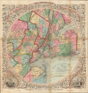
Map of The Country Thirty Three Miles Around The City of New York.
$1,200.00
Acquire
- Digital Map Information
- Suitable for large format printing
- Full resolution TIFF file
- ICC color profile embedded
- Delivered instantly via download link
This is the extremely rare 1846 first edition of one of the most beautiful pocket maps of New York made in the 19th century: Colton's Thirty Three Miles Around the City of New York. The map depicts New York City and vicinity as far south as Ocean County, New Jersey, as far east as Suffolk County, as far north as Rockland County, and as far west as Somerset County. The area is illustrated in considerable detail with special attention to settlements, tolls, roads, and railroads. New York Bay and Harbor offer numerous depth soundings taken from the 1850 U.S. Coast Survey chart of the region. The whole is surrounded by a splendid decorative border with engraved views depicting 'City Hall, New York' and 'City Hall, Brooklyn.' (more details)
Pushing Manhattan's urbanization northward.
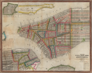
Map of the City of New York, with the Adjacent Cities of Brooklyn and Jersey City, and the Village of Williamsburg.
$1,200.00
Acquire
- Digital Map Information
- Suitable for large format printing
- Full resolution TIFF file
- ICC color profile embedded
- Delivered instantly via download link
This is a striking 1848 Ensigns and Thayer pocket map of New York City. It illustrates the city just as massive redistricting, leveling, and gridding were beginning to push urbanization into central and upper Manhattan. (more details)
Adding California and chronicling Texas' changing borders.
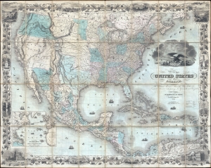
Map of the United States of America, the British Provinces, Mexico, the West Indies, and Central America: with part of New Granada and Venezuela.
$10,000.00
Acquire
- Digital Map Information
- Suitable for large format printing
- DPI: 300
- File Size: 70.47 MB
- File Type: ZIP / TIFF
- ICC color profile embedded
- Delivered instantly via download link
This is J. H. Colton's first edition 1849 map of the United States on the cusp of the California Gold Rush, in a fine example. The map depicts the United States immediately following the 1848 Treaty of Guadeloupe Hidalgo, including Texas at its largest and the Mexican Cession of Upper California (or New California). (more details)
Dawn of the American Industrial Revolution.
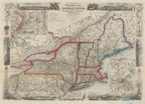
Colton's Map of the States of New England and New York, with Parts of Pennsylvania, New Jersey, the Canadas and c. Showing the Railroad, Canals and Stage Roads. With distances from place to place.
$1,500.00
Acquire
- Digital Map Information
- Suitable for large format printing
- Full resolution TIFF file
- ICC color profile embedded
- Delivered instantly via download link
A scarce and highly decorative first edition 1850 J. H. Colton and J. M. Atwood map of New York and New England. Thanks to Atwood's masterful engraving, this is one of the most decorative mid-19th-century maps of New England. It captures the northeastern United States at the beginning of the Industrial Revolution, when, fueled by Pennsylvania anthracite and a well-connected railway network, the region became the core of American manufacturing. (more details)
Westward Expansion.
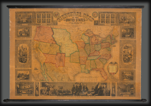
Pictorial Map of the United States.
$3,000.00
Acquire
- Digital Map Information
- Suitable for large format printing
- DPI: 600
- File Size: 1802.6 MB
- File Type: ZIP / TIFF
- ICC color profile embedded
- Delivered instantly via download link
A highly decorative 1853 wall map of the United States is published by Horace Thayer and engraved by J. M. Atwood. This map was published in editions from 1847 - 58, covering thus the critical moments of the American westward expansion, with each edition being significantly updated to reflect the rapid changes endemic to that heady period. The present 4th edition example reveals major developments following the 1849 Gold Rush. (more details)
The United States - fully formed.
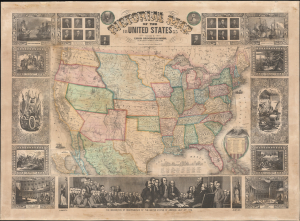
Pictorial Map of the United States.
$3,000.00
Acquire
- Digital Map Information
- Suitable for large format printing
- File Size: 1717.2 MB
- File Type: ZIP / TIFF
- ICC color profile embedded
- Delivered instantly via download link
A decorative 1855 wall map of the United States. Issued by Ensign, Bridgman and Fanning, this map covers from Atlantic to Pacific and from Canada to the Gulf of Mexico. This map illustrates an ephemeral period in the development of the American West with each of its many editions exhibiting significant changes and updates. (more details)
Ephemeral Territories in the American West.
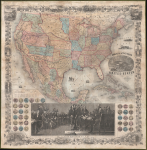
Phelps and Watson's New Map of the United States.
$3,000.00
Acquire
- Digital Map Information
- Suitable for large format printing
- Full resolution TIFF file
- ICC color profile embedded
- Delivered instantly via download link
This is a rare 1860 wall map of the United States published by Phelps and Watson. It presents the territorial configuration of U.S. states and territories on the eve of the U.S. Civil War (1861 - 1865), which would drastically reshape the map. (more details)
One of the last editions of one of the most unusual and decorative pocket maps of New York City to appear in the 19th century.
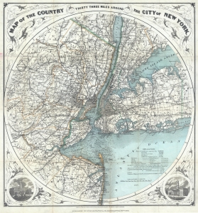
Map of The Country Thirty Three Miles Around The City of New York.
$1,200.00
Acquire
- Digital Map Information
- Suitable for large format printing
- File Size: 16.02 MB
- File Type: ZIP / TIFF
- ICC color profile embedded
- Delivered instantly via download link
This is the 1890 edition of one of the most beautiful pocket maps of New York made in the 19th century: Colton's Thirty Three Miles Around the City of New York. (more details)