
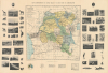
1930 Flamme Wall Map of the Belgian Congo

This item has been sold.
Carte administrative du Congo belge et de ses voies de communication.
Coffee, Cotton, and Mines.
- Digital Map Information
- Suitable for large format printing
- Full resolution TIFF file
- ICC color profile embedded
- Delivered instantly via download link
Coffee, Cotton, and Mines.
This Jules Flamme 1930 illustrated wall map of the Belgian Congo combines administrative and transport geography with a photographic survey of colonial production. Mines, processing works, and plantation agriculture occupy the margins alongside wildlife and botanical specimens, presenting the territory as both a natural treasury and an industrial enterprise. Its royal portraits give this economic geography a dynastic framework. Published in the year of Belgium's centenary, the map belongs to a period when public celebration of the colonial undertaking increasingly rehabilitated Leopold II as its founding figure.A Closer Look
The map covers the entirety of the Belgian Congo along with portions of neighboring territories, especially Ruanda-Urundi, which had originally been a German colony but was occupied by Belgium during World War I (1914 - 1918) and ceded to it afterward as a League of Nations mandate. The various districts of each province are color-shaded for easy distinction. Administrative centers, commercial centers (including trading posts), Catholic and Protestant missions, waterways, railways (extant and under construction), automobile roads, passable roads (routes carrossables), telegraph offices, and air routes are indicated throughout. In the margins are portraits of King Leopold II (d. 1909, architect of the infamous Congo Free State) and his son, and reigning monarch when the map was published, Albert I. Below them are photographs of representative animals and plants of the Congo, and of various economic projects relating to mining and plantation agriculture. At the bottom is basic geographic information about the Congo and a comparative map of Belgium.Historical Context
The Interwar Period (1918 - 1939) in the Belgian Congo marked a transition from the chaotic, murderous extraction of the King Leopold Era (the 'Congo Free State,' taken over by the Belgian state in 1908) to a more organized, though still highly coercive, state-managed economy. This 'model colony' period saw the rise of large mining corporations, such as the Union Minière du Haut-Katanga, which turned the region into a global hub for copper, cobalt, and diamonds. The epicenter of the colonial-era resource rush was the southern province of Katanga, where the powerful corporate cartel, Union Minière du Haut-Katanga (UMHK), held a virtual monopoly over mining operations. As global demand for industrial metals surged through both World Wars and into the Cold War, the Belgian administration aggressively expanded infrastructure, laying thousands of miles of railways to transport raw wealth to Atlantic ports.To fuel this industrial machine, the colonial administration enforced 'prestation' (forced labor) and other coercive measures such as high taxes and breaking up workers from the same tribe or area to prevent resistance. The Belgians also established large coffee and cotton plantations to export cash crops. The era's guiding philosophy was dominer pour servir, a Belgian take on the mission civilisatrice, which, as in the French case, was closely coordinated with Catholic missionaries who ran schools and clinics in addition to churches. While Belgium invested in some infrastructure (especially railways) and basic healthcare to maintain a healthy labor force, it systematically denied the Congolese access to higher education and political rights. It is no surprise then that this period saw the rise of powerful anti-colonial movements, especially the Kimbanguist movement, a religious and proto-nationalist surge led by Simon Kimbangu, which the Belgians suppressed by imprisoning Kimbangu for 30 years.
Publication History and Census
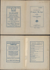
This map was prepared by Jules Flamme, drawn by Fr. (likely Frédéric) Menger, and printed by the Imprimerie A. Lesigne. A note on the cover indicates that this map belonged to one 'Soeur Marie Elizabeth,' presumably a Catholic missionary. Flamme's map was printed in several editions between 1927 and 1939, all held by a small handful of institutions, with the present edition held only by the Bibliothèque nationale de France, the University of Oxford, and the New York Public Library.Cartographers
Jules César Constant Flamme (February 15, 1866 - September 7, 1943) was a Belgian cartographer, military officer, colonial administrator, and author active in the Congo and Brussels during the late 19th and early 20th centuries. Born in Brussels, he enlisted in the 1st Regiment of Guides in 1886 and joined the Force Publique as a second lieutenant in November 1899. His Congolese service included reconnaissance toward the White Nile, Ruwenzori, and Aruwimi forests and the establishment of a colonial post at Mahagi. Ill health brought him back to Belgium in 1902; he returned to the Congo as an administrative agent in 1904, serving in the Stanley-Pool district and later at Boma, before another medical return and renewed service in the Belgian army. His geographical publications included administrative maps and gazetteers intended to organize information about settlements, territorial divisions, and communications. His Carte administrative du Congo belge et de ses voies de communication, published in Brussels by Lesigne, appeared in successive interwar editions, including those of 1929, 1930, and 1939. The 1930 edition was credited as a compilation from the Ministry of Colonies' cartographic service documents and drawn by Fr. Menger. Flamme also compiled the Recueil des localités du Congo belge et des territoires Ruanda-Urundi, published by Lesigne in 1927 with an administrative map and information drawn from official and commercial documents. His other writings included Dans la Belgique africaine (1908) and ethnographic studies concerning the regions around Lakes Albert and Kivu. He died at Ixelles on September 7, 1943. Further Details...
Imprimerie Lesigne (c. 1843 - 1965) was a Belgian printing firm founded in the mid-19th century (c. 1843) by Théodore Lesigne. By 1856, the firm had established its primary printing works at Nos. 25-27, Rue de la Charité, in the Brussels municipality of Saint-Josse-ten-Noode. Operating over generations under various names, including Imprimerie Th. Lesigne, Veuve Lesigne, and Imprimerie A. Lesigne, the firm became one of Belgium's leading institutional and administrative printing houses. It built a prolific portfolio heavily focused on state and academic commissions, printing official parliamentary reports and debate transcripts, the national statistical yearbook (Annuaire statistique de la Belgique), university annals, and key socio-economic government inquiries. Imprimerie Lesigne continued operations into the 1960s. The firm's historic neoclassical complex on Rue de la Charité was demolished in 1995 as the surrounding district made way for contemporary office development. Further Details...
Condition
Very good. Minor archival reinforcement at fold intersections on verso.
References
OCLC 494647231, 908403274, 40343547. Bibliothèque nationale de France, FRBNF40607691. de Haas, Michiel, 'Cotton imperialism in Africa: Rethinking the gap between metropolitan rhetoric and colonial practice', Journal of Global History, 21/1 (2026), pp. 126 - 151. Vellut, Jean-Luc, scientific director, Memory of Congo: The Colonial Era. Selection of Exhibition Texts, pp. 11 - 12, 26 - 30, 32.