
1946 Strategic Bombing Survey Booklet and Maps of the Effects of the Atomic Bombs

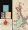
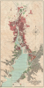
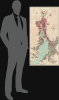
The United States Strategic Bombing Survey. The Effects of the Atomic Bombs on Hiroshima and Nagasaki. / U.S. Strategic Bombing Survey Atomic Bomb Damage Nagasaki Japan. / Hiroshima Extent of Fire and Limits of Blast Damage.
Investigating the damage done by the atomic bombs.
Investigating the damage done by the atomic bombs.
This is the 1946 United States Strategic Bombing Survey report on the effects of the atomic bombs on Hiroshima and Nagasaki at the end of World War II (1939 - 1945). Two maps depict Hiroshima and Nagasaki, respectively, and detail the damage wrought on the cities by the bombs. The report details these catastrophic events in a cold, administrative manner. However, the photographs included make the reality of the destruction abundantly clear.The Atomic Bombings of Hiroshima and Nagasaki
The United States dropped the first atomic bomb used in war on Hiroshima, Japan, on August 6, 1945, and followed that attack by dropping a second atomic bomb on Nagasaki three days later on August 9, 1945. These attacks, combined with the Soviet declaration of war on Japan, compelled the Emperor of Japan to surrender to the Allies, which was broadcast over the radio on August 15, 1945. The official surrender was signed on September 2, 1945, aboard the USS Missouri in Tokyo Bay.The Map of Nagasaki
The map of Nagasaki is the cartographic centerpiece of this report. It measures nearly four feet tall and details the destruction wrought by the atomic bomb in astonishing detail. Orange, pink, and green crisscrossed lines cover areas of differing degrees of structural damage caused by the blast and the subsequent fire. Areas shaded gray were heavily populated, which makes the orange and pink of the crisscrossed lines slightly more difficult to differentiate. A black dot marks Ground Zero of the blast, and concentric circles expand from this point at 1,000-foot intervals. 89 locations are identified by name and by a number assigned to them, including schools, shrines, factories, and a prisoner of war camp.The Map of Hiroshima
The map of Hiroshima is less detailed than the map of Nagasaki. Bright red highlights the parts of the city that were destroyed by the fire following the blast. Concentric circles expand from Ground Zero in 1000-foot intervals. The Old Castle is the only landmark identified by name within the fire zone. The Japan Steel Company is labeled near the right border because it is mentioned in the cartouche in the upper right as having structural damage 4.1 miles from the epicenter of the blast.The Report
The report is 46 pages long (with a two-page index of the Survey's reports at the end) and recounts in detail the effects of the bombs on Hiroshima and Nagasaki and includes information on how the bombs worked. Numerous photos illustrate the report, informing the viewer of the unimaginable destruction caused by the bombs in a manner that text and numbers cannot.The United States Strategic Bombing Survey
The United States Strategic Bombing Survey was founded on November 3, 1944, following an order by President Franklin D. Roosevelt. The Survey was composed of hundreds of prominent civilians and was initially tasked with assessing the strategic bombing campaign in Germany. The Survey's scope was eventually expanded to cover the Pacific Theater as well. The Survey published over 330 reports and annexes in the summer of 1946, including a report of the effects of the atomic bombs on Hiroshima and Nagasaki.Publication History and Census
This booklet was created and published by the United States Strategic Bombing Survey in 1946. It is well represented in institutional collections. The booklet occasionally appears on the market, but it is not always accompanied by the two maps.Cartographer
The Army Map Service (AMS) (1941 - 1968) was the military cartographic agency of the U.S. Department of Defense and part of the U.S. Army Corps of Engineers. The AMS compiled, published, and distributed military topographical maps and other related materials for use by the U.S. Armed Forces. They also prepared maps for space exploration, intelligence reports, and the establishment of world geodetic control networks. Formed during World War II, by the end of the war the Army Map Service had prepared 40,000 maps. 3,000 different maps were created for the Normandy invasion alone. The AMS was instrumental in the Korean War and the Vietnam War, and during all three of these conflicts distributed tens of millions of maps to U.S. servicemen. On September 1, 1968, the AMS was resdesignated the U.S. Army Topographic Command, and continued under this name as an independent organization until January 1, 1972 when it was merged with the new Defense Mapping Agency and renamed the DMA Topographic Center. The Defense Mapping Agency was added to the National Imagery and Mapping Agency on October 1, 1996, which was redesigned the National Geospatial-Intelligence Agency in 2003. Further Details...
Source
The United States Strategic Bombing Survey, 'The Effects of the Atomic Bombs on Hiroshima and Nagasaki', (Washington, D.C.: U.S. Government Printing Office) 1946.
Condition
Very good. The maps are in excellent condition with light wear along the original fold lines. Report detached from cover but complete. Dimensions given are for the map of Nagasaki. The map of Hiroshima measures 17.5 x 18 inches. The booklet itself is 10.25 x 8 inches.
References
OCLC 1397707.