
1960 Cairo Drafting Office Transportation Map of Egypti (United Arab Republic)


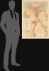
خريطة طرق مواصلات الإقليم المصري، الجمهورية العربية المتحدة / [Transportation and communication map for the Egyptian region, United Arab Republic.]
Modernization of Egypt's Infrastructure.
$750.00
Choose a Collection:
This Item
Enquire
Modernization of Egypt's Infrastructure.
This is a c. 1960 large-format Arabic-language map of Egypt under the United Arab Republic, prepared by Abdel-Aal Mohammed Rashdan of the Cairo Drafting Office. It reflects the Egyptian government's modernization drives under Gamal Abdel Nasser.A Closer Look
Covering the densely populated Nile Delta, this map provides information on the country's geography and infrastructure. Provinces (mudiriyah مديرية) are color-shaded for easy distinction. Paved roads, 'agricultural roads' (طرق زراعية), railways (main and secondary), towns and cities of various sizes and administrative functions, and airports are noted as indicated in the legend below the title. Important cultural and religious sites, including ancient Egyptian ruins, are represented pictorially and labeled, as are more recent economic projects, such as the Aswan Dam and an oil refinery near Suez. Circled numbers throughout correspond to a town index at the bottom left. The top left contains a comprehensive table of distances between various settlements. The bottom-right inset map continues the main map along the course of the Nile. At the bottom left is an inset map of Egypt, officially the Egyptian region of the UAR, indicating roads from the Nile Delta to other parts of the country.The United Arab Republic
The United Arab Republic (UAR), founded in 1958, was a political union between Egypt and Syria. It was a manifestation of pan-Arabism, a nascent ideology in the wake of the creation of the State of Israel and during the era of Arab countries declaring independence from Western empires (Britain and France). The main catalyst for the UAR's creation was the 1956 Suez Crisis, in which Israel seized control of the Suez Canal with British and French support after Egyptian President Gamal Abdel Nasser nationalized it. The broader Cold War context also contributed to the creation of the United Arab Republic, as Communist influence in Syria grew and Syrian elites reluctantly agreed that a union with Egypt was the best way to prevent a Communist coup. Officially established on February 1, 1958, the new republic was quickly beset by disagreements between Nasser and Syrian elites, especially the Ba'ath Party, which he attempted to sideline. Although Nasser was extremely popular with the public throughout the Arab world, Syrians soon felt that outsiders were taking over their country. Thus, the union only lasted until 1961, when a coup d'état in Syria led to its secession. Egypt remained known as the UAR until 1971.More specifically related to the content of this map, whether as the Republic of Egypt or the United Arab Republic, Nasser aimed to invest heavily in Egypt's infrastructure. With lofty ambitions, his government undertook several large-scale projects, including new railways, highways, ports, and the Aswan High Dam, built in the 1960s with Soviet assistance. Some projects, such as shifting more of the population away from the Nile Delta to new interior settlements, did not pan out. Still, Nasser's years in power left the country with the modern infrastructure it relies on today.
Publication History and Census
This map was prepared by cartographer Abdel-Aal Mohammed Rashdan (عبد العالمحمد رشدان) of the Cairo Drafting Office (مكتب القاهرة للخرائط). It is undated, but the use of 'Egyptian region' of the UAR and other details (such as the absence of the Aswan High Dam) suggests a date between 1958 and 1961. The map is quite scarce, with OCLC noting holdings at the American University in Cairo and Pennsylvania State University. It appears to be based on an earlier 1957 English-language edition, which was then updated and reissued regularly until 1976. The present map, however, is the only Arabic edition.Condition
Very good. Light wear along original folds.
References
OCLC 933755848.