
1860 First Edition of of Johnson's New Illustrated Family Atlas (Richmond imprint)


This item has been sold.
Johnson's New Illustrated (Steel Plate) Family Atlas.
First maps to name Arizona?
First maps to name Arizona?
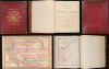
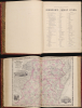
This is the 1860 Richmond-imprint first edition of Johnson's New Illustrated (Steel Plate) Family Atlas. While Johnson's atlases are not, in general, rare, the 1860 Richmond first edition is a genuine rarity. It is one of the only atlases published in the soon-to-be Confederacy prior to the American Civil War (1861 - 1865). It also includes the first two maps to name Arizona, predating the existence of the Arizona Territory by 5 years. In 20 years in the rare map trade, this is the first time we have seen a Richmond-imprint first edition of this atlas.A Closer Look
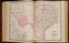
The 59-map atlas was printed in Richmond by Charles H. Wynne under the supervision of Johnson's partner Ross Browning. It was Wynne's last publication before joining the Confederate cause in the Virginia Artillery and transitioning his presses to war bonds, Confederate currency, and other war materials.In content, it is largely similar to the 1860 edition issued simultaneously by Johnson himself in New York, except the Texas map, which in this edition is double-paged. The most interesting map is the general map of North American and the Southwest map covering modern-day California, Arizona, New Mexico, Nevada, Colorado, Utah, and Wyoming. We believe these to be the first printed maps to name Arizona, nearly half a decade before it would become a Territory.
New York and Richmond?
Recognizing political tensions building between the northern and southern states, Johnson and Browning split the production of their atlas between two centers, with Johnson heading up the New York operation, while Browning set up in Richmond. Despite being a committed Union man, Browning published 2 editions of the Family Atlas in Richmond: as here in 1860, and a subsequent 1861 edition (c.f. johnsonatlasrichmond-johnson-1861) issued in late April or May of 1861.First to Map Arizona Territory?
A most unusual variant state of the important Johnson map of the southwest, covering all of modern-day California, Nevada, Utah, Colorado, Arizona, and New Mexico. The map offers much of interest, including placing the capital of Utah Territory at Fillmore City. Nonetheless, it is most distinctive for its illustration of the provisional Arizona Territory. This is not to be confused with the Confederate Territory of Arizona, which looks very similar and appeared in later editions of the atlas. When this map was issued, the Territory of Arizona did not exist. This map is instead presents the provisional Arizona Territory proposed to Congress in April 1860, when a constitution for the 'Territory of Arizona' was drafted in Tucson.The idea for an Arizona Territory appeared as early as 1856 when the government of the Territory of New Mexico began to express concerns about being able to effectively govern its southern parts, as it was separated from Santa Fe by the Jornada del Muerto, a particularly unforgiving stretch of desert. The New Mexico territorial legislature acted on these concerns in February 1858, approving a resolution in favor of creating an Arizona Territory, with a north-south border to be defined along the 32nd Meridian (from Washington). Impatiently waiting for Congress to approve the creation of the new territory, 31 delegates met at a convention in Tucson in April 1860 and drafted a constitution for the 'Territory of Arizona', which was to be organized out of the New Mexico Territory below 34th parallel. The convention even elected a territorial governor and a delegate to Congress.
Congress, however, was reluctant to act. Anti-slavery Representatives knew that the proposed territory was located below the line of demarcation set forth by the Missouri Compromise for the creation of new slave and free states, and they were not inclined to create yet another slave state. Thus, Congress never ratified the proceedings of the Tucson Convention, and the provisional territory was never considered a legal entity.
Moving ahead of this map somewhat, at the beginning of the Civil War, support for the Confederacy ran high in the southern parts of the New Mexico Territory. Local concerns drove this sentiment, including a belief that the war would lead to insufficient federal troops to protect against the Apache, while others felt neglected by Washington. Also, the Butterfield Overland Mail Route (an overland mail and stagecoach route from Memphis and St. Louis to San Francisco) was closed in 1861, depriving Arizona of its primary connection to California and the East Coast.
All of these factors led to the people of the southern New Mexico Territory to formally call for secession, and a convention adopted a secession ordinance on March 16, 1861, with a subsequent ordinance ratified on March 28, establishing the provisional territorial government of the Confederate 'Territory of Arizona'. The Confederate Arizona Territory was officially proclaimed on August 1, 1861, following Lieutenant-Colonel J. R. Baylor's victory over Union forces in the First Battle of Mesilla, and the territory was officially recognized by the government of the Confederacy on February 14, 1862. However, by July 1862, Union forces from California, known as the 'California Column,' were marching on the territorial capital of Mesilla. Sent to protect California from a possible Confederate incursion, the 'California Column' drove Confederate forces out of the city, allowing them to retreat to Franklin, Texas. The territorial government fled as well and spent the rest of the war in 'exile'. First, they retreated to Franklin, then, after Confederate forces abandoned Franklin and all of West Texas, to San Antonio, where the 'government-in-exile' would spend the rest of the war. Confederate units from Arizona would fight for the rest of the war, and delegates from Arizona attended both the First and Second Confederate Congresses.
Publication History and Census
This Atlas was published in Richmond by Johnson and Browning in 1860. It was printed in Richmond by Charles H. Wynne. The 1860 Richmond edition is the atlas's first edition, though if there is primacy between the 1860 Richmond and 1860 New York editions (c.f. Rumsey 2905C), it is unclear and undocumented.Cartographers
Alvin Jewett Johnson (September 23, 1827 - April 22, 1884) was a prolific American map publisher active from 1856 to the mid-1880s. Johnson was born into a poor family in Wallingford, Vermont, where he received only a basic public education. He is known to have worked as a school teacher for several years before moving to Richmond, Virginia. Johnson got his first taste of the map business as a salesman and book canvasser for J. H. Colton. The earliest Johnson maps were published with D. Griffing Johnson (no clear relation) and date to the mid-1850s; however, it was not until 1860 that the Johnson firm published its first significant work, the Johnson's New Illustrated (Steel Plate) Family Atlas. The publication of the Family Atlas followed a somewhat mysterious 1859 deal with the well-established but financially strapped J. H. Colton cartographic publishing firm. Although map historian Water Ristow speculates that Colton sold his copyrights to Johnson and his business partner, another Vermonter named Ross C. Browning (1822 - 1899), a more likely theory is that Johnson and Browning financially supported the Colton firm in exchange for the right to use Colton's existing copyrighted map plates. Regardless of which scenario actually occurred, it is indisputable that the first Johnson atlas maps were essentially reissues of earlier Colton maps. Early on, Johnson described his firm as the 'Successors to J. H. Colton and Company'. Johnson's business strategy involved transferring the original Colton steel plate engravings to cheaper lithographic stones, allowing his firm to produce more maps at a lower price point. In 1861, following the outbreak of the American Civil War (1861 - 1865) Johnson and Browning split their firm between two offices. Johnson moved from Richmond, Virginia, to New York City. Browning remained in Richmond, where he published at least one more edition of the atlas in 1862, at the height of the war. Johnson and Browning published two editions of the Johnson Atlas: 1860 (Richmond and New York) and 1861 (Richmond and New York). Sometime in 1861, Browning's portion of the firm (or perhaps the New York portion?) was purchased by Benjamin P. Ward, whose name subsequently replaced Browning's on the imprint. The 1863 issue of the Family Atlas was one of the most unusual, it being a compilation of older 'Johnson and Browning' maps, updated 1862 'Johnson and Ward' maps, and newer 1863 maps with a revised border design. The 1864 issue of the Family Atlas is the first fully 'Johnson and Ward' atlas. Johnson published one more edition of the atlas in partnership with Ward in 1865, after which Johnson bought out Ward. The next issue of the atlas, 1866, is the first purely 'Johnson' atlas with all new map plates, updated imprints, and copyrights. The Family Atlas went through roughly 27 years of publication, from 1860 to 1887, outliving Johnson himself, who died in 1884. Johnson maps from the Family Atlas are notable for their unique borders, of which there are four different designs, the 'strapwork border' from 1860 to 1863, the 'fretwork border' from 1863 to 1869, the 'spirograph border' in 1870 to 1882, and a more elaborate version of the same from 1880 to 1887. In addition to the Family Atlas, Johnson issued numerous wall maps, pocket maps, and in the 1880s, the Cyclopedia. Johnson maps are known for their size, accuracy, detail, and stunning, vivid hand coloring. Johnson's maps, purely American in their style and execution, chronicle some of the most important periods in American history, including the Civil War, the Westward Expansion, and the Indian Wars. Today Johnson's maps, especially those of the American West, are highly sought after by map collectors and historians. Further Details...
Ross Charles Browning (September 8, 1822 - March 26, 1899) was an American publisher and editor. Browning was born in Barre, Vermont in 1822. He studied at the Liberal Institute of Lebanon, New Hampshire. Afterward graduating he move to Sussex County, New Jersey, where he taught school. Seeking a better future in the bustling railroad industry, he took a position with the Erie Railroad at Piermont-on-the-Hudson. Relocating to Richmond, Virginia, he entered the publishing business in 1859, when he partnered with Alvin Jewett Johnson (1827 - 1884) to introduce Johnson's New Illustrated (Steel Plate) Family Atlas under the imprint of 'Johnson and Browning'. Perhaps seeing war on the horizon, Johnson and Browning spit their firm, with Johnson moving to New York and Browning running the southern arm of the firm out of Richmond. Richmond editions of the atlas are extremely rare, and contain several different maps from the New York editions. We are aware of Richmond editions in 1860 and 1861. At this time, Browning, being an ardent Union man, snuck through the lines to settle in New York. Back in Richmond, Johnson and Browning's printer Charles H. Wynne (1822 - 1870) transitioned his presses for the Confederacy, printing currency and war bonds. It is unclear how Johnson and Browning divided the firm when Johnson moved to New York, be subsequent editions of the atlas appear under 'Johnson and Ward', suggesting a sale of shares. What is known is that he left the publishing business altogether in 1863 during the New York Draft Riots (Jul 11, 1863 – Jul 16, 1863) to volunteer as a vigilante, a profession he continued throughout the war. After the war, Browning settled in Llewellyn Park, New Jersey, where he started a new business manufacturing and selling clothes wringers. He remained in this business until selling out to a conglomerate in 1892. He died in Jacksonville, Florida from pneumonia. Further Details...
Charles H. Wynne (1822 - March 19, 1870) was an American publisher and newspaperman based in Richmond, Virginia, active during the middle part of the 19th century. Wynne established a printing house in Richmond, Virginia, at the corner of Main and 14th sometime in the 1850s. Wynne was the Richmond printer of the Johnson and Browning Johnson's New Illustrated (Steel Plate) Family Atlas from 1860 to 1862. On April 21, 1861, Browning fled the Confederacy for New York, and Wynne enlisted in the Confederate 1st Regiment, Virginia Artillery to fight the American Civil War (1861 - 1865). The Confederacy must have decided he was more valuable as printer than as a solider, and so he contributed to the war effort by printing war bonds and currency. At the end of the Civil War he founded the The Richmond Times, which began publishing with its first issue on Friday, April 21, 1865. In September of 1865, he was attacked by a disgruntled employee, John M. Reyner, and severely beaten with a strip of cow hide. Two years later, in 1867, Wynne and The Richmond Times fell into insolvency and his presses were liquidated at auction in 1868. After the bankruptcy he continued to publish, issuing Wynne's Virginia and North Carolina Almanac - 1869. As his financial fortunes declined, so did his heath. Wynne died of a heart attack in April of 1870. Further Details...
Source
Johnson, A. J. and Colton J. H., Johnson's New Illustrated (Steel Plate) Family Atlas, with descriptions, Geographical, Statistical, and Historical, (Richmond: Johnson and Browning) 1860.
Johnson's New Illustrated Family Atlas was produced in numerous editions from about 1860 to 1887. Johnson's first atlas was mostly likely the 1859 edition of Colton's General Atlas which both aesthetically and comprehensively very similar to the 1860 first edition of the New Illustrated Family Atlas. Johnson's atlas was noteworthy in its day as one of the few commercially produced American atlases that could compete with more established European Atlases. Although he called the atlas 'Steel Plate' on the title page for marketing purposes, Johnson in fact incorporated modern lithographic printing techniques and lower quality woven wood pulp paper to economically produce large format maps in quantity. He also began publishing the New Illustrated Family Atlas on the cusp of the American Civil War, a decision that proved fortuitous, as the war corresponded to a general increased interested in cartography. For the most part, Johnson's Atlas was sold by subscription; nonetheless it became so popular that for at time he was considered the largest publisher in the world. Other than the first edition, the atlas itself has no true editions. Rather, Johnson incorporated updated maps as they became available, so each example of the Johnson atlas might well contain unexpected and scarce individual maps. Johnson's map of the American Southwest, for example, appeared in more than 17 different states, each illustrating minor variations to the rapidly chasing geography of that region. Moreover, Johnson's offered a service whereby he would mail updated map pages that could be tipped into older atlases to keep them current. Generally speaking, Johnson's atlas was issued in four periods - each defined by a distinctive decorative border. The earliest edition featured a strapwork border that appears as rolled and decoratively cut leather. This border work remained in use until 1863. In 1864 Johnson started using an updated fretwork or grillwork border that resembles worked iron - as in a decorative fence. This border was in use from 1863 to 1869. The 1863 edition of Johnson's atlas used both borders and is considered transitional. From 1870 to 1882, Johnson introduced a new border that featured elaborate Spirograph style geometric designs, which was used from 1870 to 1882. After 1880 a new border different but aesthetically similar to the Spirograph border began appearing. Certain editions of the atlas issued from 1880 - 1882 were transitional.
Condition
Good. Large folio. Spine replaced, otherwise Johnson's deluxe ful-calf leather binding. All maps present. Minor damage to a couple maps, including centerfold damage to the important Southwest map.