1585 Mercator's Map of Germany
Germany-mercator-1585$500.00

Title
Germania.
1585 (undated) 14.25 x 19.25 in (36.195 x 48.895 cm) 1 : 3000000
1585 (undated) 14.25 x 19.25 in (36.195 x 48.895 cm) 1 : 3000000
Description
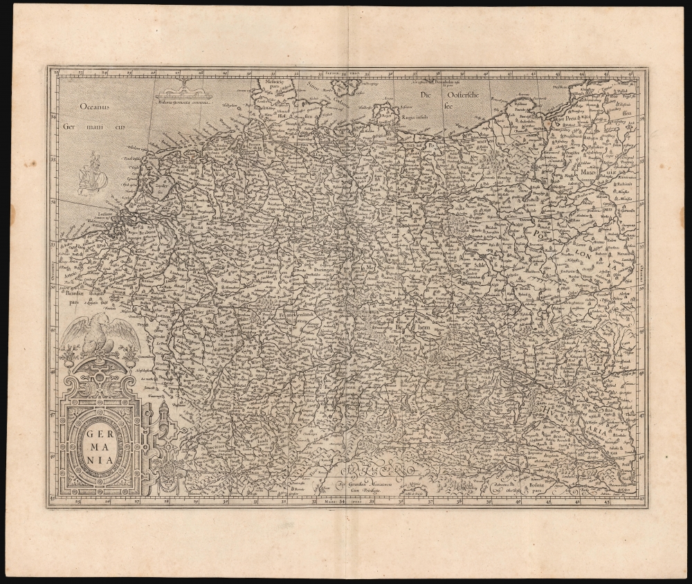
This is Gerard Mercator's 1585 map of Germany. It marks a significant transition in the mapping of German lands and is far advanced over earlier maps, such as those of Munster. Moreover, it is one of Mercator's earliest obtainable maps.
A Closer Look
It defines the region broadly, extending from southern Denmark and the Baltic coast in the north to the Gulf of Trieste in the south and from Flanders in the west to Poland and the Vistula River in the east. The map thus includes Hungary, Bohemia, Switzerland, the Low Countries, and Luxembourg - essentially, the bounds of the Holy Roman Empire. It is richly detailed, placing a multitude of cities in the context of a network of rivers. Mountains and forest regions are indicated pictorially. An elegant strapwork cartouche decorates the lower right, surmounted by an imperial eagle. The waters of the North Sea and the Baltic are stippled; the map's scales and a sailing ship appear in the upper left.Obscure Sources
This map was derived largely from Mercator's own 1554 wall map of Europe. Of that map, Karrow declared that it 'gave a completely up-to-date picture of the continent based on the best information available, without any debt to the Ptolemaic tradition' but as to the specific sources, particularly with respect to Germany, both Karrow and Mercator were silent. Mercator's cartography certainly represented a great transformation in comparison to pre-1554 maps, such as that of Münster and its precursor, the 1511/1520 Carta Itineraria Europae. Mercator's correspondence reveals that he had been working on a map of Europe as early as 1540. During this period he produced a map specifically of Flanders, and Karrow supposes it to have been based on triangulated surveys by Jacob van Deventer. It is reasonable to assume that Mercator similarly relied on local surveyors to supply data for the regions he was mapping. It is also known that Mercator himself produced surveys of Valenciennes and Arras and he may well have done others pertinent to this map.Publication History and Census
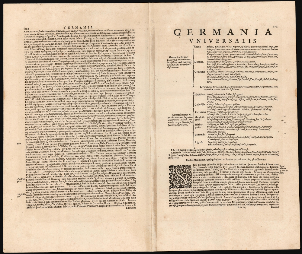
This is among Mercator's earliest acquirable maps, having been engraved for inclusion in the first part of his atlas: this, comprised of maps of France, Germany and the Low Countries, was first printed in 1585. It remained in the Mercator/Hondius atlas until 1633, after which point Jansson replaced it with a new map of his own making. The present example conforms typographically to the 1623 Latin edition of the Mercator/Hondius atlas.CartographerS
Gerard Mercator (March 5, 1512 - December 2, 1594) is a seminal figure in the history of cartography. Mercator was born near Antwerp as Gerard de Cremere in Rupelmonde. He studied Latin, mathematics, and religion in Rupelmonde before his Uncle, Gisbert, a priest, arranged for him to be sent to Hertogenbosch to study under the Brothers of the Common Life. There he was taught by the celebrated Dutch humanist Georgius Macropedius (Joris van Lanckvelt; April 1487 - July 1558). It was there that he changed him name, adapting the Latin term for 'Merchant', that is 'Mercator'. He went on to study at the University of Louvain. After some time, he left Louvain to travel extensively, but returned in 1534 to study mathematics under Gemma Frisius (1508 - 1555). He produced his first world map in 1538 - notable as being the first to represent North America stretching from the Arctic to the southern polar regions. This impressive work earned him the patronage of the Emperor Charles V, for whom along with Van der Heyden and Gemma Frisius, he constructed a terrestrial globe. He then produced an important 1541 globe - the first to offer rhumb lines. Despite growing fame and imperial patronage, Mercator was accused of heresy and in 1552. His accusations were partially due to his Protestant faith, and partly due to his travels, which aroused suspicion. After being released from prison with the support of the University of Louvain, he resumed his cartographic work. It was during this period that he became a close fried to English polymath John Dee (1527 - 1609), who arrived in Louvain in 1548, and with whom Mercator maintained a lifelong correspondence. In 1552, Mercator set himself up as a cartographer in Duisburg and began work on his revised edition of Ptolemy's Geographia. He also taught mathematics in Duisburg from 1559 to 1562. In 1564, he became the Court Cosmographer to Duke Wilhelm of Cleve. During this period, he began to perfect the novel projection for which he is best remembered. The 'Mercator Projection' was first used in 1569 for a massive world map on 18 sheets. On May 5, 1590 Mercator had a stroke which left him paralyzed on his left side. He slowly recovered but suffered frustration at his inability to continue making maps. By 1592, he recovered enough that he was able to work again but by that time he was losing his vision. He had a second stroke near the end of 1593, after which he briefly lost speech. He recovered some power of speech before a third stroke marked his end. Following Mercator's death his descendants, particularly his youngest son Rumold (1541 - December 31, 1599) completed many of his maps and in 1595, published his Atlas. Nonetheless, lacking their father's drive and genius, the firm but languished under heavy competition from Abraham Ortelius. It was not until Mercator's plates were purchased and republished (Mercator / Hondius) by Henricus Hondius II (1597 - 1651) and Jan Jansson (1588 - 1664) that his position as the preeminent cartographer of the age was re-established. More by this mapmaker...
Henricus Hondius II (1597 – August 16, 1651) was a Dutch engraver, cartographer and publisher. The son of the cartographer Jodocus Hondius, Henricus took over the business after father died in 1612, co-ran the business with his brother Jodocus II. In 1628 Henricus partnered with Jan Janssonius and together they continued the business, with Jansson’s name appearing on the Atlasas co-publisher after 1633. Eventually, about 50 editions of the Atlas were released in the main European languages. In the Islamic world, the atlas was partially translated by the Turkish scholar Katip Çelebi. The series is sometimes called the 'Mercator/Hondius/Jansson' series because of Jansson's later contributions. Learn More...
Source
Mercator, G., and Hondius, H., Atlas sive Cosmographicae, (Amsterdam: Hondius) 1623.
Mercator's Atlas is one of the most important works in the history of cartography. Although in fact Ortelius was the first to publish a proper atlas, the Teatrum Orbis Terrarum, Mercator's work the first book to employ the term Atlas for a collection of maps. The term is derived both from the mythical titan, Atlas, who was forced to bear the world upon his shoulders, and the Libyan king, philosopher, and astronomer of the same name that, so the legend goes, constructed the first globe. Mercator dedicated the final 25 years of his life to compile the Atlas. He published two parts during his lifetime in 1585 and 1589, but the final part published posthumously by his son Rumold Mercator, in 1595. The map plates for the Atlas were later acquired by Jodocus Hondius who published the most complete and well known edition in 1606. It was Jodocus who popularized the Atlas and who did the most to elevate Gerard Mercator's name.
Condition
Excellent. Light marginal soiling; marginal mend to bottom centerfold not impacting printed image.
References
OCLC 633720536. Rumsey 10534.213. Van der Krogt, P., Koeman's Atlantes Neerlandici, 2000:1A.