
Hondius, Henricus II

Henricus Hondius II (1597 – August 16, 1651) was a Dutch engraver, cartographer and publisher. The son of the cartographer Jodocus Hondius, Henricus took over the business after father died in 1612, co-ran the business with his brother Jodocus II. In 1628 Henricus partnered with Jan Janssonius and together they continued the business, with Jansson’s name appearing on the Atlasas co-publisher after 1633. Eventually, about 50 editions of the Atlas were released in the main European languages. In the Islamic world, the atlas was partially translated by the Turkish scholar Katip Çelebi. The series is sometimes called the 'Mercator/Hondius/Jansson' series because of Jansson's later contributions.
Advancing the map of Germany.
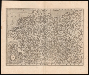
Germania.
$500.00
Acquire
- Digital Map Information
- Suitable for large format printing
- Full resolution TIFF file
- ICC color profile embedded
- Delivered instantly via download link
This is Gerard Mercator's 1585 map of Germany. It marks a significant transition in the mapping of German lands and is far advanced over earlier maps, such as those of Munster. Moreover, it is one of Mercator's earliest obtainable maps. (more details)
Richly-Engraved Guinea Coast.
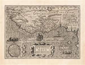
Guineae Nova Descriptio.
$550.00
Acquire
- Digital Map Information
- Suitable for large format printing
- DPI: 600
- File Size: 69.97 MB
- File Type: ZIP / TIFF
- ICC color profile embedded
- Delivered instantly via download link
This is Jodocus Hondius' 1606 map of the Guinea coast of Africa, stretching from the mouth of the Senegal River to Cape Lopez, from modern Senegal to Benin. It shows this coast at a time when its trade was largely controlled by the Portuguese, with whom the Dutch were at war; this map thus presented to a Dutch audience what would have been considered a rich prize to be taken. (more details)
Mercator's British Isles in original color.
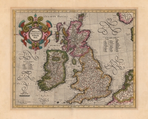
Anglia, Scotia et Hibernia.
$1,100.00
Acquire
- Digital Map Information
- Suitable for large format printing
- Full resolution TIFF file
- ICC color profile embedded
- Delivered instantly via download link
This is a beautiful, original-color example of Gerard Mercator's 1595 map of the British Isles, in its 1623 Hondius edition. This would be the definitive map of the British Isles for many subsequent decades. (more details)
Classic Dutch Golden Age map of Continental Africa.
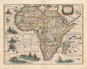
Africae nova Tabula Auct. Hen. Hondio.
$1,800.00
Acquire
- Digital Map Information
- Suitable for large format printing
- DPI: 600
- File Size: 20.33 MB
- File Type: ZIP / TIFF
- ICC color profile embedded
- Delivered instantly via download link
This is an attractive example of the Hondius map of Africa. It is a classic of Dutch decorative cartography. The map is embellished with lions, zebras, elephants, ostriches, and monkeys, while the oceans display seven sailing ships menaced by sea monsters. Flying fish skim the waters west of Guinea. A merman and mermaid embrace in the southern Atlantic - a recurring image in Hondius' maps (the identical couple appears in at least one other, Hondius' 1631 map of Italy.) (more details)
A Likely Appendix Issue of a Richly Decorative Dutch Map of Asia Minor and Cyprus
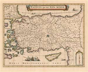
Natolia, quae olim Asia Minor.
$750.00
Acquire
- Digital Map Information
- Suitable for large format printing
- DPI: 600
- File Size: 19.92 MB
- File Type: ZIP / TIFF
- ICC color profile embedded
- Delivered instantly via download link
This 1636 map of Asia Minor and Cyprus was engraved by Jansson in 1636 for inclusion in his business partner Henry Hondius's atlases. This example, lacking verso text and exhibiting a bold, sharp strike, was probably an early appendix issue intended for distribution to previous subscribers to Hondius' atlas. The map depicts the region from the Aegean Sea to the Euphrates River, and from the Black Sea to Cyprus and the Mediterranean Sea. The beautifully engraved map is embellished with an evocative cartouche flanked by two turbaned putti. West of Cyprus, two Ottoman triremes blast away at a square-rigged ship, alluding to the long contention between Turkish and Christian European powers over the region. Hondius and Jansson produced this map quite shortly after fellow Amsterdam mapmaker Blaeu produced a virtually identical map in 1634. Despite the heated competition evident between the two mapmaking giants, the map's geographical data was not strictly fresh - the 16th century cartographic giant, Gastaldi, remained authoritative with respect to this region. (more details)