
1939 Matthes / Evans Two-Sheet Topographic Map of Grand Canyon National Park

This item has been sold.
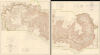
Topographic Map of the Grand Canyon National Park Arizona (West Half) / Topographic Map of the Grand Canyon National Park Arizona (East Half).
'A vast wilderness of rocks in a sea of light'.
- Digital Map Information
- Suitable for large format printing
- File Size: 182.26 MB
- File Type: ZIP / TIFF
- ICC color profile embedded
- Delivered instantly via download link
'A vast wilderness of rocks in a sea of light'.
This is a stunning two-sheet, large-format, 1939 topographic map of the Grand Canyon National Park, issued by the U.S. Geological Survey. Based on surveys undertaken in the early 20th century, it captures the canyon in a period when it was transitioning from a storied but still largely inaccessible national treasure to a tourist site for the masses, aided by the completion of the Grand Canyon Railroad and early highways.A Closer Look
This remarkable map, measuring nearly 7 feet across when combined, covers the contemporary Grand Canyon National Park (which was expanded significantly in 1975), from the confluence of the Colorado River with Nankoweap Creek in the east to the confluence of the Colorado and Havasu Creek in the west. Emphasizing topography with contour lines, packed so tightly as to resemble a fabric pattern, the map also records the location of buttes, canyons, peaks, 'temples,' 'towers,' ridges, crests, valleys, plateaus, gorges, 'pyramids,' and related features. Many of these are named after concepts and figures from various world religions, such as the Confucius Temple, Tower of Ra, Brahma Temple, Thor Temple, and Jupiter Temple. Another group are named for figures from Arthurian Legend, including Lancelot Point, Holy Grail Temple, King Arthur Castle, Guinevere Castle, and Excalibur.Aside from the Colorado River, its tributary creeks, streams, and springs are noted, as are rapids in the Colorado, which were famously turbulent in the years before it was dammed (the Glen Canyon Dam, completed in the 1960s, has had a particularly strong impact on the river's flow through the Grand Canyon). The developing tourist accommodations along the South Rim, including the Grand Canyon Railroad (completed 1905 by the Santa Fe Railway) and the El Tovar Hotel (also 1905), are indicated, along with the nearby 'Hermit Camp' established by early non-native resident Louis Boucher, and a smaller collection of buildings on the North Rim at Bright Angel Point. At left, within the Havasupai Indian Reservation (and serving as its capital) is the village of Supai, the only place in the U.S. where mail is still carried in by mule. At right are historic 'cliff dwellings' (actually granaries) of the Ancestral Puebloans (or Ancestral Paiute) that were in use roughly a thousand years ago.
Early Tourism to the Grand Canyon
After the arrival of the railroad to northern Arizona in the 1880s, the Grand Canyon became accessible to travelers who had previously only heard of its vastness through explorers' accounts. The Santa Fe Railway played a major role in promoting the Grand Canyon as a tourist destination, partnering with entrepreneur Fred Harvey to build hotels, trails, and other visitor facilities, including the famous El Tovar Hotel. When Grand Canyon National Park was established in 1919, the National Park Service (itself only created in 1916) began to formalize visitor management, improving roads, trails, and facilities. The rise of automobile travel and the development of early highways in the 1920s and 1930s dramatically expanded tourism, leading to the construction of scenic routes. After World War II, visitor numbers surged again, prompting the introduction of modern visitor centers and tourist infrastructure to accommodate millions of annual visitors.Publication History and Census
This map was printed in 1939 by the U.S. Geological Survey in conjunction with the National Park Service and is based on surveys undertaken in the early 20th century by Francois E. Matthes and Richard T. Evans. The map was originally published in 1927 and reprinted in 1948 and 1963, in addition to this 1939 printing. It is well-represented in institutional collections, with the 1939 printing appearing in the collections of 14 institutions in the OCLC, but is relatively scarce to the market.Cartographers
François Émile Matthes (March 16, 1874 - June 21, 1948) was a Dutch-American geologist, glaciologist, and surveyor who mapped several remote areas of the American West for the U.S. Geological Survey in the early 20th century. Matthes was born in Amsterdam, where his father, Willem Ernst Matthes (1842 - 1906), was a partner in a major trading firm importing goods from the Dutch East Indies. Both François and his twin brother Gerard became deeply interested in geology at a young age, particularly when both were sent to live in the Alps to recover from malaria. Originally preparing to enter a German technical university, the brothers were persuaded by a visiting Harvard University professor to go to the United States instead, and both entered the Massachusetts Institute of Technology in 1891, where one of their professors who had worked with the U.S. Coast and Geodetic Survey steered them towards geodesy. Soon after graduation from MIT, François joined the U.S. Geological Survey, where he would spend the rest of his career. He was soon sent west, to Indian Territory (Oklahoma), Montana, Wyoming, and Arizona. Later in his career he worked in California (mapping the Yosemite Valley and, in the wake of the 1906 Earthquake and Fire in San Francisco, the San Andreas Fault) and Mount Rainier in Washington. From 1913, Matthes was tasked by the Geological Survey to study geomorphology, a long-time interest of his. He soon became a central figure in a long-running debate over the geomorphology of the Yosemite Valley, which he memorably dubbed 'the Incomparable Valley.' He contributed significantly to the understanding of the formation of the Yosemite Valley and to the importance of glaciers in geomorphology more broadly, and is credited for coining the term 'Little Ice Age' (though he applied it only to the Sierra Nevada and the Western U.S., not the entire globe). Later in his career, Matthes worked with the National Park Service to acquire data about the geology of the Sequoia National Park area and Mount Whitney. During both World Wars, he lent his geologic knowledge and linguistic skills to the military. By the end of his career, Matthes was an international expert on glaciers and geological history. He retired in June 1947 and moved to El Cerrito, California in the East Bay region of the San Francisco Bay Area, but died less than a year later. His ashes were spread in the Yosemite Valley, which had occupied so much of his life's attention and work. Further Details...
Richard Tranter Evans (July 1, 1881 - September 1, 1966) was a long-time topographic engineer with the U.S. Geological Survey and a protégé of noted geologist François Matthes (1874 - 1948). Among other accomplishments, he is credited with helping survey the Grand Canyon, including a summit that now bears his name as a result (Evans Butte). Evans is perhaps best known for applying names from Arthurian Legend to features in and around the Grand Canyon, the source of the unusual names for King Arthur Castle, Guinevere Castle, Elaine Castle, Lancelot Point, and others. Evans also did important early work in the Pikes Peak region. In the 1920s, he went to work for the National Park Service, serving as Acting Superintendent of Zion and Hawaii (now Hawai'i Volcanoes) National Parks. By the early 1930s, Evans had returned to Washington, D.C. and the Geological Survey, where he co-authored a history of the Survey's Topographic Branch (not published until 2009) among other works. After retiring in 1951, Evans remained active in professional circles, serving as the secretary and executive treasurer for the American Congress on Surveying and Mapping, among other positions. Further Details...
The United States Geological Survey (1878 - Present), aka the U.S.G.S., is a scientific agency of the United States government, which was founded in 1879. USGS scientists study the landscape of the United States, its natural resources, and the natural hazards that threaten it. The organization has four major science disciplines: biology, geography, geology, and hydrology. It is a bureau of the United States Department of the Interior and is the department's only scientific agency. Further Details...
The National Park Service (August 25, 1916 - Present) is a United States government agency tasked with managing all national parks, most national monuments, and other historical, recreational, and natural properties. Part of the U.S. Department of the Interior, the Service oversaw 423 units in 2020, sixty-three of which were national parks, and employed over 12,500 people. Further Details...
Condition
Very good. Slight wear along original fold lines. Some light pencil annotations.
References
OCLC 66897668.