
1784 Zatta 2 Sheet Map of India

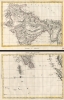
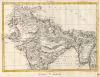
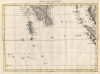
Indie Imo. Foglio. / Indie IIo. Foglio.
Second Anglo-Mysore War.
- Digital Map Information
- Suitable for large format printing
- Full resolution TIFF file
- ICC color profile embedded
- Delivered instantly via download link
Second Anglo-Mysore War.
This is a 1784 Antonio Zatta 2 sheet map of India. Published as the British East India Company was fighting to bring all of India within its sphere. At it went to the presses, the British East India Company and the Kingdom of Mysore were at a war, partially ignited by the American Revolutionary War (1775 - 1783), known as the Second Anglo-Mysore War (1780 - 1784).A Closer Look
Depicting from Tibet to Sri Lanka, the map includes the Maldives and parts of the Malaysian peninsula and Sumatra. Zatta includes impressive detail throughout modern-day India, Afghanistan, Bangladesh, Pakistan, and western Myanmar.The Second Anglo-Mysore War
Fought between 1780 and 1784, the Second Anglo-Mysore War pitted the British East India Company against the Kingdom of Mysore. Mysore, being allied to the French, who were in turn allied with the American Revolutionaries, led to the American Revolution spilling over into India. In 1873, a preliminary peace was settled between Great Britain and France and the fighting ended in Mysore. The subsequent 1784 Treaty of Mangalore formally ended the war and restored the status quo ante bellum, an unsatisfactory end in the eyes of the British East India Company.Publication History and Census
This map was created by Antonio Zatta and published by Zatta in 1788 in his Atlante novissimo. We note cataloged examples of the separate sheets as being part of the collection at the University of Toronto and an example of the entire atlas is digitized and is part of the David Rumsey Map Collection.Cartographer
Antonio Zatta (1722 - February 16, 1804) was a Venetian printer and publisher whose illustrated books and atlases made him a leading figure in late 18th-century Italian publishing. Born in Venice into a printing family active since 1656, he attempted to relocate to Rovereto in 1752, but Venetian authorities blocked the move. The merchant Amedeo Svajer financed his early ventures. His connections with the Jesuits, including publications defending the order under false imprints (1760 - 1761), attracted controversy, although these ties weakened during the 1760s. Geography became a major undertaking: he published Anton Friedrich Büsching's Nuova geografia in 34 volumes (1773 - 1782), followed by the four-volume Atlante novissimo, illustrato ed accresciuto (1779 - 1785), comprising approximately 240 maps. Portions appeared separately, notably Le colonie unite dell'America settentr.le, an Italian adaptation of John Mitchell's 1755 map. His geographical publications also included Cook's voyages (1794 - 1795) and the map-illustrated political periodical Prospetto degli affari attuali dell'Europa (1788 - 1801). Beyond cartography, he published literature, medicine, and Buffon's natural history (1782 - 1791), cultivating collaborations with leading Venetian illustrators and engravers. His sons Giacomo and Giovanni joined the business in 1783; the printing house closed shortly after his death. Further Details...
Source
Zatta, A., Atlante novissimo, (Venice: Zatta) 1788.
Condition
Very good. Some soiling to margins on both sheets.
References
Rumsey 11598.202, 11598.203. OCLC 977690102, 977395546.