This item has been sold, but you can get on the Waitlist to be notified if another example becomes available, or purchase a digital scan.
1703 Scherer Map of Southeast Asia and the East Indies
InsulaeIndicae-scherer-1703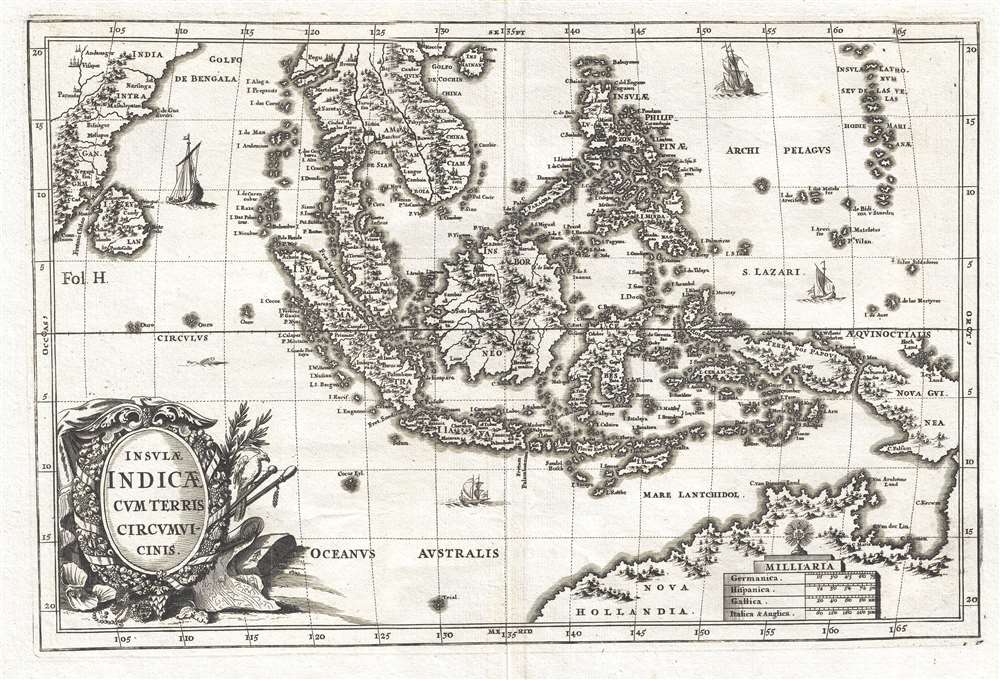

Title
1710 (undated) 9.5 x 14.25 in (24.13 x 36.195 cm) 1 : 50000000
Description
This map was created by Heinrich Scherer and published in his Atlas Novus c. 1703. There
Cartographer
Heinrich Scherer (1628 - 1704) was a Jesuit cartographer, geographer, and professor. Scherer served as a Professor of Hebrew, Ethics, and Mathematics at the University of Dillingen in Germany until around 1680 when he became the Official Tutor to the Royal Princes of Mantua and Bavaria in Munich. During his time in Munich, Scherer's work as a cartographer gained recognition and acclaim. His atlas, the Atlas Novus was first published between 1702 and 1710 and subsequently reissued between 1730 and 1737. The Atlas Novus is recognized as a revolutionary work that highlighted the highly sophisticated cartographical work accomplished by Jesuits during the early 18th century. The atlas featured maps from all over the known world and included the religious tendencies of the given region, along with the desire to promulgate the Catholic faith. More by this mapmaker...