
1943-44 World War II-Era Aerial Attack Archive of Kwajalein Atoll

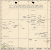
[Kwajalein Atoll Aerial Attack Archive.]
A glimpse into how WWII aviators were briefed before missions.
$2,500.00
Choose a Collection:
- Digital Map Information
- Suitable for large format printing
- Full resolution TIFF file
- ICC color profile embedded
- Delivered instantly via download link
This Item
Enquire
A glimpse into how WWII aviators were briefed before missions.
This is a 1943-1944 intelligence archive prepared for the aerial campaign preceding the invasion of Kwajalein Atoll, offering unique insights into how American World War II aircrews were briefed for combat missions. Strategically located, Kwajalein was occupied and fortified by Imperial Japan early in the war and became a principal American objective in the Central Pacific. U.S. forces landed on Kwajalein and Roi-Namur on January 31, 1944, following months of reconnaissance and preparatory bombing. Comprising annotated aerial photographs, target maps, a manuscript planning overlay, and a regional aviation chart, this archive reveals how pilots moved from broad theater geography to the identification of individual airfields, warehouses, gun positions, and other tactical targets.A Closer Look
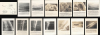
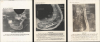
The archive comprises the following:- Aerial Target Map and Photographs: The centerpiece of the archive is a group of seventeen aerial photographs depicting targets throughout Kwajalein Atoll, accompanied by a target-location map. The materials are dated December 21 and 27, 1943, and January 9, 1944. Almost certainly prepared for pilot briefings before the January 31 invasion, the photographs include captions identifying airfields, piers, warehouses, barracks, machine shops, hangars, and other military installations. Known antiaircraft positions are marked, although several captions caution that additional, unidentified gun emplacements were probably present. The accompanying Target Location Map Kwajalein Atoll places twelve designated targets within the atoll's broader geography and identifies the individual islands, providing pilots with an overview of their objectives.
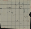
- Manuscript Map of Part of the Marshall Islands: Also included is a manuscript map of the Marshall Islands drawn in black ink on transparent plastic. Coverage extends from Aijuk south to Ebon and from Jiae east to Maloelap, with Kwajalein appearing in the upper-left quadrant. Despite a near-complete centerfold split, the map preserves remarkable detail, including the individual islands composing each atoll. Its transparent medium suggests it was intended as an overlay for planning or briefing the preliminary raids.
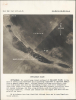
- Eastern Caroline Islands Chart: The final component is a regional chart of the Eastern Caroline, Marshall, and Gilbert Islands, published by the Naval Air Combat Intelligence Hydrographic Office in November 1943, contemporaneous with the battles of Tarawa and Makin. The chart places the region's widely dispersed islands and atolls within their broader strategic context, helping aviators understand routes, distances, and relationships among individual objectives. Truk Atoll, the formidable Japanese naval and air base that had acquired near-legendary status among American aviators, appears along the left border. Airfields are identified throughout the region, with particular concentration in the Marshall Islands.
Preliminary Operations Against Kwajalein
Before the amphibious landings of January 31, 1944, American Army and Navy aircraft operating from land bases and aircraft carriers conducted an extended campaign against Japanese positions in the Marshall Islands. Raids in November and December 1943, and in January 1944, struck not only Kwajalein but also Maloelap, Jaluit, Mille, and Wotje. Hundreds of tons of bombs were dropped on airfields, coastal defenses, shipping facilities, barracks, and other military installations in an effort to suppress Japanese air power and weaken resistance before the Battle of Kwajalein (January 31 - February 3, 1944).Publication History and Census
The aerial photographs are dated December 21 and 27, 1943, and January 9, 1944. We have been unable to locate other surviving examples from these sets or closely comparable digitized briefing materials. As a hand-drawn planning document, the transparent manuscript map is unique. The Eastern Caroline Islands chart was published by the Naval Air Combat Intelligence (N.A.C.I.) Hydrographic Office in November 1943. We note no other cataloged example.Condition
Very good to average. All photographs very good. Likely mimeographed. Some stamped 'CONFIDENTIAL' on verso. Manuscript map average. Drawn on transparent plastic with unrepaired centerfold split.